Country:
 City:
City:


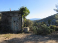
From Allauch, follow the Route des Thermes (D908) towards Peypin and Cadolive. At the Auberge de Pichauris, turn right onto the D46A. Park in the free car park near the park’s large gate.
(S/E) From the car park, head east along the path that runs alongside the D46A. At a bend, cross the road, go through the barrier and immediately take the path on the left which winds its way up through the forest. At the top, turn right. Further on, pass under the high-voltage power line, then veer left, following the yellow-red-yellow markings ofthe GRP®2013. You’ll come to a Y-junction.
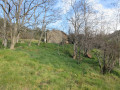
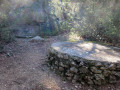
(1) Turn right, then about 200 m further on, turn left under the trees. Follow the GRP®2013 markings, which pass alongside olive trees, to reach the ruins of La Bastidonne. In the large field on the right, look out for a well. This is Joseph’s well. Keep to the left of the building and head westwards until you reach a crossroads.
(2) Continue to the right along the path marked on the trees ‘No Hunting Zone’
, which leads to the Romu and Antonin wells. Follow the path as it heads north until you reach fire hydrant no. 478. Admire Mont Julien. Turn right towards the east onto the wide track, then right at the Fork in the road after the barrier (elevation 415). A good hundred metres further on, you’ll reach a large open area with several junctions.
(3) Turn left towards the north-east onto the stony track which descends steeply through the woodland before levelling out. Ignore the paths to the left and right. Join a DFCI track and keep to the right. Follow this track to a Y-junction with a rock marking the boundary between Allauch and another municipality
, and a barrier.
(4) Turn left and follow the track, which leads to some houses and a tarmac road. Keep to the left and follow the road past a cemetery.
(5) After the cemetery, turn right onto the unmarked path climbing alongside the ruins of an old fire lookout post. At the top, you’ll reach a junction of paths. Look out for a fire lookout post and take the path to its right, marked Yellow-Red-Yellow. This path, which is sometimes steep, joins the bed of the Cride stream. Admire the waterfalls and potholes. Turn right into a path through the undergrowth and join a DFCI track (GB205).
(6) Turn left at the gate and follow the track, which winds its way down with lovely views of Cride Hill. You’ll reach a star-shaped junction and a gate.
(7) Go straight on and pass through the gate. The track descends towards the east. Pass a junction of several paths (elevation 338) then reach a Fork in the road.
(8) Turn right at the Fork in the road and walk past an underground cistern, no. 253. Further on, you’ll pass a closed well and a wildlife drinking trough. The path descends gently through the forest. Avoid a few large boulders and you’ll reach a tarmac road and some houses. Follow the road for about 80 m and look out for a clear area on the right used as a car park. At the far end is the start of a path.
(9) Leave the road and take this very stony path heading south. Cross some beautiful limestone slabs and potholes. This is the Mau Vallon. The very wild landscape levels out towards the end as you pass through the vegetation. You’ll reach a small hut, which you should go past on the left. You’ll arrive at an open area with several junctions (Font de Mule)
. Look out for an underground cistern marked no. 305.
(10) Pass to the right of the cistern, then go round it on the left to rejoin a path that climbs alongside the track. You’ll reach an area with tables, benches and a developed spring. Pass a few terraces, then rejoin the track further up (stone hut and signposts).
(11) Turn immediately right onto the Yellow-Red-Yellow marked path, heading south-west. The last 100 metres are steep. Join the track and turn right. Pass by a concrete shelter (with benches and an oven), go through a gate and walk past underground cistern no. 180. You’ll reach a Y-junction; take the track on the right. Look out for a sign on the left for ‘Le Balcon des Tourdre’
at elevation 546.
(12) Turn left at the sign and immediately follow the path leading off to the right. Pass through a few steep, rocky sections before reaching a T-junction at the foot of some rocks.
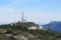
(13) Leave the path on your right and turn left towards Mont du Marseillais. Walk round the facilities to admire the 360° panorama, then head back along the same path to return to the previous junction.
(13) Continue along the path heading west; further down, it joins the DFCI track. Turn left onto the track and walk for about 350 m, keeping to the right at the Fork in the road. Look out for the start of a path on the right.
(14) Turn right onto this stony path, which joins theGRP® ‘Sentier Provence Mines d’Energies’
and, further down, the Route du Regage. Walk for about 60 m along the tarmac road and rejoin theGRP® on the left at elevation 422. At the top, continue straight on and rejoin the tarmac road. Pass fire tank no. 474 and turn left onto the path leading to the riding centre at elevation 425. Head west for about 500 m until you reach a green gate.
(15) Leave theGRP® and turn left, passing to the right of an abandoned house. At the bottom, turn right, then join the Sentier des Bergers
and the open spaces of the Pichauris estate. You’ll reach the ruins of La Plâtrière at elevation 362, then the hamlet of Pichauris, which the Sentier des Bergers bypasses on the left. Turn right at elevation 346 to follow the road out of Pichauris, which leads back to the estate’s large car park on the left (S/E).

 Visorando Member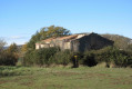

 Difficult