Le Creux de l’Envers in Gex

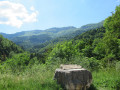
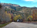
Partly running alongside the River Journans, the path passes through the canyon of the mysterious Portes Sarrazines. This trail, with its lush and varied landscapes, is situated in a protected area.

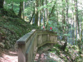
This pleasant walk, accessible from April to November, follows the course of the River Journans. The ‘Au fil du bois’ interpretive trail highlights human activities linked to the forest and water. Finally, the Portes Sarrazines, which frame a gorge carved out by the river, take their name from a local legend: the inhabitants of Gex are said to have taken refuge behind these stone gates during Saracen invasions in the Middle Ages. The route offers a variety of landscapes, alternating between forest paths, roads and steeper sections. Access is restricted; dogs are not permitted within the Reserve.

Details

36430683
Creation:
Last update:
Last review:
  • Walking
    Activity: Walking
  • ↔
    Distance: 3.83 mi
  • ◔
    Average duration: 2h 15 
  • ▲
    Difficulty: Easy

  • ⚐
    Back to start: Yes
  • ↗
    Ascent: + 558 ft
  • ↘
    Descent: - 545 ft

  • ▲
    Highest point: 2,411 ft
  • ▼
    Lowest point: 2,008 ft

Photos

Description of the walk

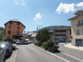
The walk starts in Gex at the car park on Place du Perthemps.

(S/E) With your back to the square, cross the Route du Col de la Faucille. At the small square opposite, turn right onto a small road, the Chemin des Combes.

(1) Follow this path as it descends towards a mill.

(2) Walk past the mill and continue. At the end of the tarmac road, take a path on the left, leading to a three-way junction.

(3) Turn left and follow the signposts towards Haut des Galas until you reach the path of the same name.

(4) Turn right, following a wide track and then a tarmac road at the next junction.

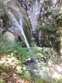
(5) At the junction, take a sharp right-hand bend, cross the stream and make sure you don’t miss the path leading downhill at the side of the road. Discover the wooden sculpture of the woodcutter. The path then climbs up a series of steps (waterfall platforms) to the track.

(6) Turn right onto the track. Continue straight on until you reach the start of the downhill path.

(7) Head down to the right, to the bottom of the valley, until you reach the crossroads.

(8) Turn right towards the Portes Sarrazines.

(9) Take in the views, then return to the previous junction via the same route.

(8) Turn right and keep to the left all the way to the junction you passed on the way out.

(3) Continue to the left and return to the starting point via the reverse route of the outward journey (S/E).

Waypoints

  1. S/E : mi 0 - alt. 2,103 ft - Place Perthemps
  2. 1 : mi 0.06 - alt. 2,119 ft - Chemin des Combes
  3. 2 : mi 0.38 - alt. 2,014 ft - Moulin - Journans (rivière) - Affluent du Lion
  4. 3 : mi 0.69 - alt. 2,139 ft - Carrefour circular
  5. 4 : mi 1.1 - alt. 2,411 ft - Road
  6. 5 : mi 1.6 - alt. 2,375 ft - Fork in the path
  7. 6 : mi 1.98 - alt. 2,349 ft - Trail
  8. 7 : mi 2.16 - alt. 2,388 ft - Downhill trail
  9. 8 : mi 2.52 - alt. 2,156 ft - Turn-off towards Portes Sarrazine - Journans (rivière) - Affluent du Lion
  10. 9 : mi 2.65 - alt. 2,185 ft - Portes Sarrazines
  11. S/E : mi 3.83 - alt. 2,103 ft - Place Perthemps

Notes

  1. Safety instructions:

Part of this route passes through the Haute Chaîne du Jura National Nature Reserve; please respect its regulations.
https://www.rnn-hautechainedujura.fr/

Among these rules: Dogs are not permitted, even on a lead!

  1. Before setting off:

- Check the general and local weather forecast to ensure there is no rain

- Find out about the approach walk, the altitude of the route, the walking time and possible escape routes (IGN map, GPS, guidebook, etc.)

- Assess potential risks by consulting mountain professionals, mountain huts and lodges

- Inform a friend or family member of your plans and contact them again if there are any changes: departure and return times, number of participants with each person’s telephone number, vehicle(s), car park.

- Avoid setting off alone; use equipment suitable for the activity, properly adjusted and in good condition, including a head torch, a fully stocked first-aid kit, a survival blanket, etc.

In the event of an emergency, call 112 (the European emergency number).

This route passes through a protected area, which may be subject to special regulations:

Worth a visit

The Saracen Gates: a legend dating from the 19th century tells that the people of Gessi took refuge beyond these stone gates during the Saracen invasions of the 7th and 9th centuries.

Reviews and comments

4.6 / 5
Based on 3 reviews

Reliability of the description
4.7 / 5
Ease of following the route
5 / 5
Route interest
4 / 5
Dofel
Dofel

Overall rating : 4.7 / 5

Date of your route : Aug 02, 2026
Reliability of the description : ★★★★★ Very good
Ease of following the route : ★★★★★ Very good
Route interest : ★★★★☆ Good
Very busy route : Yes

A short, mostly shaded walk – very pleasant during this heatwave. There isn’t much water at this time of year, but it’s well worth the trip. Thank you for suggesting this route!

Machine-translated

User 20702911

Overall rating : 4.3 / 5

Date of your route : Jun 22, 2026
Reliability of the description : ★★★★★ Very good
Ease of following the route : ★★★★★ Very good
Route interest : ★★★☆☆ Average
Very busy route : Yes

An easy route. This route can be difficult with very young children because of the steps.
It’s often in the shade, which is ideal in hot weather.

Machine-translated

Artophile
Artophile

Overall rating : 4.7 / 5

Date of your route : Aug 29, 2023
Reliability of the description : ★★★★☆ Good
Ease of following the route : ★★★★★ Very good
Route interest : ★★★★★ Very good
Very busy route : No

A lovely walk through the woods, with a gentle climb, along a quiet, well-signposted path

Machine-translated

Other walks in the area

For more walks, use our search engine .

The GPS track and description are the property of this route's author. Please do not copy them without permission.