


From Calvi, take the D818 road towards Galéria along the coast and shortly after the turn-off for the Notre Dame de la Serra viewpoint, you will find a car park on your right at the start of the trail.
(S/E) The hike begins with a steeply descending rocky track. Take this track. Be careful, as you may encounter 4x4s, motorbikes, mountain bikes and, of course, other hikers. Follow the track for about 2.5 km. Feel free to stop and admire the cliffs from several viewpoints.
(1) Leave a path on your right, which will be the return route, and continue along the same track heading north-west-north. Pass the water tank on your left.
(2) After a little over 2.5 km, leave the track and take a small path on the left. A signpost indicates the direction to follow: "Sentier des Crêtes". The path is marked in yellow. Along the route, the yellow markings are sometimes replaced by cairns. There are many viewpoints along the way.
(3) When you reach the Phare de la Révélatta lighthouse (the lighthouse is not open to visitors), take a few moments to admire the splendid landscape offered by the tip of the peninsula.
(4) You can walk around the lighthouse to reach a small viewpoint and take a short break. Then return to the path until you reach the signpost for the "Sentier de la Révélatta" (Révélatta Trail).
(3) Continue left along the path down to Port Stareso.
(5) When you reach Oscelluccia Beach, continue along the path that runs alongside the beach. From here, there are many small paths through the heath. Follow the yellow markings.
(6) Pass the ruins of the house where Prince Pierre-Napoléon Bonaparte, the emperor's nephew, settled when he arrived in Calvi in 1852, before establishing his residence 10 km further south, in the Calenzana area.
(7) At Alga beach, continue straight ahead, following the yellow markings. You can take a short break to quench your thirst or enjoy the beautiful white sandy beach of Alga. Continue south-west until you reach the crossroads on the way out.
(1) Turn left to return to the starting point (S/E).
The Pointe de La Revellata


The Pointe de la Revellata is a fairly easy but quite long walk. It takes a little over 3 hours there and back. Wear good shoes and be careful of the strong sun in summer.
This is a lovely hike, not to be missed if you are staying in Calvi, offering magnificent views of the citadel of Calvi.
The site is home to rare, endemic and protected plant species, the most emblematic of which is Armeria soleirolii.
Details
-
 Activity: Walking
 -
 Distance: 5.69 mi
 -
 Average duration: 3h 25
 -
 Difficulty: Moderate
 -
-
 Back to start: Yes
 -
 Ascent: + 938 ft
 -
 Descent: - 942 ft
 -
-
 Highest point: 551 ft
 -
 Lowest point: 7 ft
-
 Country:
France
Country:
France
-
 Area: Balagne
 -
 City:
Haute-Corse (2B)
City:
Haute-Corse (2B) -
 Start/End: N 42.556188° / E 8.726124°
 -
 IGN map(s): Ref. 4149OT
 -


 Hour-by-hour weather
Photos
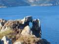
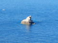
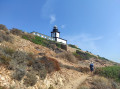
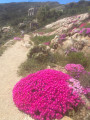
Description of the walk
Waypoints
- S/E : mi 0 - alt. 351 ft - Parking is available 2 km from Calvi towards Galéria.
- 1 : mi 0.46 - alt. 135 ft - Crossroads of the loop
- 2 : mi 1.74 - alt. 230 ft - Sentier des Crêtes on the left
- 3 : mi 2.99 - alt. 203 ft - Révélatta lighthouse
- 4 : mi 3.1 - alt. 128 ft - Belvédère de la Pointe de la Révélatta
- 5 : mi 3.91 - alt. 20 ft - Oscelluccia Beach
- 6 : mi 4.87 - alt. 33 ft - Ruins of a stone house
- 7 : mi 4.93 - alt. 7 ft - Alga Beach
- S/E : mi 5.69 - alt. 348 ft - Arrival
Notes
There are no water sources except for a beach bar at the end of the trail. Be careful in hot weather, as the hike is in full sun. Wear good hiking shoes and bring plenty of water. Remember to bring your swimsuit and towels, as you will pass two beautiful little beaches.
Here is a video of the Pointe de la Revellata to inspire you to go hiking in this wild natural setting.https://www.youtube.com/watch?time_conti...
Worth a visit
Things to see: The Revellata lighthouse.
The Stareso underwater research station, a scientific base dedicated to marine research in the Mediterranean, located at the tip of Cap de la Revellata in Corsica. The small harbour sheltering the scientific base.
Several small beaches where you can swim.
The ruins of the house where Prince Pierre-Napoléon Bonaparte lived on Aghja beach. The view of the gulf and the various headlands is magnificent. The water is crystal clear and the beach slopes gently into the sea.
After picking up your car, don't miss a trip up to Notre-Dame de la Serra, where the views of Calvi Bay are magnificent. On the way, you can see some funny rocks!
Reviews and comments
4.7 / 5
4.7 / 5
4.8 / 5

Overall rating : 5 / 5
Date of your route : Jun 16, 2026
Reliability of the description : ★★★★★ Very good
Ease of following the route : ★★★★★ Very good
Route interest : ★★★★★ Very good
Very busy route : No
A lovely walk – best done early in the morning when it’s very hot; make sure you bring plenty of water, a good pair of walking shoes and your swimming costume
The final climb back to the car is in full sun. After the walk, take a detour to Notre-Dame-de-la-Serra
to enjoy a magnificent view of Calvi Bay
Machine-translated
Overall rating : 5 / 5
Date of your route : Jun 18, 2026
Reliability of the description : ★★★★★ Very good
Ease of following the route : ★★★★★ Very good
Route interest : ★★★★★ Very good
Very busy route : Yes
A lovely, easy walk with beautiful scenery. Best avoided in very hot weather.
Machine-translated
Overall rating : 5 / 5
Date of your route : Jul 03, 2026
Reliability of the description : ★★★★★ Very good
Ease of following the route : ★★★★★ Very good
Route interest : ★★★★★ Very good
Very busy route : Yes
We reckon we would have preferred to do this walk in the opposite direction, as the cliff section is quite challenging if you stick to the path running along the cliff (rather than the track), and it’s best to tackle it whilst it’s still cool and finish via the path leading to the coves and beaches for a swim
Otherwise, the route described here starts with a descent, and the path follows the little coves as far as the lighthouse. There’s little shade and you quickly get very hot. This section is fairly easy, with plenty of possible variations. The views are magnificent.
The return journey along the path skirting the cliff in full sun over rocky ground is more difficult but spectacular.
We finished on the track, which is of little interest apart from allowing you to walk faster
We came across two jeeps. It was very hot
Make sure you take plenty of water and set off early
Small car park
Machine-translated
Overall rating : 5 / 5
Date of your route : Jun 08, 2026
Reliability of the description : ★★★★★ Very good
Ease of following the route : ★★★★★ Very good
Route interest : ★★★★★ Very good
Very busy route : No
In June, it’s not too busy
We took the ridge trail – it’s stunning, but the wind can be fierce
It’s not too difficult, but make sure you have good shoes and water
Beautiful views
Machine-translated

Overall rating : 5 / 5
Date of your route : May 18, 2026
Reliability of the description : ★★★★★ Very good
Ease of following the route : ★★★★★ Very good
Route interest : ★★★★★ Very good
Very busy route : No
A lovely, easy walk provided you’re wearing suitable footwear. The ‘Circuit des Cimes’ route climbs a bit and is quite a bit of a workout, but the view from the top is superb, of course. There aren’t many people on this first section. Once you reach the lighthouse, there are more people; you can’t go inside, but a small path winds its way round to a viewpoint. Return via the beach path, which presents no difficulty. Perhaps a swim for the more adventurous, but you have to get past the patches of seaweed before reaching the clear water.
Machine-translated
Overall rating : 5 / 5
Date of your route : May 11, 2026
Reliability of the description : ★★★★★ Very good
Ease of following the route : ★★★★★ Very good
Route interest : ★★★★★ Very good
Very busy route : No
A superb hike, with the first half being a bit of a workout (but nothing too difficult), and the second half being more gentle. The route is clearly marked, and the views are magnificent all the way. There’s no shade along the route, so make sure you bring plenty of water and appropriate sun protection 😉
Machine-translated
Overall rating : 5 / 5
Date of your route : May 01, 2026
Reliability of the description : ★★★★★ Very good
Ease of following the route : ★★★★★ Very good
Route interest : ★★★★★ Very good
Very busy route : No
A lovely walk, but it was far too windy on 1 May to take the path on the left.
Machine-translated
Overall rating : 5 / 5
Date of your route : Apr 24, 2026
Reliability of the description : ★★★★★ Very good
Ease of following the route : ★★★★★ Very good
Route interest : ★★★★★ Very good
Very busy route : No
A lovely walk; the flowers are beautiful in spring.
There are no particular difficulties on this walk, apart from the fact that there is no shade along the route, so it can get quite hot.
We’d packed beach shoes and a swimming mask in our rucksacks.
On the way back, we stopped for a swim at the lovely little beach of "U Chiaruccia".
Machine-translated
Overall rating : 5 / 5
Date of your route : Apr 18, 2026
Reliability of the description : ★★★★★ Very good
Ease of following the route : ★★★★★ Very good
Route interest : ★★★★★ Very good
Very busy route : No
A lovely walk, though quite a strenuous one if you take the path on the left instead of staying on the road – but nothing you can’t manage.
Machine-translated
Overall rating : 4.7 / 5
Date of your route : Apr 13, 2026
Reliability of the description : ★★★★★ Very good
Ease of following the route : ★★★★★ Very good
Route interest : ★★★★☆ Good
Very busy route : No
A pleasant route with no major difficulties, though there are a few narrow sections at the tip.
No shade, so bring a cap and water.
Machine-translated
Overall rating : 5 / 5
Date of your route : Apr 03, 2026
Reliability of the description : ★★★★★ Very good
Ease of following the route : ★★★★★ Very good
Route interest : ★★★★★ Very good
Very busy route : No
I went on this hike out of season in early April; there were very few people on the trail. It’s a lovely route for seeing the Pointe de la Revellata. The route is fairly straightforward; the path is well-marked, so there’s little risk of getting lost using GPS. Make sure you wear good walking boots though, as the route isn’t all wide paths. Be aware that almost the entire route is in full sun, so make sure you take plenty of water with you, and there are a few spots close to the cliff edge which might be a bit tricky for those prone to vertigo or a fear of heights, but nothing insurmountable.
A very beautiful hike that I highly recommend!
Machine-translated
Overall rating : 4.7 / 5
Date of your route : Oct 13, 2025
Reliability of the description : ★★★★★ Very good
Ease of following the route : ★★★★☆ Good
Route interest : ★★★★★ Very good
Very busy route : Yes
Magnificent, beautiful on the ridges, on the headland, in the coves... magical. And the view of Calvi is superb
The beaches are not very suitable for swimming, full of white seaweed
The route is not very well marked, but easy to follow with geolocation
Machine-translated
Overall rating : 4.3 / 5
Date of your route : Oct 13, 2025
Reliability of the description : ★★★★★ Very good
Ease of following the route : ★★★★☆ Good
Route interest : ★★★★☆ Good
Very busy route : Yes
There are many routes on the site, so be sure to follow the GPX track. Otherwise, it's a magnificent hike with superb views of Calvi
Machine-translated
Overall rating : 5 / 5
Date of your route : Oct 02, 2025
Reliability of the description : ★★★★★ Very good
Ease of following the route : ★★★★★ Very good
Route interest : ★★★★★ Very good
Very busy route : No
A beautiful hike with magnificent views of the sea, the coast and the rocks sculpted by erosion.
Taken in early October, not many people around!
Machine-translated
Overall rating : 4.7 / 5
Date of your route : Sep 18, 2025
Reliability of the description : ★★★★★ Very good
Ease of following the route : ★★★★☆ Good
Route interest : ★★★★★ Very good
Very busy route : No
A very attractive route, well signposted and of a good standard. I think the average rating is a little low.
Machine-translated
Other walks in the area
Notre-Dame della Serra from the Citadel of Calvi
 Visorando Member
 5.38 mi
+755 ft
-764 ft
3h 10
5.38 mi
+755 ft
-764 ft
3h 10
 Easy
Easy
 Departure from Haute-Corse
Between two towers from Arinella Beach
 3.30 mi
+256 ft
-240 ft
1h 45
Easy
Departure from Lumio (Haute-Corse)
3.30 mi
+256 ft
-240 ft
1h 45
Easy
Departure from Lumio (Haute-Corse)
Carchincu and Spano peaks from Lumio
 7.46 mi
+883 ft
-883 ft
4h 10
Moderate
Departure from Lumio (Haute-Corse)
7.46 mi
+883 ft
-883 ft
4h 10
Moderate
Departure from Lumio (Haute-Corse)
Capu d'Occi via the village of Occi
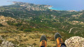 3.18 mi
+1,178 ft
-1,188 ft
2h 30
Moderate
Departure from Lumio (Haute-Corse)
3.18 mi
+1,178 ft
-1,188 ft
2h 30
Moderate
Departure from Lumio (Haute-Corse)
Capu Bracajo via the abandoned village of Occi
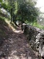 4.27 mi
+1,270 ft
-1,257 ft
3h 05
Moderate
Departure from Lumio (Haute-Corse)
4.27 mi
+1,270 ft
-1,257 ft
3h 05
Moderate
Departure from Lumio (Haute-Corse)
The Cross of Lumio
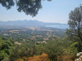 1.46 mi
+558 ft
-558 ft
1h 10
Easy
Departure from Lumio (Haute-Corse)
1.46 mi
+558 ft
-558 ft
1h 10
Easy
Departure from Lumio (Haute-Corse)
The ruined village of Occi (formerly Occi Lumio)
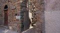 3.53 mi
+1,070 ft
-1,056 ft
2h 35
Moderate
Departure from Lumio (Haute-Corse)
3.53 mi
+1,070 ft
-1,056 ft
2h 35
Moderate
Departure from Lumio (Haute-Corse)
From Calenzana to the Ortu di U Piobu refuge
 Association / Club / Walk leader
 7.39 mi
+4,961 ft
-623 ft
7h 45
7.39 mi
+4,961 ft
-623 ft
7h 45
 Difficult
Departure from Calenzana (Haute-Corse)
Difficult
Departure from Calenzana (Haute-Corse)
For more walks, use our search engine .
The GPS track and description are the property of this route's author. Please do not copy them without permission.

