The Puy Saint-Romain Forest

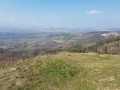
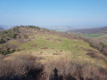
Starting from the village of Mirefleurs, the route takes walkers to the foot of Puy Saint-Romain, a popular spot with paragliders. From its summit, which is accessible on foot, you can enjoy a panoramic view of the Val d’Allier and the volcanic massifs.

Details

944520
Creation:
Last update:
Last review:
  • Walking
    Activity: Walking
  • ↔
    Distance: 4.83 mi
  • ◔
    Average duration: 3h 25 
  • ▲
    Difficulty: Moderate

  • ⚐
    Back to start: Yes
  • ↗
    Ascent: + 1,375 ft
  • ↘
    Descent: - 1,368 ft

  • ▲
    Highest point: 2,546 ft
  • ▼
    Lowest point: 1,211 ft

Photos

Description of the walk

(S/E) From the starting sign in the car park, take the route shared by two routes: Rue du Guichet to the left, then the steps opposite. From the church, head up Place de la Molle.

(1) Take Rue de la Grande Charreyre, to the left of the clock tower (town scales at the base, bell tower at the top).

(2) Cross Place Jean Domat and continue straight ahead along Rue de la Conche.

(3) At the fork, turn right up Rue de Chalendrat, then right again onto Rue de la Thioule until you reach the junction with Rue de Laurassou. Head towards Busséol by continuing straight on.

(4) After passing a pond on the right (with a view of the Sancy), at the junction where the two routes split, head up to the right into the woods. Ignore the successive paths on the right to reach the plateau.

(5) Pass a hairpin bend and turn immediately right onto a grassy path. Keep to the right and follow the fence along the edge of the woodland (views of the Livradois and Forez mountains) until you reach the foot of Puy Saint-Romain.

(6) Go round the left-hand side of Puy Saint-Romain to join the path leading to its summit (unmarked section of the route). Descend via the same route to return to the foot of Puy Saint-Romain.

(6) Then begin the descent to the left via a muddy and stony path.

(7) At the fork in the road, turn right onto a narrow path. Pass through a chicane, then a log staircase, and continue to the edge of the woods (panoramic view of the Val d’Allier, the Chaîne des Puys and the Sancy massif). Continue the descent along the fence.

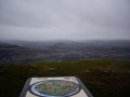
(8) Pass a third hairpin bend to enter the woods. Walk down to the village. Turn right into Rue de Lamprat, then, at the end of the street, right again into Rue de Vignoux (orientation board). At the end of the street, turn right again into Rue des Aires.

(2) From Place Jean Domat, follow Rue de la Grande Charreyre to the left, then via Place de la Molle and Rue du Guichet to return to the starting point (S/E).

Waypoints

  1. S/E : mi 0 - alt. 1,214 ft - Car park near the cemetery, Rue de Chelles
  2. 1 : mi 0.16 - alt. 1,342 ft - Place de la Molle
  3. 2 : mi 0.28 - alt. 1,325 ft - Place Jean Domat
  4. 3 : mi 0.37 - alt. 1,365 ft - Junction of Rue de Busséol and Rue de Chalendrat
  5. 4 : mi 1.28 - alt. 1,739 ft - Junction where the routes split
  6. 5 : mi 1.94 - alt. 2,379 ft - Chicane 1 (plateau)
  7. 6 : mi 2.34 - alt. 2,428 ft - Foot of Puy Saint-Romain
  8. 7 : mi 2.94 - alt. 2,310 ft - Junction
  9. 8 : mi 3.15 - alt. 2,096 ft - Chicane 3
  10. S/E : mi 4.83 - alt. 1,211 ft - Car park near the cemetery, Rue de Chelles

Notes

Yellow markings

Worth a visit

The village of Mirefleurs: this is a former wine-growing village, with relatively well-exposed vineyards. The technique of ‘pailhats’ (terraces supported by dry-stone walls) is widespread across all the hillsides. The village has retained a few winegrowers’ houses. Of particular note is the bell tower, separate from its church, which still houses at its base a town weight that was once used at livestock markets. Fountains and crosses are a common sight throughout the village.

Puy Saint-Romain (781 m): Puy Saint-Romain is the highest point on the banks of the Limagne and offers a superb 360° view. It is also a famous historical site, once home to a priory and a chapel surrounded by a field of Merovingian burial mounds.

Chaînes des Puys.
Sancy Massif.
Val d’Allier.
Livradois-Forez Mountains.

Reviews and comments

3.9 / 5
Based on 5 reviews

Reliability of the description
4 / 5
Ease of following the route
3.6 / 5
Route interest
4 / 5
alvi
alvi

Overall rating : 1.7 / 5

Date of your route : Nov 20, 2023
Reliability of the description : ★☆☆☆☆ Very disappointing
Ease of following the route : ★☆☆☆☆ Very disappointing
Route interest : ★★★☆☆ Average
Very busy route : No

It is not possible to follow the route shown as one of the paths mentioned does not exist.
Poor signposting
This walk is impossible to complete without the app and guidance.

Machine-translated

Alain DOSSI
Alain DOSSI

Overall rating : 4.7 / 5

Date of your route : Jan 10, 2022
Reliability of the description : ★★★★★ Very good
Ease of following the route : ★★★★☆ Good
Route interest : ★★★★★ Very good
Very busy route : No

On the way back down to the village, the directions tell us to turn right onto Rue de Lampart, but there I realise that the yellow guide says to turn left, so from that point on, I’m a bit lost. Anyway, after winding our way through various streets and keeping an eye out for the church, we do eventually find our way back to the starting point.

Machine-translated

Débo63
Débo63

Overall rating : 4.3 / 5

Date of your route : Feb 11, 2019
Reliability of the description : ★★★★★ Very good
Ease of following the route : ★★★★★ Very good
Route interest : ★★★☆☆ Average

The trail is very, very muddy at this time of year; not to mention the many fallen trees... You need to be well equipped (walking poles and waterproof shoes recommended), otherwise you’ll be slipping about and end up with soaked feet

Machine-translated

claudekiko
claudekiko

Overall rating : 4.7 / 5

Date of your route : Dec 17, 2018
Reliability of the description : ★★★★★ Very good
Ease of following the route : ★★★★☆ Good
Route interest : ★★★★★ Very good

There was plenty of mud in the woodland at this time of year, both on the way up and on the way down! Magnificent views from the top of the hill. On the way back, between 5 and 6, it seemed that the point where the path went through the fence had been moved further down relative to the trail, and this led us onto a yellow-marked PR path which was quite different from the trail but which also led back to the village.

Machine-translated

63Vincent
63Vincent

Overall rating : 4 / 5

Date of your route : Feb 12, 2018
Reliability of the description : ★★★★☆ Good
Ease of following the route : ★★★★☆ Good
Route interest : ★★★★☆ Good

Hello,
A lovely walk – a nice change from my usual route
Piche 63

Machine-translated

Other walks in the area

For more walks, use our search engine .

The GPS track and description are the property of this route's author. Please do not copy them without permission.