The Uomo di Cagna

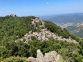
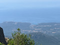
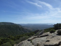
This is a round-trip hike that leads to a summit at an altitude of 1,217 metres. At the end of the climb, rising up from a jumble of black granite, stands the Uomo di Cagna, a balancing rock formation. The summit plateau offers a beautiful view of the southern coastline.

Details

224340
Creation:
Last update:
Last review:
  • Walking
    Activity: Walking
  • ↔
    Distance: 5.32 mi
  • ◔
    Average duration: 4h 35 
  • ▲
    Difficulty: Difficult

  • ⚐
    Back to start: Yes
  • ↗
    Ascent: + 2,461 ft
  • ↘
    Descent: - 2,438 ft

  • ▲
    Highest point: 3,898 ft
  • ▼
    Lowest point: 1,552 ft

Photos

Description of the walk

Head to Monacia d’Aullène via the RT40 (formerly the RN196). The walk starts from the main (and only) street in the hamlet of Giannuccio, where you should park as soon as possible, as there are no other parking options further into the village, which is a cul-de-sac.

(S/E) Follow the main road as it climbs. Turn right at the first junction (the “L’Uomo di Cagna” path is signposted).

(1) The path is then reached by taking a sharp left-hand bend. Walk alongside a stone wall and follow the path as it climbs.

(2) At a junction, turn right to follow the direction indicated by a sign attached to a tree.
From this point, follow the yellow markings present throughout the route. The path enters the woodland and skirts the 887-metre peak to the south. Continue climbing in a north-easterly direction, through increasingly open terrain.

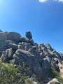
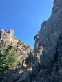
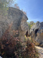
(3) Towards the end of the ascent, the route takes you through a field of boulders and you will often need to use your hands to help you along. Follow this tricky path to the summit of Uomo di Cagna.

(4) The return journey follows exactly the same path as the outward journey, taking you back to the starting point (S/E).

Waypoints

  1. S/E : mi 0 - alt. 1,555 ft - Start from the entrance to Giannuccio
  2. 1 : mi 0.23 - alt. 1,621 ft - Start of the path. Take the hairpin bend to the left.
  3. 2 : mi 0.4 - alt. 1,680 ft - Crossroads. Turn right and follow the signposted direction.
  4. 3 : mi 1.94 - alt. 3,340 ft - Entrance to the rocky area.
  5. 4 : mi 2.67 - alt. 3,898 ft - Uomo di Cagna
  6. S/E : mi 5.32 - alt. 1,555 ft - You arrive on the main street in Giannuccio.

Notes

Equipment: a good pair of walking boots is strongly recommended (stony ground and rocks), as well as walking poles.

Worth a visit

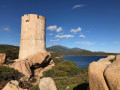
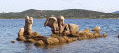
(4) View of the granite rock formation known as L’Uomo di Cagna.

Reviews and comments

4.7 / 5
Based on 30 reviews

Reliability of the description
4.8 / 5
Ease of following the route
4.6 / 5
Route interest
4.8 / 5
NLE
NLE

Overall rating : 5 / 5

Date of your route : Jun 23, 2026
Reliability of the description : ★★★★★ Very good
Ease of following the route : ★★★★★ Very good
Route interest : ★★★★★ Very good
Very busy route : No

The start of the climb sets the tone – it’s going to be steep right to the end, including on the descent. The route is mostly shaded, which is a real bonus. The scenery is quite varied and the views are truly stunning. The finish is well worth the effort. A break on the large flat rock just below the summit is a must. Trying to get closer to the Omú remains difficult, if not dangerous – not to say pointless. An unmissable hike.

Machine-translated

lemarcheur65
lemarcheur65 ★

Hello patricklanglois
Thank you for reporting this.
If the author doesn't react, I'll delete his review.

Hello jbe83
I can delete your review, which is obviously not posted on the relevant hike.

Machine-translated

patricklanglois
patricklanglois
• Edited:

Hello
You are giving an opinion on a hike that is not, in principle, the one you have done...
You say that you looked for the loop and mention WP 7 and 8...
However, this is a return route and only includes 4 work packages...
Please correct this to give your opinion on the trail you actually followed.

Machine-translated

estelle05
estelle05

Overall rating : 5 / 5

Date of your route : Jul 22, 2024
Reliability of the description : ★★★★★ Very good
Ease of following the route : ★★★★★ Very good
Route interest : ★★★★★ Very good
Very busy route : No

A difficult hike but with some very pretty scenery. You need to set off in the morning because even though most of the hike is in the shade, it's very hot. Bring plenty of water.

Machine-translated

mimy
mimy

Overall rating : 5 / 5

Date of your route : Jun 24, 2024
Reliability of the description : ★★★★★ Very good
Ease of following the route : ★★★★★ Very good
Route interest : ★★★★★ Very good
Very busy route : Yes

a magnificent hike on the ile aux cailloux

Machine-translated

fnicoud
fnicoud

Overall rating : 4.7 / 5

Date of your route : Jun 05, 2024
Reliability of the description : ★★★★★ Very good
Ease of following the route : ★★★★☆ Good
Route interest : ★★★★★ Very good
Very busy route : No

Easy 2-hour walk. Pleasant climb through the forest
From marker 3 onwards, we go around a rocky hill and sometimes you have to use your hands to get past certain passages. But there is no particular danger.
Once you reach the signpost, continue upwards, following the yellow markers almost all the way to the foot of the umo di cagna.
At 50m from the balanced rock, it is advisable to put down your rucksacks to climb the large boulders and get as close as possible. This is a more difficult part. We stopped fairly quickly because we couldn't find a way to go any further. But the view of the rock was very good.
A beautiful day with splendid views

Machine-translated

Miss2roub
Miss2roub

Overall rating : 4.7 / 5

Date of your route : Apr 18, 2024
Reliability of the description : ★★★★★ Very good
Ease of following the route : ★★★★☆ Good
Route interest : ★★★★★ Very good
Very busy route : No

3 very different phases of walking
- small stones
- forest
- large stones
Nice viewpoint.

Machine-translated

Skawa15
Skawa15

Overall rating : 4.7 / 5

Date of your route : Oct 05, 2023
Reliability of the description : ★★★★★ Very good
Ease of following the route : ★★★★★ Very good
Route interest : ★★★★☆ Good
Very busy route : No

Lovely walk, the path is very well signposted from the village. A little climb at the end to get to the balanced rock face.

Machine-translated

Albertha
Albertha

Overall rating : 4.7 / 5

Date of your route : Aug 08, 2023
Reliability of the description : ★★★★★ Very good
Ease of following the route : ★★★★☆ Good
Route interest : ★★★★★ Very good
Very busy route : No

A beautiful hike with superb views from the summit. The path is well marked up to the finish under the uomo di cagno, after which you have to improvise to climb the last rocks. This part is a bit "sporty" but no major problems, including for my 13-year-old son who is used to walking.

Machine-translated

RandoCorsica
RandoCorsica

Overall rating : 4.7 / 5

Date of your route : Jul 27, 2023
Reliability of the description : ★★★★★ Very good
Ease of following the route : ★★★★☆ Good
Route interest : ★★★★★ Very good
Very busy route : No

A good description and a lovely walk.

Machine-translated

Trajane
Trajane

Overall rating : 5 / 5

Date of your route : Jun 09, 2023
Reliability of the description : Not used / Not applicable
Ease of following the route : ★★★★★ Very good
Route interest : ★★★★★ Very good
Very busy route : No

You need to set off very early in the morning, with plenty of water in summer to avoid the heat. However, three-quarters of the climb is in the shade. The path is well marked, but good footwear is recommended as there are rocks to negotiate.
Once on the eminence, finding the way up to the Homme de Cagna rock (with its characteristic head) is difficult and dangerous as it is located at the top of a large granite chaos.
Beautiful rocks, 270° views from the east coast to Propriano on the west coast.
There's a nice little café in the starting village.

Machine-translated

boize
boize

Overall rating : 4.3 / 5

Date of your route : Jun 15, 2023
Reliability of the description : ★★★★☆ Good
Ease of following the route : ★★★★★ Very good
Route interest : ★★★★☆ Good
Very busy route : No

A very fine hike, well worth the effort.

Machine-translated

BAMX
BAMX

Too difficult

Machine-translated

IsaYa
IsaYa

Overall rating : 5 / 5

Date of your route : Aug 26, 2022
Reliability of the description : ★★★★★ Very good
Ease of following the route : ★★★★★ Very good
Route interest : ★★★★★ Very good
Very busy route : No

A very fine, physical hike, so we set off early in the morning to avoid the high heat and packed plenty of water.
We made it to the plateau with a view of the bilboquet thanks to the (original) yellow markings, without any problems. We didn't try the last 50 metres, which were more of a climb, but that didn't detract from the beauty of the landscape.
On the other hand, for us the hike was more like 10.9 km!
Thank you for a wonderful day.

Machine-translated

AdrienC
AdrienC

Overall rating : 5 / 5

Date of your route : Jul 21, 2022
Reliability of the description : ★★★★★ Very good
Ease of following the route : ★★★★★ Very good
Route interest : ★★★★★ Very good
Very busy route : No

Hello,
A hike worth doing!
At the top, a landscape of stone and a beautiful panoramic view.
CDT

Machine-translated

Other walks in the area

For more walks, use our search engine .

The GPS track and description are the property of this route's author. Please do not copy them without permission.