From Serra des Boc to Cavalleria Lighthouse

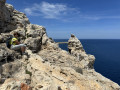
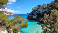
A lovely walk along the rugged coastline and past magnificent coves. It’s a must-see in Menorca.
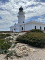
The lighthouse is situated at the very northern tip of the island.

Details

49997944
Creation:
Last update:
Last review:
  • Walking
    Activity: Walking
  • ↔
    Distance: 10.25 mi
  • ◔
    Average duration: 5h 25 
  • ▲
    Difficulty: Moderate

  • ⚐
    Back to start: Yes
  • ↗
    Ascent: + 846 ft
  • ↘
    Descent: - 827 ft

  • ▲
    Highest point: 279 ft
  • ▼
    Lowest point: -3 ft

Photos

Description of the walk

At Serra des Boc, there’s free parking along the road (Carrer de Dalt). Park as soon as possible.

(S/E) Head south, then take the road on the right (Carrer de S’Alcor) which leads to Cala Tirant.

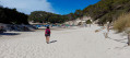
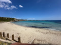
(1) Turn right onto the Cami de Cavalls and walk past a shop on the corner of the road: as a reminder, the Cami de Cavalls is marked not only by signposts but also by the white and red markings ofthe GR®223. Cross the first small beach, then head down to Cala Tirant and walk along it.

(2) Continue along the coast, temporarily leaving the Cami de Cavalls, which branches off to the left. Walk past a block of flats, then turn left towards a clearly visible building and rejoin the Cami de Cavalls a little further on.

(3) Turn right, then right again about a hundred metres further on, towards Punta de la Talaieta. Continue in the same direction to reach Punta Negra.

(4) Go round Macar Gran Bay, continue along the coast until you come out onto the tarmac road of the Cami de Far.

(5) Carry on to the right to reach the lighthouse via a series of long, straight stretches.

(6) Once you reach the lighthouse, take a moment to rest and enjoy the views as you walk around it. The return journey follows the same route as the outward leg until you reach a junction you passed on the way out.

(3) Carry on straight ahead along the Cami de Cavalls, leaving the path you took on the way out on your left. Return to Cala Tirant beach.

(2) Walk along the beach, keeping to the right and following the route in the opposite direction to the outward journey, until you reach the car park (S/E).

Waypoints

  1. S/E : mi 0 - alt. 75 ft - Free parking on Carrer de Dalt
  2. 1 : mi 0.43 - alt. 39 ft - Fork in the path
  3. 2 : mi 0.79 - alt. 0 ft - Crossroads – 1st circular loop
  4. 3 : mi 1.34 - alt. 82 ft - Crossroads, 2nd circular loop
  5. 4 : mi 2.28 - alt. 20 ft - Punta Negra
  6. 5 : mi 3.42 - alt. 26 ft - Tarmac road, Cami de Far
  7. 6 : mi 5.05 - alt. 236 ft - Cavalleria Lighthouse
  8. S/E : mi 10.25 - alt. 75 ft - Free parking on Carrer de Dalt

Notes

The closer you park to Cala Tirant, the less of the village you’ll have to walk through. That said, the walk to the Cami de Cavalls is very pleasant.
The tarmac road leading to the lighthouse is a bit of a slog; it’s up to you whether you want to go there or give it a miss.
There is a shuttle service, but it wasn’t running in May.
So I walked there from the gate, but on the way back, a kind lady gave me a lift back down to the gate, where I rejoined the Cami de Cavalls to head back.
Please note that there’s no drinking water along the route. Make sure you take plenty with you to ensure you can enjoy the walk in comfort.
The path is not difficult at all. However, a good pair of walking shoes is strongly recommended.

Worth a visit

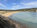
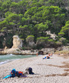
You can go for a swim at various points along the walk. Alternatively, you can wait until you reach the end and relax in the crystal-clear waters at Cala Tirant.

Always be cautious and plan ahead when you're outdoors. Visorando and the author of this route cannot be held responsible for any accidents occurring on this route.

The GR® and PR® markings are the intellectual property of the Fédération Française de Randonnée Pédestre.

Reviews and comments

5 / 5
Based on 2 reviews

Reliability of the description
5 / 5
Ease of following the route
5 / 5
Route interest
5 / 5
MCVR13
MCVR13

Overall rating : 5 / 5

Date of your route : May 07, 2025
Reliability of the description : ★★★★★ Very good
Ease of following the route : ★★★★★ Very good
Route interest : ★★★★★ Very good
Very busy route : No

Hello, a lovely walk which we tweaked slightly.
We set off from Cala Tirant, then at point 5, instead of heading towards the lighthouse with the cars, we turned off towards the recently restored Sanitja Tower, situated on a beautiful stretch of coastline that’s ideal for a refreshing dip (rocks, no sand).
Thank you for sharing.

Machine-translated

patrick55
patrick55

Yes, it’s a lovely walk, like so many others in Menorca. It’s a shame about the start of the Serra Bocs – it’s marshy terrain with lots of birds. I’m delighted you enjoyed it.
Have a lovely stay.

Machine-translated

Patrick PREVOST
Patrick PREVOST

Overall rating : 5 / 5

Date of your route : Oct 25, 2024
Reliability of the description : ★★★★★ Very good
Ease of following the route : ★★★★★ Very good
Route interest : ★★★★★ Very good
Very busy route : Yes

A really lovely walk! We set off from Platges de Fornells rather than Serra des Boc… It was a personal choice to shorten the route a bit, as the starting point didn’t seem particularly interesting to us and ours was more convenient.
It’s true that the final stretch towards the lighthouse (and back) is a bit tedious, but it’s well worth it! What a view!

Machine-translated

Other walks in the area

For more walks, use our search engine .

The GPS track and description are the property of this route's author. Please do not copy them without permission.