Tortequeue Route

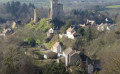
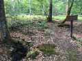
Venture into the heart of a lush bocage landscape made up of small plots and discover the Soulongis oak forest, which, in the Middle Ages, formed a single entity with that of Tronçais. The Templar Church at Le Vilhain and the Pierre Chevriau will give you a glimpse of the mysterious past surrounding the forest.

Details

692611
Creation:
Last update:
Last review:
  • Walking
    Activity: Walking
  • ↔
    Distance: 6.73 mi
  • ◔
    Average duration: 3h 25 
  • ▲
    Difficulty: Moderate

  • ⚐
    Back to start: Yes
  • ↗
    Ascent: + 364 ft
  • ↘
    Descent: - 354 ft

  • ▲
    Highest point: 1,214 ft
  • ▼
    Lowest point: 938 ft
  • ⚐ Country: France
  • ⚐ City: Le Vilhain (03350)
  • ⚑
    Start/End: N 46.55957° / E 2.79658°
  • ❏
    IGN map(s): Ref. 2427SB
  • Hour-by-hour weather

Description of the walk

(S/E) At the car park opposite the town hall, turn left onto the road leading downhill, away from the village. Ignore a path on the right (at the cross) and, at the following bends, ignore the road on the right leading to Les Souliers. Continue to the Soulongis State Forest, ignoring a road on the left leading to Les Frênes. In the forest, ignore a path on the right and follow the road to the bend at the Soulongis Forest House.

(1) Near the Soulongis Forest House, the road bends to the right. Turn left here, towards the Forest House, then carry on straight ahead along the path through the forest. Follow the path and then the road that continues from it, ignoring a path on the right at the top of the road.

(2) At La Maillerie, the road bends to the right. Take the path on the left that leads downhill. Ignore a path on the right and continue along the road.

(3) Turn left onto the dirt track, then take the first track on the right (a grassy track).

(4) At the end of the track, turn left. Then, at the junction with the road, turn right and follow the road until you reach the D16.

(5) At the road, turn left and follow it for 300 metres. Take the road on the right as it bends. Ignore two paths on the right and carry on straight ahead along the dirt track.

(6) At the end of the track, turn right and follow the road for 200 metres. Then turn left.

(7) At the next junction, take the track on the left until you reach the road. Cross the road and take the track opposite.

(8) When you reach the hamlet of Les Bordes, ignore one path on the right, then a second one, and take the road on the left. Continue until you reach the junction with the D16.

(9) Cross the road and take the path opposite. After 125 metres, turn left. Continue to the village of Le Vilhain. At the road, cross over and take the path opposite. Walk past the church and the Pierre Chevriau and return to the starting point (S/E).

Waypoints

  1. S/E : mi 0 - alt. 1,175 ft - Car park opposite the town hall
  2. 1 : mi 1.84 - alt. 1,096 ft - Junction – turn left
  3. 2 : mi 2.78 - alt. 1,053 ft - Junction – turn left
  4. 3 : mi 3.34 - alt. 1,109 ft - Junction – turn left, then immediately right
  5. 4 : mi 3.65 - alt. 1,145 ft - Crossing path – to the left
  6. 5 : mi 4.12 - alt. 1,207 ft - D16 on the left
  7. 6 : mi 4.78 - alt. 1,178 ft - Junction – turn right
  8. 7 : mi 5.18 - alt. 1,135 ft - Crossroads, path on the left
  9. 8 : mi 5.73 - alt. 1,129 ft - Les Bordes
  10. 9 : mi 6.22 - alt. 1,207 ft - Opposite the junction with the D16
  11. S/E : mi 6.73 - alt. 1,175 ft - Car park opposite the town hall

Worth a visit

Soulongis Forest.
Templar Church.
Pierre Chevriau.

Reviews and comments

4.1 / 5
Based on 4 reviews

Reliability of the description
4 / 5
Ease of following the route
4.5 / 5
Route interest
3.8 / 5
MarineSylf
MarineSylf

Overall rating : 2.7 / 5

Date of your route : Jan 17, 2022
Reliability of the description : ★★☆☆☆ Disappointing
Ease of following the route : ★★★★☆ Good
Route interest : ★★☆☆☆ Disappointing
Very busy route : No

An enticing itinerary, but unfortunately, FAR too much driving… Apart from a stunning stretch through the Soulongis Forest, most of the route is on tarmac, and even though the surrounding countryside is beautiful, it’s a real shame…Furthermore, whilst following the route description, I noticed numerous inconsistencies and even, at times, the directions given were the wrong way round… You’d be better off relying on your map if you’re keen to do this walk… But it would be better to re-plan the route along pleasant, unpaved paths…

Machine-translated

bernardino
bernardino ★

Hello, and many thanks for this message, which – having read our author’s description – has surprised me in three respects:
- Firstly, our website offers our readers walks based on a personal account written by the author after they have completed the route;
- secondly, we do not wish to base these descriptions on trail markings; however, where markings are present, authors are advised to mention them to help future walkers,
- the third is that this route makes no mention whatsoever of the yellow trail markings you highlight; therefore, once you have cleared the markings from this route, the description provided by our author will be fully accurate.
But we do appreciate volunteers on the site, such as yourself, who devote their time to marking out trails; in fact, there are several of us on the site who carry out this work for the FFRP and other organisations.
Have a lovely rest of the day.

Machine-translated

Bourbonnais
Bourbonnais

As a trail marker for the French Hiking Federation, I am responsible for removing the markings from the Tortequeue route, which means that the official yellow signposts will be taken down; it would be best to remove this walk from your records.
This walk will be replaced by the 12.5 km ‘Le Moulin de Doure’ route, starting from Le Vlhain 03350, which I plan to mark out in June.
J P Dénoyer

Machine-translated

gloumeaud
gloumeaud

Overall rating : 4.7 / 5

Date of your route : Apr 10, 2018
Reliability of the description : ★★★★★ Very good
Ease of following the route : ★★★★★ Very good
Route interest : ★★★★☆ Good

A really lovely route with beautiful views over the valleys of pretty streams and the edge of the Soulongis Forest. There’s just one slightly dangerous section – a stretch along the road for a few hundred metres on the way back – but otherwise it’s along small country lanes with very little traffic. Thank you for this route, which is accessible to everyone. Jean-Pierre

Machine-translated

NOSSIREH
NOSSIREH

Overall rating : 5 / 5

Date of your route : Nov 13, 2017
Reliability of the description : ★★★★★ Very good
Ease of following the route : ★★★★★ Very good
Route interest : ★★★★★ Very good

A easy route, suitable for everyone.

Machine-translated

ainésrandonneurs
ainésrandonneurs

Overall rating : 4 / 5

Date of your route : Aug 16, 2017
Reliability of the description : ★★★★☆ Good
Ease of following the route : ★★★★☆ Good
Route interest : ★★★★☆ Good

a bit too much tarmac...

Machine-translated

Other walks in the area

For more walks, use our search engine .

The GPS track and description are the property of this route's author. Please do not copy them without permission.