Pont Menou Route

An easy short route starting from the foot of the Douron at Pont Menou, taking you through the Plouégat countryside via Kelumec and Kerforn, just a few metres from the Cozmezou cider house.

Details

13891150
Creation:
Last update:
Last review:
  • Walking
    Activity: Walking
  • ↔
    Distance: 3.23 mi
  • ◔
    Average duration: 1h 40 
  • ▲
    Difficulty: Easy

  • ⚐
    Back to start: Yes
  • ↗
    Ascent: + 197 ft
  • ↘
    Descent: - 226 ft

  • ▲
    Highest point: 266 ft
  • ▼
    Lowest point: 23 ft

Photos

Description of the walk

The start is at the car park at the base of the Douron at Pont Menou, by the information board.

Blue Triangle signposting

(S/E) At the end of the car park, turn left, follow the edge of the woodland towards the houses below. Go round these houses on the right and follow the path to the road. Continue to the end of the road.

(1) Follow the road to the left as far as the junction (Chapelle Sainte-Marguerite), then turn left. Walk up Rue de Pont Menou for about 250 m, then turn right towards Créac’h Coat. Walk up the street, past the old Pont Menou school, and continue to the first junction. Turn left onto Impasse de Créac’h Coat and carry on straight ahead to Quélumec. Once you reach the road, turn right towards the houses and continue past them for 100 m until you reach a fork in the road.

(2) Follow the path to the left until you reach the road. Take a right-then-left turn, cross the road and carry on towards Kernonnen.

(3) At the right-hand bend, take the path on the left and head towards Kerforn: you are now halfway along the route. Continue straight on until you reach the road, then turn right. Follow this road for about 250 m, then, after the house on the left, turn left onto a track and walk for about 150 m.

(4) Turn left, then carry on straight ahead until you reach the Route des Quatre Chemins. Cross it and carry on straight ahead for about 300 m towards Feunteun Guen (Fontaine Blanche on IGN maps).

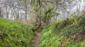
(5) Turn left, follow the edge of the woodland, then head down into the sunken track and continue to the small stream. Cross it and turn right. After the gate, turn left and head back up to the base of the Douron (S/E).


Waypoints

  1. S/E : mi 0 - alt. 108 ft - Car park at the foot of the Douron
  2. 1 : mi 0.23 - alt. 30 ft - Road junction - Douron (fleuve)
  3. 2 : mi 1 - alt. 125 ft - Quémulec hamlet
  4. 3 : mi 1.53 - alt. 253 ft - Route de Kernonnen
  5. 4 : mi 2.27 - alt. 266 ft - Crossroads
  6. 5 : mi 2.95 - alt. 115 ft - Feunteun-Guen hamlet
  7. S/E : mi 3.24 - alt. 108 ft - Car park at the foot of the Douron

Reviews and comments

4.9 / 5
Based on 3 reviews

Reliability of the description
5 / 5
Ease of following the route
5 / 5
Route interest
4.7 / 5
stutzy
stutzy

Hello,
Thank you for your comment, which recognises the work carried out by the volunteers who maintain this route.
We’re delighted that you enjoyed the walk.

Machine-translated

User 25964945
• Edited:

Overall rating : 4.7 / 5

Date of your route : Jul 27, 2026
Reliability of the description : ★★★★★ Very good
Ease of following the route : ★★★★★ Very good
Route interest : ★★★★☆ Good
Very busy route : No

A lovely little walk. Beautiful scenery through the countryside, sunken paths, woods… Hardly any sections on roads. Very well signposted and well-maintained.
Perfect for when you’re short on time!

Machine-translated

stutzy
stutzy

Hello,
Thank you for your comment, which recognises the work done by the volunteers who maintain this route.
We are delighted that you enjoyed the walk.

Machine-translated

Randos Plestinaises
Randos Plestinaises

Overall rating : 5 / 5

Date of your route : Mar 26, 2026
Reliability of the description : ★★★★★ Very good
Ease of following the route : ★★★★★ Very good
Route interest : ★★★★★ Very good
Very busy route : No

The guidebook is flawless.
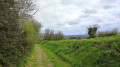
The route consists mainly of dirt tracks that are remarkably well maintained.
Lovers of sunken paths will be in their element.
A few beautiful buildings add to the charm of the walk.
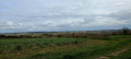
The middle third of the route winds along the ridge. It offers a wealth of panoramic views over the rolling countryside set back from the coast.
The route presents no difficulty.
It is suitable for everyone, at their own pace.

Machine-translated

gerard payelle
gerard payelle

Overall rating : 5 / 5

Date of your route : Jan 15, 2024
Reliability of the description : ★★★★★ Very good
Ease of following the route : ★★★★★ Very good
Route interest : ★★★★★ Very good
Very busy route : No

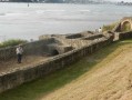
A very easy route that follows the meandering course of the river; very pleasant

Machine-translated

Other walks in the area

For more walks, use our search engine .

The GPS track and description are the property of this route's author. Please do not copy them without permission.