Ermitage route

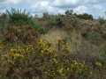
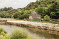
A beautiful route between the towns of Baulon, Lassy and Goven, surrounded by the legends of the Notre-Dame chapel. Discover the history surrounding the statue of Saint Anne and the nearby fountain.
This route is partially signposted (wooden sign, yellow paint indicating the Hermitage route). Part of it is shared with another very well-signposted route (the Caffort route).

Details

442873
Creation:
Last update:
Last review:
  • Walking
    Activity: Walking
  • ↔
    Distance: 7.10 mi
  • ◔
    Average duration: 3h 30 
  • ▲
    Difficulty: Moderate

  • ⚐
    Back to start: Yes
  • ↗
    Ascent: + 269 ft
  • ↘
    Descent: - 243 ft

  • ▲
    Highest point: 377 ft
  • ▼
    Lowest point: 197 ft
  • ⚐ Country: France
  • ⚐ City: Goven (35580)
  • ⚑
    Start/End: N 47.994617° / W 1.884597°
  • ❏
    IGN map(s): Ref. 1119SB
  • Hour-by-hour weather

Photos

Description of the walk

The starting point is located in the small car park near the Ermitage chapel. From the crossroads leaving the D44, the car park is located about 300 metres on the left.

(S/E) From the car park, walk a few metres towards the crossroads and take the small path on the right leading to the Chapel of the Hermitage.

(1) Then take the path on the left, which continues on from the chapel, to reach the D44 below.
Follow the road to the right and note the tree house on the private property on the right.

(2) At the bend, before crossing the Canut, take the small path on the left. Pass the first path on the right and follow the sign for Route de Caffort. At the next fork, continue on the path on the right until you reach the road near Hillandais.

(3) Take this road on the left, then the first road on the right before Le Beauchais (wooden sign indicating the route de l'Ermitage). Follow this path, then turn left onto the D62 (facing you, the bell tower of Goven).

(4) After 100 metres on the D62, take the small path on the left winding between the fields, then at the end of this path, take a small road for 50 metres until you reach the stop sign at La Sauvageais.

(5) Turn right onto the D44 for about 100 metres, then at the bus stop, take the path on the left between two houses (signposted Route de Caffort). The path crosses the Lande de Caffort and joins a wider path, which you take to the right.

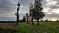
(6) At Noë de Caffort, cross the road and let it run to the right towards Noë, continuing straight ahead on the grassy path towards the fir trees. At Ville Hamon, cross the road and continue straight ahead on this path.

(7) Leave the path on the right and follow the wooden sign pointing to the Ermitage route.

(8) Leave the path continuing to the right and continue along the small path opposite, near the large rock. When you reach a wider path, turn left and go around the house on your right.

(9) Continue straight ahead on this path, leaving the path on the right leading to a small pond.

(10) At the road, turn left and ignore the road on your right leading to La Jouannelay. Pass a bread oven on your left, then a wayside cross. Ignore the road on your left and, after the bus stop, take the grassy path on the left.

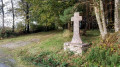
(11) When you reach the road, turn left. Don't miss the old stone wayside cross on the left (not marked on the map), near the grassy path.

(12) Continue along the road, then after the bend, take the path on the right 200 metres further on (wooden sign). Stay on this path until you reach the road and turn right. After 300 metres, you will see a sign on the right indicating the Ermitage chapel. Take the road on the right; the car park is 200 metres away (S/E).

Waypoints

  1. S/E : mi 0 - alt. 308 ft - Car park near the chapel.
  2. 1 : mi 0.26 - alt. 276 ft - Chapelle Notre Dame de l'Ermitage
  3. 2 : mi 0.7 - alt. 197 ft - Fork in the road at a bend - Canut (rivière) - Saint-Senoux à finaliser
  4. 3 : mi 1.22 - alt. 312 ft - La Hillandais
  5. 4 : mi 2.01 - alt. 302 ft - Start of the path on the left
  6. 5 : mi 2.69 - alt. 299 ft - La Sauvageais
  7. 6 : mi 3.15 - alt. 341 ft - La Noë de Caffort
  8. 7 : mi 3.84 - alt. 276 ft - Ermitage route sign
  9. 8 : mi 4.02 - alt. 279 ft - Rock
  10. 9 : mi 4.3 - alt. 312 ft - Turn right
  11. 10 : mi 4.99 - alt. 348 ft - Road
  12. 11 : mi 5.23 - alt. 374 ft - Bus stop
  13. 12 : mi 6.09 - alt. 335 ft - Ermitage route sign
  14. S/E : mi 7.1 - alt. 308 ft - Car park near the chapel.

Worth a visit

(1) Don't miss reading the history of this chapel, rebuilt in 1938, the statue of Saint Anne and the fountain.

Reviews and comments

4.1 / 5
Based on 14 reviews

Reliability of the description
4.4 / 5
Ease of following the route
4.1 / 5
Route interest
3.9 / 5
User 8497234

Overall rating : 3.7 / 5

Date of your route : Jul 20, 2025
Reliability of the description : ★★★★☆ Good
Ease of following the route : ★★★★☆ Good
Route interest : ★★★☆☆ Average
Very busy route : Yes

Simple route, no difficulties and fairly well signposted.

Machine-translated

hervérob
hervérob

Overall rating : 5 / 5

Date of your route : Jun 02, 2025
Reliability of the description : ★★★★★ Very good
Ease of following the route : ★★★★★ Very good
Route interest : ★★★★★ Very good
Very busy route : Yes

very pleasant hike, beautiful grassy path

Machine-translated

Kaal
Kaal

Overall rating : 2.7 / 5

Date of your route : Jul 18, 2023
Reliability of the description : ★★★☆☆ Average
Ease of following the route : ★★☆☆☆ Disappointing
Route interest : ★★★☆☆ Average
Very busy route : No

The route is rather poorly marked (few visible signposts) and uninteresting (lots of fields and several sections of road...).

Machine-translated

damiens jf
damiens jf

Overall rating : 3.3 / 5

Date of your route : Mar 06, 2023
Reliability of the description : ★★★★★ Very good
Ease of following the route : ★★☆☆☆ Disappointing
Route interest : ★★★☆☆ Average
Very busy route : No

The path was impassable after the chapel, much too muddy right from the start of the walk.
Despite the Nordic walking poles.

This explains the poor assessment of the ease of following the route.

So we did the hike in reverse order: Arrival => No. 12 => No. 11 => No. 10
Then we returned by roughly the same route.

Machine-translated

DESMOTTES Gérard
DESMOTTES Gérard

Overall rating : 4.3 / 5

Date of your route : Dec 11, 2022
Reliability of the description : ★★★★☆ Good
Ease of following the route : ★★★★★ Very good
Route interest : ★★★★☆ Good
Very busy route : Yes

This route is suitable for autumn or winter weather as it is not very wet. However, there are two fairly long and dangerous sections of road. When travelling in groups, discipline is essential.

Machine-translated

Galahad
Galahad
• Edited:

Overall rating : 4 / 5

Date of your route : Dec 06, 2022
Reliability of the description : ★★★★★ Very good
Ease of following the route : ★★★☆☆ Average
Route interest : ★★★★☆ Good
Very busy route : No

A beautiful route, ideal for short winter days.
However, the paint markings that indicate the route are not very clear.
They are often marked on the wrong side of tree trunks or posts.
What's more, they are often yellow, sometimes green.

Machine-translated

Kupsou
Kupsou

Overall rating : 4 / 5

Date of your route : Apr 10, 2022
Reliability of the description : ★★★★☆ Good
Ease of following the route : ★★★★☆ Good
Route interest : ★★★★☆ Good
Very busy route : No

Lovely walk, varied scenery. I recommend it.

Machine-translated

domivasseur2935
domivasseur2935

Overall rating : 4.7 / 5

Date of your route : Nov 07, 2021
Reliability of the description : ★★★★★ Very good
Ease of following the route : ★★★★★ Very good
Route interest : ★★★★☆ Good
Very busy route : No

A lovely, classic short hike through the countryside. Nothing particularly remarkable, but with pretty views of the countryside. Few elevation changes. An astonishing church from the 1930s at the starting point. Very well marked by Sud-Vallons.

Machine-translated

MorgatVezin
MorgatVezin

Overall rating : 4.7 / 5

Date of your route : Jun 12, 2021
Reliability of the description : ★★★★★ Very good
Ease of following the route : ★★★★★ Very good
Route interest : ★★★★☆ Good
Very busy route : No

Very nice route in the countryside with a bit of forest.
The tarmac sections are a bit long.
Two sections on busy roads; take great care.
But the route is well signposted and very pleasant.

Machine-translated

gverron
gverron

Overall rating : 5 / 5

Date of your route : Aug 23, 2020
Reliability of the description : ★★★★★ Very good
Ease of following the route : ★★★★★ Very good
Route interest : ★★★★★ Very good
Very busy route : No

A very pleasant walk combining moorland, countryside and forest landscapes. Some beautiful views and a few hills.

Machine-translated

kerphil
kerphil

Overall rating : 4 / 5

Date of your route : May 03, 2019
Reliability of the description : ★★★★★ Very good
Ease of following the route : ★★★★☆ Good
Route interest : ★★★☆☆ Average

The area near the Hermitage Chapel is very wet, but the site is well worth a little mud on our boots.

Machine-translated

henri57
henri57 ★

Hello,

the markings are missing or not visible

The signposting is not the responsibility of Visorando

which forced us to make several long stops (and even turn back)

Did the description and route cause any problems? If so, how can we remedy this?

to study the map and description.

Finding your way while hiking is not easy. If you are not confident in your orientation skills, I recommend using the Visorando GPS app in addition to the description and route map.

The aim is not to be glued to your smartphone, but to have a tool that allows you to validate waypoints and thus remove any doubts about your orientation.

This is just a modest suggestion.

See you soon!

Machine-translated

familledes7
familledes7

Overall rating : 3.3 / 5

Date of your route : Oct 12, 2018
Reliability of the description : ★★★☆☆ Average
Ease of following the route : ★★★☆☆ Average
Route interest : ★★★★☆ Good

A very beautiful walk. However, the signposting is missing or not immediately visible at several key points, which forced us to make several long stops (and even turn back) to study the map and the description.
Best regards, Franck.

Machine-translated

bguillot86
bguillot86

Overall rating : 4 / 5

Date of your route : Oct 04, 2018
Reliability of the description : ★★★★☆ Good
Ease of following the route : ★★★★★ Very good
Route interest : ★★★☆☆ Average

Pleasant hike

Machine-translated

martinecharpentier
martinecharpentier

Overall rating : 5 / 5

Date of your route : Feb 20, 2017
Reliability of the description : ★★★★★ Very good
Ease of following the route : ★★★★★ Very good
Route interest : ★★★★★ Very good

I didn't complete the entire hike due to lack of time, but what I did see was really great. All the frozen ponds were truly magnificent. Thank you for this beautiful walk.
Martine

Machine-translated

Other walks in the area

For more walks, use our search engine .

The GPS track and description are the property of this route's author. Please do not copy them without permission.