


Widdop Loop
Details
Creation:
Last update:
–
–
-
 Activity: Walking
 -
 Distance: 8.38 mi
 -
 Average duration: 4h 30
 -
 Difficulty: Not specified
 -
-
 Back to start: Yes
 -
 Ascent: + 778 ft
 -
 Descent: - 830 ft
 -
-
 Highest point: 1,568 ft
 -
 Lowest point: 883 ft
-
 Country:
United Kingdom
Country:
United Kingdom
-
 City:
Calderdale
City:
Calderdale -
 Start/End: N 53.787334° / W 2.081905°
 -


 Hour-by-hour weather


Waypoints
- S/E : mi 0 - alt. 935 ft - Continue
- 1 : mi 0.02 - alt. 919 ft - Turn right onto Slack Road
- 2 : mi 0.74 - alt. 1,050 ft - Turn left
- 3 : mi 8.38 - alt. 912 ft - Turn slight left onto Slack Road
- S/E : mi 8.38 - alt. 912 ft
Other walks in the area
Hardcastle Crags and Gibson mill
 Visorando Member5.19 mi
+643 ft
-633 ft
2h 55
Visorando Member5.19 mi
+643 ft
-633 ft
2h 55
 Easy
Easy
 Departure from Calderdale (West Yorkshire)
Lovely walk in the wood to see Gibson mill and Hardcastle Crags following the Hebden river. Best during spring time to see the bluebells.
Haworth Moor and Bronte Bridge
3.29 mi
+315 ft
-312 ft
1h 45
Easy
Departure from Haworth and Stanbury (West Yorkshire)
A short walk that visits the Bronte Bridge and includes some wwalking on the Haworth Moors.
Towneley Hall via Holme Chapel
 6.92 mi
+673 ft
-712 ft
3h 45
6.92 mi
+673 ft
-712 ft
3h 45
 Moderate
Departure from Burnley (Lancashire)
Moderate
Departure from Burnley (Lancashire)
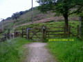
The walk starts from Towneley Hall Burnley and follows the anticlockwise circular route via Holme Chapel.
Singing Ringing Tree
 5.82 mi
+843 ft
-873 ft
3h 25
Moderate
Departure from Burnley (Lancashire)
5.82 mi
+843 ft
-873 ft
3h 25
Moderate
Departure from Burnley (Lancashire)
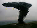
The walk starts from Towneley Hall Burnley and follows the anticlockwise circular route via Golf Course, Singing Ringing Tree sound sculpture.
Top Withins and the Bronte Bridge from Haworth
6.72 mi
+692 ft
-636 ft
3h 40
Moderate
Departure from Haworth and Stanbury (West Yorkshire)
Top Withins is an excellent objective for a walk from Haworth in the South Pennines. The Brontë family have strong associations with Haworth and this walk onto the moors perhaps gives you the chance to experience the landscape that dominated their writing.
Foulridge via Noyna Hill
 6.13 mi
+587 ft
-614 ft
3h 20
Moderate
Departure from Foulridge (Lancashire)
6.13 mi
+587 ft
-614 ft
3h 20
Moderate
Departure from Foulridge (Lancashire)
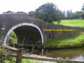
The walk starts opposite Church of Saint Michael and All Angels and follows the anticlockwise circular route via Foulridge Reservoir, Noyna Hill and Leeds Liverpool canal.
Luddenden Foot Circular
7.66 mi
+1,230 ft
-1,230 ft
4h 35
Moderate
Departure from Calderdale (West Yorkshire)
This Calderdale walk takes you into an area that was once a dense hive of mills and industry: spinning, carding and weaving. Today much of the industry has long since departed and you can enjoy the scenic highlights of this area.
For more walks, use our search engine .
The GPS track and description are the property of this route's author. Please do not copy them without permission.

