


West Wood Loop Via Hastingleigh & Stowting R1
Details
Creation:
Last update:
-
 Activity: Walking
 -
 Distance: 11.68 mi
 -
 Average duration: 6h 10
 -
 Difficulty: Not specified
 -
-
 Back to start: Yes
 -
 Ascent: + 925 ft
 -
 Descent: - 925 ft
 -
-
 Highest point: 597 ft
 -
 Lowest point: 282 ft
-
 Country:
United Kingdom
Country:
United Kingdom
-
 City:
Lyminge
City:
Lyminge -
 Start/End: N 51.154895° / E 1.063106°
 -


 Hour-by-hour weather


Waypoints
- S/E : mi 0 - alt. 515 ft - Start
- 1 : mi 0.03 - alt. 525 ft - Turn left
- 2 : mi 0.12 - alt. 509 ft - Turn left
- 3 : mi 0.41 - alt. 541 ft - Turn right
- 4 : mi 0.49 - alt. 538 ft - Turn left
- 5 : mi 0.75 - alt. 545 ft - Turn left onto Stone Street, B2068
- 6 : mi 0.75 - alt. 545 ft - Keep right
- 7 : mi 1.22 - alt. 541 ft - Turn left
- 8 : mi 8.53 - alt. 591 ft - Turn left onto Farthing Common
- 9 : mi 8.55 - alt. 591 ft - Turn slight right onto Farthing Common
- 10 : mi 8.57 - alt. 591 ft - Turn left
- 11 : mi 9.25 - alt. 469 ft - Turn left onto Skeete Road
- 12 : mi 10.12 - alt. 574 ft - Turn left
- 13 : mi 10.18 - alt. 574 ft - Turn right onto Woodland Road
- 14 : mi 10.23 - alt. 574 ft - Turn left onto Green Lane
- 15 : mi 10.65 - alt. 577 ft - Turn left
- 16 : mi 10.67 - alt. 581 ft - Turn slight right
- 17 : mi 11.09 - alt. 574 ft - Turn right
- 18 : mi 11.19 - alt. 548 ft - Turn left
- S/E : mi 11.68 - alt. 515 ft
Other walks in the area
The Wye Hills
 Visorando Member10.02 mi
+932 ft
-915 ft
5h 25
Visorando Member10.02 mi
+932 ft
-915 ft
5h 25
 Moderate
 Departure from Wye with Hinxhill (Kent)
Hiking in nature alternating between undergrowth and meadows on hilly slopes in the middle of pastures and crops.
Folkestone to Dover along the North Downs Way
8.79 mi
+1,483 ft
-1,575 ft
5h 20
Moderate
Departure from Folkestone (Kent)
This linear Kent walk follows the coast between Folkestone and Dover using the North Downs Way Natioanl Trail for much of the way. The vies especially at the Dover end of the walk area excellent. To return to the start use the regular train service that runs along the foot of the cliffs.
Stour Valley Rural
13.56 mi
+1,165 ft
-1,161 ft
7h 15
Moderate
Departure from Challock (Kent)
A rural route (avoiding habitation) around the Stour Valley. Starting through King's Wood and a little of the North Downs Way heading north, crossing the valley and picking up some of the Stour Valley Walk heading south before crossing the river again and heading back into the woods.
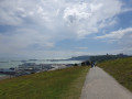
White Cliffs and Lagdon Stairs and bay, Channel Geopark Transmanche
 Association / Club / Walk leader
 2.25 mi
+449 ft
-446 ft
1h 25
2.25 mi
+449 ft
-446 ft
1h 25
 Easy
Departure from Guston (Kent)
Easy
Departure from Guston (Kent)
From the National Trust Visitor Centre, enter the Channel Geopark Transmanche and walk along the clifftop enjoying views of the harbour, Dover castle, ferries, white cliffs. On the way back, take a detour to Lagdon Stairs and Bay before coming back to the start. This is an ideal walk as you wait for the ferry.
⚠️Check the tide to access Lagdon Stairs and Bay. Note the way down can be unsuitable for children, and is quite steep.
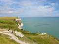
White Cliffs and views of the ferries, Channel Geopark Transmanche
 0.89 mi
+184 ft
-180 ft
0h 35
Easy
Departure from Guston (Kent)
0.89 mi
+184 ft
-180 ft
0h 35
Easy
Departure from Guston (Kent)
From the National Trust Visitor Centre, enter the Channel Geopark Transmanche and walk along the clifftop enjoying views of the harbour, Dover castle, ferries, white cliffs. This is an ideal walk as you wait for the ferry.
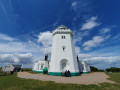
South Foreland Lighthouse, White Cliffs Channel Geopark Transmanche
 4.27 mi
+981 ft
-991 ft
2h 50
Easy
Departure from Guston (Kent)
4.27 mi
+981 ft
-991 ft
2h 50
Easy
Departure from Guston (Kent)
From the National Trust Visitor Centre, enter the Channel Geopark Transmanche and walk along the clifftop enjoying views of the harbour, Dover castle, ferries, white cliffs until you reach the beautiful South Foreland Lighthouse. On the way back, take a detour to Lagdon Stairs and Bay before coming back to the start. This is an ideal walk as you wait for the ferry.
⚠️Check the tide to access Lagdon Stairs and Bay. Note the way down can be unsuitable for children, and is quite steep.
Faversham to Hollowshore circular route
 4.25 mi
+20 ft
-20 ft
2h 00
Easy
Departure from Faversham (Kent)
4.25 mi
+20 ft
-20 ft
2h 00
Easy
Departure from Faversham (Kent)
A small part of the Saxon Shore Way. A great walk along Faversham Creek to Hollowshore. Great pub, then a shorter walk back through farmland. Enjoy the beautiful desolation of the marshes, just you, the birds, and the breeze. Stop for a rest or bite to eat at the wonderful Shipwrights Arms, then either re-trace your steps or take the shorter walk back through Ham Farm.
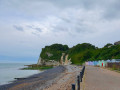
From Dover Patrol War Memorial to Saint Margaret's Bay
 1.65 mi
+351 ft
-351 ft
1h 05
Easy
Departure from St. Margaret's at Cliffe (Kent)
1.65 mi
+351 ft
-351 ft
1h 05
Easy
Departure from St. Margaret's at Cliffe (Kent)
This short walk starts at Dover Patrol War Memorial car park and goes along the clifftop down to Saint Margaret's Bay. ⚠️At the bay, be careful about the tide timetable.
For more walks, use our search engine .
The GPS track and description are the property of this route's author. Please do not copy them without permission.

