(S/E) Large carpark in the centre of the village adjacent to the Farmer's Arms pub. Please park considerately and check with the pub that you are ok to park there (you may need to call in on your return for refreshment!). Head north up Pub Lane at the top end of the car park. Go up this lane and then take the first left hand path up the hill to join the road. Turn left at the end and walk down the road in a westerly direction.
(1) At the bend in the road and a junction of paths. Take the narrow path straight on through the stile still heading west. This path can be a little overgrown in the Summer so please watch out for Nettles! The path emerges into an orchard of Blueberries. Head straight west across the first orchard and turn right when you reach the hedge boundary. In the corner enter the next Orchard, you will need to track around the edges (right then left) of the orchard rather than head directly West as you head towards the gate in the top left corner of the second field. The gate leads onto a country lane by Uplands Farm. Turn left along the lane for a short distance.
(2) Take the kissing gate on the North (right) side of the lane into a small orchard to the left of the buildings. Follow this to the stile just past the end of the outbuilding on the right. Head North through the next field until you join a farm track. The OS map seems to suggest the path is left of the hedge line but it is so overgrown that the track to the right of the hedge is the obvious route. Continue down the hill until you reach a cross roads of tracks. Switch to the left hand side of the hedge with the strawberry polytunnels on your left. Continue following the hedge line until you reach Hollow Lane.
(3) Turn left along Hollow Lane heading west until you pass the Prior's Court Cottages.
(4) Turn right at the stile just past the cottages and the River Leadon and follow the footpath signs across the open meadow/fields as it curves past a small copse and passes a garden to the right. You will eventually reach Bromyard Road.
(5) Turn right and head north along the road. Please take extra care as this road can be busy with a few 'blind corners'. Ensure you face oncoming traffic and keep in close to the edge. Follow the road for approximately 0.6km passing the Oak Inn on your left. Just past 'The Wharf' you will see a footpath off to the right.
(6) Follow the footpath to north until you cross a small footbridge. Continue in the same direction but stay to the left of the hedge in front of you. Follow this until you reach a gate into a small open orchard near 'The Farm'. Head due north across the orchard and across another stile into a small field. Follow this North with the buildings on your right.
(7) Exit the field and turn right along the main driveway towards 'The Farm'. As you pass the cottages on the left turn left between them and the barn to the gate at the far end of the path. Continue straight on and then bear slightly to the right as you enter the next field. As you enter the orchard the path is sign-posted cutting directly across the orchard heading generally northwest then north until you emerge through a kissing gate onto the main road through the village of Bosbury.
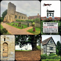
(8) Turn right and follow the road through the village. Pause to take in the 13th Century Church and separate tower (one of only 7 in Herefordshire). Take the main road out of the village heading east until you see signs for the 'Herefordshire Trail'.
(9) Turn right along the country lane until you reach a farm track on the left. Take this track going East and follow it as it narrows and enters a large open field. Go diagonally across heading SE to a stile in the hedge just before two large trees in the field beyond. Cross into the field and head past the trees to the field boundary on the far side. Turn left here and follow the track through a gate with farm buildings on your left. Cross the yard and through another gate where you will reach a lane at 'The Grange'. Turn right along the lane.
(10) Turn left off the lane just past 'The Grange' and follow the Herefordshire Trail with the field boundary on your left. Follow this until you cross a small footbridge where you enter a small orchard. Bear left and track through the orchard (as straight as you can!!) until you reach a stile tucked in the corner of the hedge. After the stile turn right heading South down the field to another stile. Cross over this and bear left but keeping the field boundary to your left until you pass through a gateway. Continue on your southerly track until you reach a small stream with a choice of paths. Take the left fork with the copse in front and slightly to the right of you. Walk up this large field with the boundary on your right until you reach a small gate in the corner.
(11) Enter the woods and take the path uphill all the way until you eventually reach the road. Go right then left immediately and follow the road into the village. After about 1km there is a lane on the right signed 'Pub lane'. Take this and follow back to your starting point.(S/E)


