


 Country:
 City:



Start from the car park at the Site 1815 visitor centre, Butte du Lion in Waterloo.
(S/E) With your back to the Butte du Lion, cross over the ring road and take the Route du Lion opposite, heading towards Alsemberg. Follow this road down, minding the right-of-way, until you reach a small roundabout.
(1) Take the cycle path on the other side of the road and follow Route du Lion until you reach a large junction (Chaussée de Mont-Saint-Jean). Turn right, then take the first street on the left, Rue du Boutons d’Or.
(2) At the end of this street, turn right after the small chapel (Rue du Ménil) and then left onto Avenue Jacques Brel. At the four-way junction, turn right (Rue de la Légère Eau) and at the next junction, continue straight ahead with caution as visibility is poor on the right. At the next fork in the road, take the left-hand branch, Rue Baty Gigot, and join the first road on the right, Chemin de l’Infante.
(3) Follow this steeply uphill until you reach a wide cross-road (Chaussée Bara).
(4) Cross it carefully and, on the other side, take the cycle path, following it to the left until you reach the roundabout. Take the second exit, Rue de l’Infante, then turn left immediately onto Rue Ma Campagne. Go over the railway line and, at the next junction, turn right onto Rue Émile Dury, then take the first left onto Rue Bodrissart. Go through the roundabout and continue straight ahead. After the school, the street narrows; carry on until you reach Drève Marguerite, turn left and then left again (Chemin des Postes).
(5) At the roundabout, take thesecond exit onto Rue des Piles, then thesecond street on the right, Rue de l’Escavée. At the fork in the road, keep left; the road quickly becomes a fairly steep sunken lane, Chemin 77. At the end of the lane, on Rue Rombaut, turn right, then immediately left onto the cul-de-sac (Rue de la Malplanquée) and you’ll reach a cross street (Chaussée d’Alsemberg).
(6) Cross it carefully and follow it to the left, then turn right onto Avenue des Érables, then right again onto Rue du Château d’Eau. At No. 48, turn left onto Chemin de Saint-Germain. The tarmac soon gives way to a footpath; the town is behind you, and here begins the countryside. At No. 124, cross a small road (Rue du Cuisinier) and follow Chemin Broctiaux straight ahead to the edge of the small wood with a wayside cross.
(7) Turn onto the path on the left (Sentier Broctiaux) which runs alongside the woodland. At the Fork in the road, keep to the right; be careful, as the descent is steep in places with numerous roots protruding from the ground. You’ll arrive at the hamlet of Odeghien. Turn left and continue until you reach the bend to the right.
(8) Take the path opposite, the Sentier Longchamps Bouvrée, which is narrow and has very uneven ground. Cross a small bridge and, 10 metres further on, at the Fork in the road, continue to the right until you reach the tarmac road (Chemin de la Bruyère d’Alconval). Turn right and, at the four-way junction, turn left onto Chemin du Long Tour and continue to the next junction.
(9) Cross carefully using the pedestrian crossing and continue straight ahead (Chemin de la Praye). After passing over the Hain, the road becomes a footpath and then a pedestrian-only route, leading to a side street (Avenue de l’Industrie). Continue to the left until you reach the entrance to the U.C.B.
(10) Just before this, follow the tarmac road that climbs to the right (Sentier de la Praye), which leads to the Noucelles pre-Ravel path. Follow it to the left until you reach Rue de la Gare.
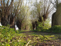
(11) Carry on straight ahead. A little further on, a bridge has been demolished; go down to the right, then turn left and left again under the ‘bridge’. Follow the magnificent Chemin du Fourçon, lined with very old pollarded willows, until you reach a side street (Rue Marius Wautier) opposite No. 250. Turn right and, at the next four-way junction, turn right (Chemin du Champ de l’Épine). When you reach the road, head straight on (Chemin du Champ de la Clôture) for about a hundred metres.
(12) Just before the high-voltage power line, take the path on the left (Sentier de la Croix Charles Boucher), which is narrow and slippery after rain. Keep to the right and descend carefully. Caution! At the bottom of the descent, the exit is blocked by a double-gate system. Then walk back up the street to the roundabout.
(13) Take thefirst exit and walk past the car parks on either side. At the end, turn left (Rue du Château) and you’ll come to a four-way junction with a few shops on your right.
(14) Carry on straight ahead for a few metres, then take the path on the left which runs alongside the Hain, passing behind the houses. At the next street, first turn left then right, crossing the bridge, and follow the cycle path just on the other side of the Hain, alongside the school. At Clos du Colbie, carry on straight ahead, staying at the bottom of the enclosure, and take the track opposite until you reach the Paradis fishing ponds. Cross the small bridge and go round the other ponds on the left until you reach the second bridge on the left.
(15) Cross this bridge, go up the hill and keep to the right at the Fork in the road. Continue along the path between the two fences and you’ll emerge near the Nausicaa swimming pool in Braine-l’Alleud.
(16) Cross the car park and take the sunken path at the far end, path no. 87. At the end of this, head down to the right (Rue des Saussois) until you reach a four-way junction (Route de Piraumont).
(17) Cross carefully and turn left onto the cycle path. Go under the bridge and, at the roundabout, take thefirst exit, Chemin du Fond Saint-Georges. At the next two junctions, keep left and, at the end of Chemin de Vieux Genappe, you’ll come out onto Route de Piraumont next to the entrance to the ring road.
(18) Turn right, then at the roundabout – after the recycling centre but before the second exit towards Brussels – take the farm track leading down to the right. You’ll come out onto Chemin de la Maison à Tout Vent at the gas installations. Follow this track uphill and, at the end, turn right then left to follow the farm track running alongside the ring road entrance.
(19) At the road (Chemin du Goumont), keep left and, very soon, you’ll come to a path leading up into the small wood on your right. Please note: in strong winds, do not enter the wood. The trees are old and large branches frequently fall; continue along the road until you emerge
out of the woods. Carry on straight ahead (Chemin des Vertes Bornes) and you will soon reach the Butte du Lion and the Site 1815 car park (S/E).

 Visorando Member

 Easy

