


 Country:
 City:
City:



Start: The circular route starts at the large car park on Stralsunder Straße (at the corner of Mukraner Straße) in Sassnitz. It is about a 1 km walk from Sassnitz railway station to the starting point. Trains on the R9 line from Stralsund (Bergen and Lietzow on Rügen) stop here several times a day.
(S/E) From the car park, we first follow Stralsunder Straße for a short distance towards the town centre (on the right) and, after a good 400 m, turn right onto Straße der Jugend.
(1) On the right-hand side is the Fischerring. After the Second World War, a housing estate was built here for the many fishermen in this Baltic Sea town. An information board, amongst other things, tells the story of how toilets were accidentally omitted from the flats.
(2) Just behind the Fischerring, on the right-hand side, stands a building that is somewhat reminiscent of a pavilion. This is the Sassnitz Butterfly Park, where countless exotic butterflies flit about during the summer months. Behind the butterfly house, we cross the Tribber Bach and, after about 50 metres, turn left into the woods.
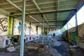
(3) At the entrance to the woodland, a sign providing further information already points towards Dwasieden Castle. We follow the path; to our right and left, old barbed-wire fences and derelict guardhouses accompany us, bearing witness to the site’s former military use.
(4) We follow the rough main path straight ahead. In a clearing, an old chimney from the boiler house rises high above the trees, beneath which stand dilapidated barracks and an old workshop.
(5) Behind the buildings on the right-hand side lie the remains of the former castle. Adolf von Hansemann.
The builder was certainly one of the richest people in Germany at the end of the 19th century. He made his fortune with the Disconto Gesellschaft, the forerunner of Deutsche Bank. And so he had the necessary funds (4 million Reichsmarks) to build himself a magnificent residence of granite and marble on Rügen, which he used as a summer retreat for two months each year. In 1934, officers of the Kriegsmarine moved into the building; in 1948, it was blown up. At that time, all military remnants had to be cleared away before the Soviet occupation forces arrived. Most of what remains today is the former stables.
After walking three-quarters of the way round the stables ruins, we turn left onto the path leading into the woods.
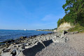
(6) If we keep slightly to the right, we’ll reach the beach after a while. We head back into the woods along the same path; at the next two junctions, we go straight on each time, then take the left-hand path at the fork.
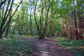
(7) This leads us further through the beech forest to a junction. Here we turn left and, at the T-junction, turn right, then right again. At the edge of the forest is the Fürstenstein tomb and a megalithic site, built from large boulders; at around 5,000 years old, it is probably the oldest such site on Rügen. At the next T-junction, we turn right, then left at the junction we passed earlier, and continue through the forest. We pass two junctions, going straight on at each
(8) We come to the forest cemetery on the left-hand side. This is a memorial cemetery dating from the Second World War. Many people died here in Sassnitz during an attack by British fighter-bombers in 1945; they are commemorated here in Dwasienden.
A good 100 metres past the woodland cemetery, we take a sharp right, then turn left at the fork. The path leads us back to the ruins of the military buildings. Behind the first buildings, we keep to the left on the wide path and follow it as it curves to the right. It takes us straight on, past further old military buildings.
(9) At the edge of the wood, we come to the ‘Straße der Jugend’. Here we turn left and then walk slightly to the right past the buildings of the Vocational Training Centre across the car park. On the opposite side, we head back into the wood along the narrow path, keep slightly to the left and emerge onto Mukraner Straße, where we turn right.
(S/E) After crossing the Tribberbach stream, we arrive back at the car park from which we set off.

