Around the Island of Sark

With 5.5 km², 600 inhabitants and 35 km from the Normandy coast, Sark is perched on a plateau surrounded by cliffs 100 m above sea-level. With superb coastal landscapes and wild nature, it's a paradise for walkers and cyclists.

Technical sheet

8163026
Creation:
Last update:
Last review:
  • Walking
    Activity: Walking
  • ↔
    Distance: 13.62 km
  • ◔
    Average duration: 4h 50 
  • ▲
    Difficulty: Moderate

  • ⚐
    Return to departure point: Yes
  • ↗
    Vertical gain: + 333 m
  • ↘
    Vertical drop: - 333 m

  • ▲
    Highest point: 105 m
  • ▼
    Lowest point: 16 m

Photos

Description of the walk

(S/E) From the square at the entrance to the village of La Collinette where horse-drawn carriages await, facing the shopping street, turn left (South - West - South) towards Dixcart Bay. At the first T-junction, turn left heading South - East and pass the hamlet.

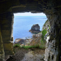
(1) Continue on the path opposite towards the cliff which then turns left (North - East) towards a viewpoint overlooking the tiny port of Creux Harbour.

(2) From Creux Harbour, retrace your steps to the previous crossroads. (1) Take the path on the left, heading South, towards Sark-Henge.

(3) Come back to the main path and take the coastal trail on the left (West) which overlooks Derrible Bay. Further on, follow a path on the left (South) which leads to the point separating the bays of Derrible and Dixcart.

(4) From there, return to the coastal trail you left previously and follow it due North. At a crossroads, continue on the path opposite (West) which veers further left to head due South towards Dixcart Bay. Before leaving the wooded area, take the left path (East) that goes down to Dixcart beach.
.
(5) Go up the only path and continue to the left (South - West) on the path you left before. Before approaching the Hôtel Dixcart, take the coastal trail on the left (South - West) which joins the road near La Coupée. Before returning to the road, enjoy the view overlooking La Coupée.

(6) Cross La Coupée to enter Petit Sark and stay on the road until you reach the Hôtel de la Sablonnerie.

(7) At the corner of the Sablonnerie, take the path on the left (South). Before the farm, take the path on the right and head due South, straight towards the chimneys of the old silver mine.

(8) Follow the coastal trail towards the South which then turns towards the North following the western part of the cliff, then joins the Sablonnerie. (7) Stay on the main road and get back to La Coupée. (6) Go straight ahead on the road to then reach the crossing towards the Pilcher Monument.

(9)Turn left (West) and then join the path coming from the village.

(10) Turn left (West) again and go as far as the monument to enjoy a superb view of Le Havre Gosselin and the islet of Brecqhou.

(11) From there, turn back on your steps. Take the path in the opposite direction, to find the previous crossroads. (10) Continue opposite and remain on this road to reach the Old Mill, the highest point in Sark with 114 m altitude.

(12) Continue East on the street which turns left at the entrance to the village. Just after, reach a small square where the tourist office and the prison are located.

(13) Continue on the main street of the island's capital, the only shopping street in Sark, ending on the square at the entrance to the village of La Collinette (S/E).

Waypoints

  1. S/E : km 0 - alt. 98 m - Village square
  2. 1 : km 0.53 - alt. 89 m - Viewpoint option
  3. 2 : km 0.81 - alt. 69 m - View of Creux Harbour and cannon.
  4. 3 : km 1.52 - alt. 62 m - Derrible Head / Sark Henge
  5. 4 : km 2.27 - alt. 67 m - Hogs Back
  6. 5 : km 3.7 - alt. 22 m - Dixcart Bay
  7. 6 : km 4.42 - alt. 84 m - Leave the path for a smaller one on the left
  8. 7 : km 5.25 - alt. 83 m - La Coupée
  9. 8 : km 6.55 - alt. 74 m - La Sablonnerie
  10. 9 : km 7.24 - alt. 58 m - Dolmen
  11. 10 : km 7.68 - alt. 72 m - Fireplace
  12. 11 : km 9.02 - alt. 62 m - Barrier
  13. 12 : km 11.06 - alt. 93 m - Crossing to Pilcher Monument
  14. 13 : km 11.53 - alt. 99 m - Pilcher-village crossroads
  15. 14 : km 11.99 - alt. 88 m - Pilcher Monument
  16. 15 : km 12.93 - alt. 105 m - Old Mill
  17. 16 : km 13.31 - alt. 100 m - Prison
  18. S/E : km 13.62 - alt. 98 m - Village square

Practical information

This hike goes through the paths, coastal trails and roads of Sark. Don't be scared of the word road: here there are no cars or scooters. The roads are not paved. Vehicles, cars and two-wheelers are prohibited. Only tractors are allowed and the roads are not paved. You only see pedestrians, bicycles and horse-drawn carriages there.

Access to the island by boat from Guernsey all year round. Passport required.

The local currency is the Guernsey pound. Pound Sterling is also accepted. Be careful if you have local pounds left, they will be refused in the rest of the United Kingdom.

The local language is English.

Sark is part of the Bailliage of Guernsey but still has its autonomy. The Lord of Sark is appointed by the British Sovereign, as is the Bailli of Guernsey. The island belongs to the Crown, but not to the United Kingdom. The feudal regime gave way to a parliamentary monarchy in 2008 following a vote.

In the nearby area

(3) Sark Henge: 9 stones set in a circle in 2015 for the 450th anniversary of the creation of the Seigneurie de Sark. The interest and more specifically the viewpoint on point Derrible.

(6) La Coupée: 80 m high rocky ridge separating big Sark from Little Sark. This passage was so dangerous that in the past children had to cross the isthmus on all fours. After the island was liberated in May 1945, German prisoners had to reinforce it and build railings.

(11) Pilcher Monument: in memory of Captain Pilcher who sank with his crew body and soul in this narrow gully separating Sark and Brecqhou. The view of the Passage Goulliot and Brecqhou is impressive.

(12) L'Ancien Moulin: Highest point of Sark at 114 m. Until 2008 (transition to the Parliamentary Monarchy), only the Lord could own a mill, a dovecote and an unsterilized female dog.
The Lord was the only person on the island legally authorized to grind grain and he charged his tenants the privilege of grinding their own. The mill was used until World War II.

(13) Prison: rebuilt in the second half of the 19th century, it is still in use. Its two cells are used very rarely and essentially for sobering up a few tourists. The stay cannot exceed two days. Beyond that, the prisoner is transferred to Guernsey. Sark has two volunteer policemen: the gendarme and his vingtenier
.

Reviews and comments

4.7 / 5
Based on 2 reviews

Reliability of the description
4.5 / 5
Clarity of route map
5 / 5
Route interest
4.5 / 5
lauzon2010
lauzon2010

Overall rating : 4.3 / 5

Date of walk : May 01, 2025
Reliability of the description : ★★★★☆ Good
Clarity of route map : ★★★★★ Very good
Route interest : ★★★★☆ Good
Busy trail : No

We did a combination of the southern and northern circuits of the island of Sark over one day, keeping to the boat's timetable. It was enough to get a glimpse of the island's beautiful coastal scenery during a period of average visitor numbers, so it was a quiet day. On the other hand, the wide paths are best done by bike, as they're a bit tiring on foot. But it's worth doing when the weather's fine. The village, on the other hand, isn't of much interest - you go there for the nature, that's for sure.

Automatically translated

Philopal
Philopal

Overall rating : 5 / 5

Date of walk : Aug 15, 2023
Reliability of the description : ★★★★★ Very good
Clarity of route map : ★★★★★ Very good
Route interest : ★★★★★ Very good
Busy trail : No

A superb walk on the island of Sark, well worth the diversions. Breathtaking views at almost every turn.
The Coupée, a natural road linking the two parts of the island, where a road was built by man during the Second World War, is grandiose.
What's more, it's a car-free island where you can hike through unspoilt countryside.

Automatically translated

Other walks in the area

For more walks, use our search engine .

The GPS track and description are the property of the author. Do not copy them without permission.