


 Country:
 City:
City:


The circular route begins at the car park by Leuchtenberg Castle (access via the junction where Hackergasse meets the road ‘Hinter der Burg’)
Marking: Hiking Trail 1
Alternative starting points:
- Hiking car park on the B22
(S/E) From the car park, we walk back down the access road for a short distance to the street ‘Hinter der Burg ’ and turn left there into Hackergasse. We follow the road as it bends to the left behind the first houses. Roughly from the ‘Zum Burgkrug’ inn on the left-hand side, Hackergasse merges into the street ‘Innerer Markt ’.
(1) After a few metres along the Innerer Markt, we reach the point where the Burgweg branches off to the left, passing the Marienbrunnen, behind which stands the yellow-painted St. Margareta Church. We follow the path past the church and, at the fork in front of the Lindenhof inn on the right-hand side, take the right-hand branch (Äußerer Markt).
(2) Here, a footpath runs to the right of the road, taking us past the chapel in the local cemetery as we head out of the village.
(3) After just under 200 m, a road branches off to the left towards the sports ground. Here we cross to the other side of the road towards the sports ground and immediately turn right onto the footpath running between the bushes. This path leads us gently to the left all the way to the edge of the wood.
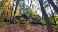
(4) Just before we enter the woods, a wooden sign points us to the left into the woods towards the Twin Rocks. After visiting the rocks, we return to the path and keep left twice in quick succession. The forest path leads us slightly downhill to the main road, which we cross (caution: no pedestrian crossing lights).
(5) On the opposite side, on the right, there is a hiking car park (alternative starting point) and an information board about the Lerautal valley, into which we now enter. To do this, we turn left at the second junction (signposted).
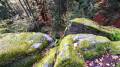
(6) After about 100 m, another wooden sign points out the rock formation known as ‘God’s Hands’, which is worth a short detour to the left.
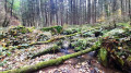
(7) Back on the main path, we continue leftwards through the wood and, after about 100 metres, come to the Lerau, in whose riverbed there are several large boulders. The Schafssteg, a footbridge made of large granite slabs, takes us across the stream.
On the opposite bank is a red bench where you can take a short break. At the fork, we keep slightly to the left as we climb the slope and continue through the woodland a little above the stream until we reach a group of boulders on the right-hand side.
(8) Just beyond the granite boulders, a short side path leads off to the left to the viewing platform overlooking the Wolfsloh Gorge. There is a red bench here too.
We walk the short distance back to the footpath and keep to the left. The route leads slightly downhill over rough and uneven ground, past the rocks of the Wolfsloh Gorge, into the Lerau valley. At the next junction (where a footbridge crosses the Lerau on the left-hand side), we continue straight ahead, pass a cleared clearing and re-enter the woodland at the bank of the stream.
After a few hundred metres, signpost 1 directs us first to the left, then immediately to the right over a bridge across the Leraubach. On the other side, the forest path turns to the right. After just under 400 metres, we turn left, cross the main road (no traffic lights) and, on the opposite side, re-enter the forest via the footpath.
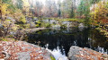
(9) The path leads us slightly uphill through the mixed woodland; at a fork, we keep to the left and come to a T-junction further up the slope. Here, it’s worth taking a short detour to the right to the disused quarry.
Otherwise, carry on to the left. The path curves to the right (keep right at the junctions). After a short stretch of straight path, we cross the wider forest track straight ahead (actually slightly to the left) and, after a short stretch through the woods, reach the first houses of Leuchtenberg.
Behind the first houses, we turn right onto the street ‘Hinter der Burg ’ and then, at the next opportunity, left into ‘Hohe Gasse’. At the end of this, a footpath leads us to ‘Burgweg ’ behind the church, where we turn right.
(10) After a few metres, the entrance to the castle ruins is on the right-hand side. If you wish, you can visit the ruins during opening hours. If they are closed, we continue straight ahead.
(S/E) We then keep to the right on the footpath past the castle wall until we reach the car park. Anyone visiting the ruins can use the exit at the far end leading to the car park.

