


Refine your search for walks in Tring Natural History Museum
Tring Natural History Museum walks


 Association / Club / Walk leader
Walks near Tring Natural History Museum
 Wendover to The Plough at Cadsden
 Visorando Member
 5.28 mi
 +568 ft
 -479 ft
 2h 55
2h 55
 Easy
Easy
 Departure from Wendover (Buckinghamshire)
This section of the walk takes you from Wendover down to Buckmoor End (where there is a pit stop and possibly a bacon sarnie!) across in front of Chequers through the nature reserve and over to The Plough at Cadsden.
Wendover to Watlington, The Ridgeway the Other Way
17.69 mi
+1,260 ft
-1,306 ft
9h 15
 Difficult
Departure from Wendover (Buckinghamshire)
Difficult
Departure from Wendover (Buckinghamshire)
The Ridgeway the other way. The National Trail from NE to SW. This Stage 2 is the most undulating with several climbs in and out of valleys and is, therefore, the most strenuous part of The Ridgeway. The route climbs Coombe Hill, passes by Pulpit Hill fort and over Lodge Hill. Goes around Bledlow Great Wood near Chinnor to go along a disused railway and go underneath the M40. It goes along the bottom edge of the Chilterns scarp and passes Watlington Hill.
The Chiltern Link
 8.41 mi
+472 ft
-548 ft
4h 15
Easy
Departure from Wendover (Buckinghamshire)
8.41 mi
+472 ft
-548 ft
4h 15
Easy
Departure from Wendover (Buckinghamshire)
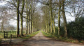
Follow an ancient trade route from Wendover to Chesham through open fields, lovely beech woodland and the peace and quiet of classic Chilterns countryside.
The "Chiltern Link" is well waymarked and shown on maps.
Thanks to the Chiltern Society’s Donate-a-Gate scheme you can enjoy your walk without the need to clamber over stiles.
Ivinghoe Beacon to Wendover, The Ridgeway the Other Way
11.33 mi
+712 ft
-1,027 ft
5h 50
 Moderate
Departure from Ivinghoe (Buckinghamshire)
Moderate
Departure from Ivinghoe (Buckinghamshire)
The Ridgeway the other way. The NationalTrail from NE to SW. This Stage 1 goes over the Chilterns, across the Grand Union Canal, past Tring, through the Three Hundreds of Aylesbury to reach the market town of Wendover.
Berkhamsted to Rickmansworth
 14.36 mi
+30 ft
-184 ft
6h 40
Difficult
Departure from Berkhamsted (Hertfordshire)
14.36 mi
+30 ft
-184 ft
6h 40
Difficult
Departure from Berkhamsted (Hertfordshire)
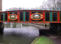
This is the fourth stage of the multi-day route "Railways and Waterways, between Oxford and London".
Following the River Bulbourne, then the River Gade along the valley, there is plenty to see on this walk, from the narrowboats, historic locks and bridges and the oldest mechanised paper mill in the world, to nature reserves and the popular Cassiobury Park.
Chequers to Little Kimble
2.15 mi
+85 ft
-354 ft
1h 05
Easy
Departure from Ellesborough (Buckinghamshire)
The final stage crosses the Chequers estate along the Ridgeway westward for a short distance, then descends down the Chilterns to Little Kimble station for rail or bus services back to High Wycombe.
Across the Chilterns: Chesham to Wendover
 10.44 mi
+764 ft
-699 ft
5h 30
Moderate
Departure from Chesham (Buckinghamshire)
10.44 mi
+764 ft
-699 ft
5h 30
Moderate
Departure from Chesham (Buckinghamshire)
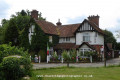
A linear walk from Chesham to Wendover climbing to the top of the Chiltern escarpment with spectacular views over the Oxford plains from the top of Coombe Hill. The Chiltern Hills are the main point of interest - you walk up one side, to the shoulder, then back down to civilisation. The physical nature of the geography and geology makes this walk feel bigger than it is.
Aylesbury to Berkhamsted
 13.27 mi
+177 ft
-89 ft
6h 15
Difficult
Departure from Aylesbury (Buckinghamshire)
13.27 mi
+177 ft
-89 ft
6h 15
Difficult
Departure from Aylesbury (Buckinghamshire)
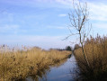
This is the third stage of the multi-day route "Railways and Waterways, between Oxford and London".
This walk along the canal towpath passes many bridges and locks, the Tring Reservoirs Nature Reserve, then climbs steadily to the highest point on the Grand Union Canal before gradually descending beside a peaceful chalk river.
From Hemel Hempstead station
 6.36 mi
+256 ft
-282 ft
3h 10
Moderate
Departure from Dacorum (Hertfordshire)
6.36 mi
+256 ft
-282 ft
3h 10
Moderate
Departure from Dacorum (Hertfordshire)
Starting from Hemel Hempstead Station this is a walk which can be enjoyed without a car. The station is right on the edge of the town so virtually all the route is through the open country, much of it through Boxmoor Trust land, on the plateau of the Chilterns and along the Grand Union Canal. There are lots of reminders of the history of the area from 1594 through WWII. If you are lucky you may see a couple of rare farm breeds kept on Trust land and some interesting birds along the canal.
Two Ridges Way from Leighton Buzzard to Ivinghoe Beacon
8.05 mi
+476 ft
-10 ft
4h 05
Easy
Departure from Leighton-Linslade (Central Bedfordshire)
The Ridgeway is linked at Ivinghoe Beacon by the Two Ridges Link (8 miles and included on OS mapping) with the Greensand Ridge Walk that in turn also connects with the Icknield Way Path. The Link uses the Grand Union Canal North from near Slapton. This route shows the link from North to South.