Country:

 City:
City:



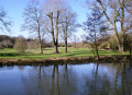
Start: Berkhamsted Station (SP 993 081)
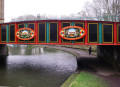
(S) From the station, turn right, cross the canal, go down the steps to the towpath and turn right under the ornate bridge.
(1) At the first bridge, cross to the other side and keep following the canal. First pass the Crystal Palace beer house, then the Boat followed by the Rising Sun. After half a mile, the towpath stops.
(2) The route crosses the bridge and continues along the road before going down to the canal again with the River Bulbourne on the right.
Option: At the third bridge, turn left over it for the Three Horseshoes.
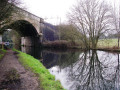
A little further on, the canal and the River Bulbourne go under Stephenson’s girder bridge, since covered in concrete.
(3) Continue past a lock and a minor road bridge.
Option: The Fishery Inn is across the next road bridge and Hemel Hempstead Station can be reached by turning right, crossing the road and taking the footpath on the left to cross the main road.
After going under two main roads Frogmore Paper Mill, the last working paper mill in the area, is on an island on the right.
(4) Soon Apsley Station is on the right. The towpath continues to follow the railway line, crossing to the other side of the canal before going under the railway bridge.
(5) After another mile and a half, a road bridge gives access to Kings Langley Station on the left as the sound of the M25 traffic gets louder.
(6) Go under the M25 bridge to the next bridge. After the A41 and the motorway spur, the prestigious Grove Hotel golf course comes into view on rising ground to the right.
(7) Keep following the canal.
Option: At the next lock, a footpath on the right leads to Whippendell Wood, which is a carpet of bluebells in Spring and is managed by the Woodland Trust.
Option: A footpath crosses the lock into Cassiobury Park, which has many tourist attractions.
Continue for another two miles.
(8) Just after the bridge carrying the Chiltern Railway, turn right on a footpath to Rickmansworth High Street, soon bearing left along the railway.
(9) At the road, cross over to the footpath opposite and keep ahead to Rickmansworth Station.(E)
 Association / Club / Walk leader
 Moderate
 Easy
Easy 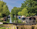
 Visorando Member