Aylesbury to Berkhamsted

This is the third stage of the multi-day route "Railways and Waterways, between Oxford and London".

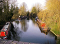
This walk along the canal towpath passes many bridges and locks, the Tring Reservoirs Nature Reserve, then climbs steadily to the highest point on the Grand Union Canal before gradually descending beside a peaceful chalk river.

This walk is part of a multi-day hike: Railways and Waterways, between Oxford and London

Details

99229004
Creation:
Last update:
Last review:
  • Walking
    Activity: Walking
  • ↔
    Distance: 13.27 mi
  • ◔
    Average duration: 6h 15 
  • ▲
    Difficulty: Difficult

  • ⚐
    Back to start: No
  • ↗
    Ascent: + 177 ft
  • ↘
    Descent: - 89 ft

  • ▲
    Highest point: 433 ft
  • ▼
    Lowest point: 256 ft

Photos

Description of the walk

Start: Aylesbury Station (SP 819 134)

(S) From the station, take the cycle route past the car park and along Bear Brook into Friarage Road and Walton Street.

(1) At the traffic lights, cross and double back. Turn right at the Grand Union Canal sign and follow the Aylesbury arm along the towpath for about 3 miles to the canal junction.
The locks and original bridges are numbered back to the junction with the main canal.
Option: Just after Bridge 9, on the Aston Clinton Road, there are picnic benches.
Option: Just before Wilstone Bridge 3, a footpath on the right leads to Wilstone and the Half Moon pub.
Continue to the junction where the Aylesbury Arm joins the main Grand Union Canal.

(2) Follow the Grand Union Canal.
Option: After the canal junction, the Anglers Retreat is down the next road on the right (drinks only). Under the bridge, lunches are served at the Water’s Edge.
Soon come to the Marsworth reservoirs, which provide water to the highest point on the canal, the Tring Summit, after three more locks.

(3) Continue under two more bridges to the bridge near Tring Station.

(4) Keep following the Grand Union Canal. The next lock is Cow Roast, the first on the descent.

(5) Follow the Grand Union Canal to Dudswell Lock.

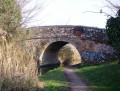
(6) Cross to the other bank. After another three locks and two miles, there is a very ornate bridge.

(7) Go up to the road here.

(8) Turn left for Berkhamsted Rail Station.(E)

Waypoints

  1. S : mi 0 - alt. 256 ft - Aylesbury Station
  2. 1 : mi 0.2 - alt. 269 ft - Traffic lights
  3. 2 : mi 6.42 - alt. 348 ft - Junction with main canal
  4. 3 : mi 7.38 - alt. 397 ft - Tring Summit
  5. 4 : mi 9.06 - alt. 417 ft - Tring Station (left for detour to Albury)
  6. 5 : mi 10.46 - alt. 390 ft - Cow Roast Lock
  7. 6 : mi 11.07 - alt. 384 ft - Dudswell Lock
  8. 7 : mi 12.93 - alt. 344 ft - Very ornate bridge
  9. 8 : mi 13.12 - alt. 351 ft - Left to the station, right to the bus
  10. E : mi 13.27 - alt. 344 ft - Berkhamsted Station

Notes

Travel Information

  • Start - The X20 bus connects Oxford, Thame and Aylesbury
  • Finish - Berkhamsted Station is on the London Northwestern Railway (LNR)
  • The 500X bus goes back to Aylesbury from Berkhamsted High Street
  • (8) For the bus back to Aylesbury, turn right towards the High Street.

OS Explorer Map

  • 181
  • 172

Grid References

  • Start SP 819 134
  • Finish SP 993 081

Refreshments and facilities

(3) Refreshment is available at the Grand Junction Arms at Bulbourne.

(4) The road to the left leads to Tring Station and the Hertfordshire Way to the historic village of Aldbury (about a mile). It nestles at the foot of the Chiltern Hills and has a pub (the Greyhound), a village pond, stocks and a whipping post.

Information to shorten the walk

(4) The road to the left leads to Tring Station.

Worth a visit

(3) The “summit” is 395’ high and stretches for two and a half miles between Bulbourne Lock and Cow Roast Lock. Refreshment is available at the Grand Junction Arms at Bulbourne.

(4) The road to the left leads to Tring Station and the Hertfordshire Way to the historic village of Aldbury (about a mile). It nestles at the foot of the Chiltern Hills and has a pub (the Greyhound), a village pond, stocks and a whipping post.

(5) Cow Roast is the source of the chalk river Bulbourne, which accompanies the canal to Hemel Hempstead.

Find more information about those walks on the Railways and Waterways Walk website.

Other walks in the area

For more walks, use our search engine .

The GPS track and description are the property of this route's author. Please do not copy them without permission.