


Crossing Bukhansan from Wonhyobong to Yeongbong via Baegundae


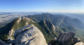
A challenging hike through Bukhansan National Park, starting from the Bukhansanseong area. The ascent takes you via Wonhyobong, followed by a climb to Baegundae (836 m), the highest point of Bukhansan, offering superb panoramic views of Seoul and the mountain range’s granite formations. The descent is via the eastern slope, with a final detour via Yeongbong, offering an impressive view of Insubong, before reaching Harujae. A demanding route, with significant elevation gain and loss over a very short distance. A very steep and rocky hike in places, but particularly spectacular.
Details
Creation:
Last update:
Last review:
–
–
-
 Activity: Walking
-
 Distance: 4.19 mi
-
 Average duration: 5h 00
-
 Difficulty: Difficult
-
-
 Back to start: No
-
 Ascent: + 3,527 ft
-
 Descent: - 2,762 ft
-
-
 Highest point: 2,684 ft
-
 Lowest point: 217 ft
-
 Country:
South Korea
-
 Start: N 37.65496° / E 126.949998°
-
 End: N 37.6581° / E 126.991305°
-


 Hour-by-hour weather


Waypoints
- S : mi 0 - alt. 230 ft
- E : mi 4.19 - alt. 994 ft
Other walks in the area
Baegundae Peak circular walk from Bukhansan UI
 Visorando Member
 5.85 mi
+2,575 ft
-2,569 ft
4h 55
Difficult
Departure from South Korea
A very pleasant walk, best done in good weather to enjoy the views and avoid any difficulties on slippery rocks.
Seoul City Wall: From Changuimun Gate to Sungnyemun Gate
 3.54 mi
+702 ft
-902 ft
2h 15
Difficult
Departure from South Korea
Magnificent tour along the city ramparts!
You really go from the hustle and bustle of the city to the peace and quiet of the mountains.
Be careful though, as the hike is long and the mountain closes at a certain time.
Breathtaking scenery!
Seoul City Wall: from Sungnyemun Gate to Changuimun Gate
 8.83 mi
+1,955 ft
-1,814 ft
5h 45
Difficult
Departure from South Korea
A magnificent tour along the city walls! You really go from the hustle and bustle of the city to the peace and quiet of the mountains. Be aware of the length of the hike and the mountain closing times. We had to do it in two parts because the two highest mountains are next to each other (to the north). The scenery is breathtaking!
For more walks, use our search engine .
The GPS track and description are the property of this route's author. Please do not copy them without permission.

