Tour and ascent of the Suc des Coux

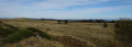
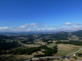
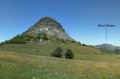
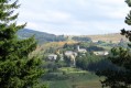
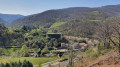
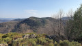
A pleasant and beautiful walk in the Ardèche mountains, sometimes in open country, sometimes in the shade, sometimes amongst blueberry bushes and heather, with woodland and pretty dry-stone walls. A magnificent 360° view if you make the climb: numerous knolls are visible, including the Mézenc, the Gerbier des Joncs, and more.

Details

60291851
Creation:
Last update:
Last review:
  • Walking
    Activity: Walking
  • ↔
    Distance: 3.53 mi
  • ◔
    Average duration: 2h 00 
  • ▲
    Difficulty: Easy

  • ⚐
    Back to start: Yes
  • ↗
    Ascent: + 390 ft
  • ↘
    Descent: - 390 ft

  • ▲
    Highest point: 5,033 ft
  • ▼
    Lowest point: 4,675 ft

Description of the walk

On the D378, after Lachamp-Raphaël heading towards Gerbier, pass the Bourlatier farm and then the next one on the right, and park in the stony car park on the right.

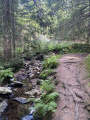
(S/E) Cross the road carefully and head for the signpost marked ‘Les Coux Est’, which points in several directions. Another green sign reads ‘Section du Goudoulet – Private property, picking prohibited except for authorised persons’. Take the path straight ahead, crossing the wooden footbridge, and continue: there are two further wooden footbridges on the path to the left of the knoll of the Coux.

(1) At the “Les Coux Ouest” signpost, take the path on the right to go round the knoll. Further on, make sure you close the park gate properly.

(2) Continue along the path on your right. Note, on the left, a work by Le Partage des Eaux depicting a large wooden blueberry comb.

(3) Look out for a tiny, barely visible path on your right which climbs through the blueberry bushes and heather to ascend the knoll. This path is very narrow: please respect the environment and avoid trampling the blueberry bushes.

(4) Once you reach the summit, take in the view and follow the same path back down.

(3) Return to the wide path on the right. Pass in front of a fenced-off area: ‘La meute d’Angakoo’.

(5) Continue to the left.

(6) After the farm (a recent build), carry on along the path to the right which leads to the road.

(7) Walk carefully alongside the D378 until you reach the car park (S/E).

:

Waypoints

  1. S/E : mi 0 - alt. 4,682 ft - Car park beside the D378
  2. 1 : mi 0.72 - alt. 4,692 ft - Signpost “Les Coux Ouest”
  3. 2 : mi 1.07 - alt. 4,688 ft - Junction
  4. 3 : mi 1.55 - alt. 4,751 ft - Junction – Access to the summit
  5. 4 : mi 1.94 - alt. 5,033 ft - Les Coux
  6. 5 : mi 2.67 - alt. 4,760 ft - Crossroads, turn left
  7. 6 : mi 2.83 - alt. 4,757 ft - Farm
  8. 7 : mi 3.16 - alt. 4,754 ft - End of the dirt track – D378
  9. S/E : mi 3.53 - alt. 4,682 ft - Car park beside the D378 - Padelle (cours d'eau) - Affluent de la Loire

Notes

Please respect the site and the environment; this is private property. Picking is prohibited.
This walk can be completed in under 2 hours. I took the time to take some photos.

Worth a visit

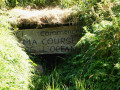
At the start of the walk, one of the sources of the Loire.

The giant comb sculpture, part of the ‘La ligne du Partage des Eaux’ art trail.

After the walk, on your way back, past the Bourlatier farm, look out for the sign and stop on the right-hand side, at a bend, to see Gilles Clément’s beautiful Water Tower, which forms part of the same art trail (car park).

Reviews and comments

5 / 5
Based on 2 reviews

Reliability of the description
5 / 5
Ease of following the route
5 / 5
Route interest
5 / 5
angeleri stephane
angeleri stephane

Overall rating : 5 / 5

Date of your route : Nov 24, 2025
Reliability of the description : ★★★★★ Very good
Ease of following the route : ★★★★★ Very good
Route interest : ★★★★★ Very good
Very busy route : No

Superb short hike with varied and magnificent passages. Don't miss the forests of twisted beech trees.

Machine-translated

Henri-Jean
Henri-Jean

Overall rating : 5 / 5

Date of your route : Aug 19, 2025
Reliability of the description : ★★★★★ Very good
Ease of following the route : ★★★★★ Very good
Route interest : ★★★★★ Very good
Very busy route : No

A lovely short hike with no major difficulties apart from the climb up the knoll in the middle of the heather, which requires walking sticks. Beautiful scenery all along the way.

Machine-translated

Other walks in the area

For more walks, use our search engine .

The GPS track and description are the property of this route's author. Please do not copy them without permission.