Tour of Vieux Mélan

A short walk from the SGDF base in Mélan. This short walk takes you round Vieux Mélan along a forest path, offering a chance to cool off.
Please note that some sections require you to pass through gates, which must be closed behind you. There is a water point at the cemetery near the chapel. The first section along the DFCI track is in the sun; the rest is in the shade along the forest path.

Details

101507786
Creation:
Last update:
Last review:
  • Walking
    Activity: Walking
  • ↔
    Distance: 4.68 mi
  • ◔
    Average duration: 3h 00 
  • ▲
    Difficulty: Moderate

  • ⚐
    Back to start: Yes
  • ↗
    Ascent: + 1,001 ft
  • ↘
    Descent: - 1,001 ft

  • ▲
    Highest point: 4,652 ft
  • ▼
    Lowest point: 3,698 ft

Description of the walk

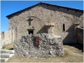
Park at the crossroads a few metres past the Sainte-Madeleine Chapel.

(S/E) Take the road on the right uphill; at the Colombier neighbourhood, turn left, enter Mélan and head for the cemetery junction.

(1) Leave the road and turn left onto the ascending track; after the Ravin de Chaix ford, you’ll reach a path junction.

(2) Continue to the right along the DFCI track. Cross the Ravin du Pela, then leave the DFCI track and take the path on the right; you’ll soon reach the GR®6 and the ‘Vieux Mélan’ sign.

(3) Turn right and head for the junction marked ‘Les Arnauds Sud’.

(4) Leave the GR® and continue along the Route Forestière du Désert until you reach the Vieux Mélan junction.

(5) Turn right at a 90° angle; follow an almost flat path to reach a Y-junction.

(6) Turn left onto a steeper descent, returning to the original junction by the cemetery.

(1) Turn left and follow the path back along the same route as on the way out to the car park at the Chapelle Sainte-Madeleine (S/E).

Waypoints

  1. S/E : mi 0 - alt. 3,698 ft - Car park after the Sainte-Madeleine Chapel
  2. 1 : mi 0.63 - alt. 3,967 ft - Crossroads at the end of the circular loop
  3. 2 : mi 1.54 - alt. 4,236 ft - DFCI crossroads
  4. 3 : mi 1.94 - alt. 4,360 ft - Sign for Vieux Mélan
  5. 4 : mi 2.35 - alt. 4,619 ft - Sign for Les Arnauds Sud
  6. 5 : mi 3.13 - alt. 4,498 ft - Vieux Mélan crossroads
  7. 6 : mi 3.53 - alt. 4,452 ft - Y-junction
  8. S/E : mi 4.68 - alt. 3,698 ft - Car park after the Sainte-Madeleine Chapel

Always be cautious and plan ahead when you're outdoors. Visorando and the author of this route cannot be held responsible for any accidents occurring on this route.

The GR® and PR® markings are the intellectual property of the Fédération Française de Randonnée Pédestre.

Other walks in the area

For more walks, use our search engine .

The GPS track and description are the property of this route's author. Please do not copy them without permission.