Country:
 City:
City:


To get there by car via the BV-2111, turn left just before the old village and park near an electricity substation.
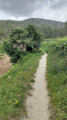
(S/E) Take the path for 150 m until you reach the road; cross it and take the track on the left which runs parallel to it before rejoining the road.
(1) Cross the road and take the path leading up to the Col de Triador: views of Olivella and the castle ruins.
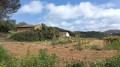
(2) Descend through the pine forest to the bottom of the Servera valley. Take the track on the left (stone shepherd’s hut), then climb up the path on the right.
(3) At the junction, take the path on the right which climbs up to the Font del Rector. Continue to the right towards a ruined chapel, then reach a junction.
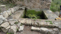
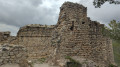
(4) Turn left to climb up to the ruins of the Ermita de Sant Pere del Castellvell, then continue to the summit of Puig Moli (ruins of Castellvell Castle).
(5) Return to the fork in the path.
(4) Head down to the left towards the buildings at Mas Vendrell. Just before reaching them, follow a track to the left (there are horses roaming freely in the valley), then you’ll reach a junction.
(6) Head left for about 1 km until you reach another junction in the Servera valley.
Turn right and follow the track for about 150 metres.
(7) Take the path on the right which descends into the bed of the River Begues and passes the Cal Montaner cave. Continue along the river, then head left towards the Cal Montaner farm.
(8) Go round the farm on the left and rejoin the track you left earlier, which you follow to the right.
(9) At the start of the bend, take the path opposite and follow it along the edge of the vineyards to the car park (S/E).

 Visorando Member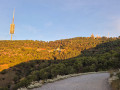
 Moderate