Circuit at the foot of the Cinque Torri from Passo Giau

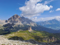
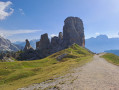
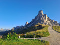
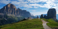
A very lovely walk in the Dolomites with views of the Cinque Torri.
The ascent of Monte Nuvolau offers an incredible view, at the cost of an extra 150 metres of elevation gain.

Details

39002940
Creation:
Last update:
Last review:
  • Walking
    Activity: Walking
  • ↔
    Distance: 5.69 mi
  • ◔
    Average duration: 4h 30 
  • ▲
    Difficulty: Moderate

  • ⚐
    Back to start: Yes
  • ↗
    Ascent: + 2,136 ft
  • ↘
    Descent: - 2,139 ft

  • ▲
    Highest point: 8,376 ft
  • ▼
    Lowest point: 6,975 ft

Photos

Description of the walk

Free parking at the Passo Giau car park. Very busy during peak season.

(S/E) Take the track that runs alongside the refuge and continue to the chalet/hotel.

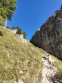
(1) Leave the lovely path with steps and take a track on your right. Wind your way along the track, between the rocks and the vegetation. Straight on – it’s the only way! Once you’ve crossed a small stream (Ru Curto), you’ll reach the foot of a very steep climb.

(2) Climb this slope to exit the gorge. It isn’t long but it’s a steep climb. At the top, take the path on the right towards the Cinque Torri Refuge

(3) From the Cinque Torri Refuge, take the track suitable for vehicles towards the Scoiattoli Refuge. Reach the refuge by turning right onto the access track at the first sharp left-hand bend.

(4) Take the time (and the energy) to cover the few metres separating you from the Scoiattoli Refuge. The view from there is incredible. Continue along the track towards the Averau Refuge, taking a track. Carry on straight ahead, then take the track on the left which turns into a footpath. At the junction, head straight on towards the summit of Monte Nuvolau for a round trip.

(5) A magnificent view awaits you at the summit of Monte Nuvolau. Return to the previous junction and head straight on to reach the Averau Refuge.

(6) Walk past it and continue along a good, very wide track suitable for vehicles (ski run). Turn left at the bend and you’ll reach a junction.

(7) Follow the track straight ahead. Continue downhill to reach the car park (S/E).

Waypoints

  1. S/E : mi 0 - alt. 7,320 ft - Passo Giau car park
  2. 1 : mi 0.15 - alt. 7,343 ft - Mountain Paradise Apartments
  3. 2 : mi 1.64 - alt. 7,073 ft - Steep slope at the exit from the Ru Curto
  4. 3 : mi 2.18 - alt. 7,024 ft - Refuge des Cinque Torri
  5. 4 : mi 2.59 - alt. 7,385 ft - Refuge Scoiattoli
  6. 5 : mi 3.63 - alt. 8,320 ft - Nuvolau Mountain Hut
  7. 6 : mi 4.08 - alt. 7,927 ft - Refuge Averau
  8. 7 : mi 4.23 - alt. 7,795 ft - Crossroads. Shortcut
  9. S/E : mi 5.69 - alt. 7,320 ft - Passo Giau car park

Notes

You can take the cable car either from the Fedare mountain hut in the south or from the Seggiovia Cinque Torri in the north. But the experience at the top isn’t quite the same.
At the Nuvolau Refuge, you can reward yourself for the climb with a small burger (€8 in 2023) and a beer.

An alternative route is possible at (7): take a path on the right that winds beneath the cable car. You’ll still need to turn left shortly afterwards to reach the car park (S/E).

Reviews and comments

4 / 5
Based on 3 reviews

Reliability of the description
3.7 / 5
Ease of following the route
4 / 5
Route interest
4.3 / 5
CRE73
CRE73

Overall rating : 5 / 5

Date of your route : Aug 08, 2025
Reliability of the description : ★★★★★ Very good
Ease of following the route : ★★★★★ Very good
Route interest : ★★★★★ Very good
Very busy route : Yes

We completed the circuit in August 2025. This circuit is very interesting and allows you to take less travelled paths. The approach via Passo Giau (between points 1 and 3) is interesting: beautiful views of the Cinque Torre and the Tofane and very few people. There are a lot of people between points 4 and 5, especially on the ascent and descent to the NUVOLAU refuge. To avoid the crowds, we took a path parallel to the track between point 4 and halfway up the ascent to the refuge. After point 3, it is possible to avoid the track by taking several paths to the north that lead to the ridge. At point 7, based on previous reviews, we continued on the ski track (a few rocky sections were uncomfortable but not dangerous at all).

Machine-translated

gldolive
gldolive

Overall rating : 3.7 / 5

Date of your route : Jun 23, 2025
Reliability of the description : ★★★☆☆ Average
Ease of following the route : ★★★★☆ Good
Route interest : ★★★★☆ Good
Very busy route : No

From point 7 onwards, the descent is difficult. You will need to use your hands and take great care of the loose, wet rocks.

Machine-translated

pascalmimi
pascalmimi

Overall rating : 3.3 / 5

Date of your route : Oct 02, 2023
Reliability of the description : ★★★☆☆ Average
Ease of following the route : ★★★☆☆ Average
Route interest : ★★★★☆ Good
Very busy route : No

Please note that the route is very challenging on the way back; the descent involves a steep climb. We are experienced walkers, but the estimated time given is completely inaccurate. It took us an extra hour and a half compared to the estimated time.

Machine-translated

Other walks in the area

For more walks, use our search engine .

The GPS track and description are the property of this route's author. Please do not copy them without permission.