The tip of Armorique

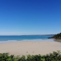
A beautiful hike, much of it taking place along the seafront corniche. Along the way, you can add a visit to a Gallo-Roman site and take a refreshing dip!

Technical sheet

50634997
Creation:
Last update:
Last review:
  • Walking
    Activity: Walking
  • ↔
    Distance: 7.13 km
  • ◔
    Average duration: 2h 20 
  • ▲
    Difficulty: Moderate

  • ⚐
    Return to departure point: Yes
  • ↗
    Vertical gain: + 107 m
  • ↘
    Vertical drop: - 104 m

  • ▲
    Highest point: 48 m
  • ▼
    Lowest point: 4 m

Description of the walk

_ Start _: Parking close to Chapelle Sainte-Barbe (departure point) or opposite Toul an Héry harbour.

Waymarker Red and White

(S/E) Take a path along the Rivière Douron estuary (on your left). Head North to the Thermes du Hogolo (Gallo-Roman remains).

(1) Continue North along the seafront path. The path reaches a small road that bends to the right (East). The road runs alongside a car park, veers right again, and climbs up to reach a wider road. Take this road to the left for about 100 m.

(2) Take the left-hand path down to the sea. The path follows the coastline, with alternating slopes. Reach a small road leading down to Porz Mellec beach.

(3) Continue along the coastal path to Beg Douar, where you cross a road.

(4) Take the path due South, which runs more or less alongside the Bay of Saint-Michel-en-Grève (on your left). Come to a small road and, when it bends to the right, continue straight ahead on the GR®.

_ No waymarker

(5) At the fork, leave the GR® (which goes left towards Toull Efflam) and turn right. Rejoin the tarmac and head West through Kerallic. Cross a larger road at the crosswalk.

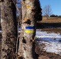
Yellow waymarker

(6) Continue straight ahead (West) past a livestock building. Reach another intersection.

Blue waymarker (rare)

(7) Then take the small road roughly opposite, heading towards Kergavarec. Before the road bends to the right, turn left onto a sunken track which, facing West, leads to Chapelle Sainte-Barbe (S/E).

Waypoints

  1. S/E : km 0 - alt. 6 m - Chapelle Sainte-Barbe (Plestin-les-Grèves)
  2. 1 : km 0.76 - alt. 12 m - Thermes du Hogolo
  3. 2 : km 1.99 - alt. 42 m
  4. 3 : km 3.35 - alt. 21 m
  5. 4 : km 4.06 - alt. 14 m - Left-hand path down to the sea
  6. 5 : km 5.42 - alt. 32 m
  7. 6 : km 5.73 - alt. 45 m
  8. 7 : km 6.15 - alt. 30 m
  9. S/E : km 7.13 - alt. 6 m - Douron (fleuve)

Practical information

_ Start & Parking_: Parking close to Chapelle Sainte-Barbe (departure point) or opposite Toul an Héry harbour.

_ Gears _: Wear shoes that don't get wet.

_ Equipment _: following the itinerary poses no major difficulty, but a 1:25,000 map is useful (at least
the one that accompanies this description).

_ Alternative in very wet conditions _:
The sunken path shortly after (7) runs alongside a stream. Sometimes, the stream overflows into the path, making progress tricky. In this case, we recommend following the PR® trail (yellow markings). From (7), turn right. Take a path that quickly turns left and heads north-west. At Toull an Hent, turn left at a crossroads, heading South-West. You reach a small road, which you follow until you reach another path that leads to Chapelle Sainte-Barbe.

Hiked by the author on August 11, 2009.

In the nearby area

- Chapelle Sainte-Barbe (S/E).
- Thermes du Hogolo|https://www.lieux-insolites.fr/cotedarmor/hogolo/hogolo.htm] (1) Gallo-Roman
remains in good condition, well worth a visit.
- Pleasant Porz Mellec beach (3) don't hesitate to make a detour here for a pleasant swim in season.
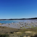
- Beautiful views over the bay of Saint-Michel-en-Grève.

 Always stay careful and alert while following a route. Visorando and the author of this walk cannot be held responsible in the event of an accident during this route.

The GR® and PR® markings are the intellectual property of the Fédération Française de Randonnée Pédestre.

Other walks in the area

For more walks, use our search engine .

The GPS track and description are the property of the author. Do not copy them without permission.