


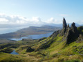
Expect considerable crowds over the first two (and therefore also the last two) kilometres… the rock known as ‘The Old Man of Storr’ is probably the island’s most unmissable landmark.
Set off early: there are fewer people and the light is much better, unless the weather is gloomy and the sky overcast, in which case you won’t see much anyway.
Once you’ve passed the Old Man of Storr and the natural viewpoint a little further up, there’s hardly anyone around.
Be careful: whilst the climb isn’t difficult in itself, the path isn’t always clearly visible (follow the cairns as you go), is sometimes quite close to the cliff edge (offering a splendid alternative view of the famous monolith) and can be shrouded in cloud and/or quite windy at times. Take care… you’re in the mountains. Using your hands can make the climb easier at two slightly steep sections.
Once at the summit, take the time to admire the 360° view and slowly make your way down the grassy slope towards the north, following the edge of the cliff. A few cairns are helpful here too, as the path is very faintly marked.
Head slightly to the right, then further on join the clearly visible path below and follow it southwards to the viewpoint before returning to the car park via the same route you took on the way up.
The Storr


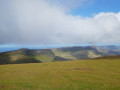
The Storr is not the highest peak on the Isle of Skye, but it is fairly easy to reach and, in good weather of course, the 360° view takes in almost the entire island and offers a lovely panorama of the ocean and the neighbouring islands.
This suggested walk goes beyond the natural viewpoint – the usual destination for visitors to the site – to reach the summit of the Storr.
Details
Creation:
Last update:
Last review:
–
–
-
 Activity: Walking
 -
 Distance: 5.23 mi
 -
 Average duration: 4h 05
 -
 Difficulty: Moderate
 -
-
 Back to start: Yes
 -
 Ascent: + 1,939 ft
 -
 Descent: - 1,909 ft
 -
-
 Highest point: 2,306 ft
 -
 Lowest point: 587 ft
-
 Country:
United Kingdom
Country:
United Kingdom
-
 City:
Highland
City:
Highland -
 Start/End: N 57.498397° / W 6.159098°
 -


 Hour-by-hour weather
Photos
Description of the walk
Waypoints
- S/E : mi 0 - alt. 587 ft - Old Man of Storr car park
- 1 : mi 1.05 - alt. 1,499 ft - Passage between the Old Man of Storr and Needle Rock
- 2 : mi 1.34 - alt. 1,575 ft - Viewpoint
- 3 : mi 2.03 - alt. 2,247 ft - Storr Summit
- S/E : mi 5.23 - alt. 587 ft - Old Man of Storr car park
Other walks in the area
The Old Man of Storr
 Visorando Member3.23 mi
+1,053 ft
-1,027 ft
2h 25
Moderate
Visorando Member3.23 mi
+1,053 ft
-1,027 ft
2h 25
Moderate
 Departure from Highland
A beautiful hike not to be missed. Do it at your own pace, but it's feasible for everyone. Fantastic views and breathtaking scenery worthy of "The Lord of the Rings" will make you forget all your previous efforts!
Old Man of Storr
 2.56 mi
+1,070 ft
-1,063 ft
2h 05
2.56 mi
+1,070 ft
-1,063 ft
2h 05
 Easy
Departure from Highland
Easy
Departure from Highland
A very short, easy walk to do late afternoon (when most walkers have come back down off the mountain) so you can enjoy the silence and evening light.
The Fairy Glen
 0.93 mi
+105 ft
-108 ft
0h 30
Moderate
Departure from Highland
0.93 mi
+105 ft
-108 ft
0h 30
Moderate
Departure from Highland
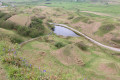
A pleasant hike to discover a surprising and delightful miniature landscape of cone-shaped grassy hills, the Fairy Glen. It is a fascinating and somewhat supernatural place to visit. The route goes around the Fairy Glen, which is ideal for soaking up the special atmosphere of this place.
A visit to Fairy Glen
 1.64 mi
+203 ft
-203 ft
0h 55
Easy
Departure from Highland
1.64 mi
+203 ft
-203 ft
0h 55
Easy
Departure from Highland
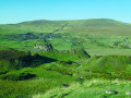
A series of conical hills, a pond, the odd little stream, a rocky outcrop that probably served as a mini stronghold a few centuries ago, a rocky barrier, meadows, sheep, rabbits and a pay-and-display car park – this is what makes up the wonderful spot known as Fairy Glen.A lovely spot that’s definitely worth a visit if you’re near Uig Bay. Naturally, it’s accessible via a few kilometres of single-track road.
The Table and the Needle at the Quiraing
 3.92 mi
+1,250 ft
-1,240 ft
2h 55
Moderate
Departure from Highland
3.92 mi
+1,250 ft
-1,240 ft
2h 55
Moderate
Departure from Highland
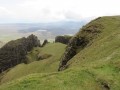
The Quiraing combines both majestic mountains and the mysteries of the Isle of Skye. The landscapes are magnificent.
From Sligachan to Elgol via Camasunary
 12.02 mi
+689 ft
-610 ft
6h 10
12.02 mi
+689 ft
-610 ft
6h 10
 Difficult
Departure from Highland
Difficult
Departure from Highland
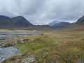
It’s a wonderful adventure, but it’s a one-way trip! You’ll need to either have a car waiting for you at the end point, book accommodation there (which can be tricky), carry your sleeping gear with you on the hike, find a place to camp near Elgol, and plan a route back to Sligachan. There are two interesting options for returning on foot: take the boat to Coruisk and return to Sligachan by skirting the magnificent Loch Coruisk to the left (the longer route) or to the right (involving two wide fords across the River Scavaig); or head along the east coast via Glasnakille, Drinan and Kilmarie, where it is possible to reach Camasunary.
Circular Sligachan loop to the Fairy Pools and back
 10.94 mi
+1,955 ft
-1,939 ft
6h 45
Moderate
Departure from Highland
10.94 mi
+1,955 ft
-1,939 ft
6h 45
Moderate
Departure from Highland
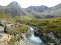
This unmissable walk to the Fairy Pools passes to the west of the Isle of Skye’s highest peaks and offers the chance to discover a multitude of ‘pools’ created by a succession of waterfalls fed by dozens of torrents rushing down the slopes of the surrounding mountains.Whilst most of the waterfalls are on the right-hand side of the path in the lower part of the walk, there are one or two quite remarkable ones on the left-hand side too, along the stream flowing down from the north-western plateau.
The Fairy Pools
 2.27 mi
+404 ft
-433 ft
1h 25
Moderate
Departure from Highland
2.27 mi
+404 ft
-433 ft
1h 25
Moderate
Departure from Highland
A superb walk to the Fairy Pools, where you can admire multiple pools of turquoise-coloured water. The first part of the route is well-maintained, but then becomes very natural with a stony path, which may discourage those with little experience of mountain terrain.
For more walks, use our search engine .
The GPS track and description are the property of this route's author. Please do not copy them without permission.

