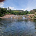
A pleasant walk letting you discover the National Forest of the Colle du Rouët, the Trou de Gournié, also called Cascade de l'Endre and the river Endre.
Depart from the car park at the beginning of the Piste des Corbières on the edge of the D47 where you can park without any problems.
(D/A) At the barrier, take the Piste des Corbières indicated by a sign prohibiting traffic. Ignore a path that appears very soon to your left and reach an intersection.
(1) Ignore the left-hand path that you'll later return on, and continue on the main track passing all other paths.
(2) At the intersection of the Stèle du Chasseur, turn left and keep following this descending track, cross the GR51 and get to the Piste des Pradinaux.
(3) When you arrive at the intersection with the Piste des Pradinaux, turn right and go up to the Trou de Gournier.
(4) From the Trou de Gournier, retrace your steps back to the Piste des Pradinaux passing the forest house.
(3) Continue until the intersection with the Piste des Pines Pignons on the left (barrier and sign with the name of the track)
.
(5) Turn left on the Piste des Pines Pignons which joins the Piste des Corbières.
(1) When you get to the intersection, turn right and join the car park (D/A).
Waypoints :
D/A : km 0 - alt. 72m
1 : km 0.33 - alt. 76m - Outward-leg and return-leg junction
2 : km 2.02 - alt. 115m - Left at la Stèle du Chasseur,
3 : km 4.25 - alt. 53m - Right at the junction of the Piste des Pradinaux
4 : km 5.36 - alt. 55m - Trou de Gournier
5 : km 7.4 - alt. 46m - Left, the Piste des Pins Pignons
D/A : km 9.66 - alt. 72m
This route has very little shade, except when you arrive at the Piste des Pradinaux which leads to the Trou de Gournier where you can refresh yourself in a pool. Nevertheless, the pines will shade you from time to time over the entire walk.
Visorando and this author cannot be held responsible in the case of accidents or problems occuring on this walk.
Global average : 4.33/5
Number of opinions : 1
Description quality : 5/5
Routemap quality : 5/5
Walk interest : 3/5
Global average : 4.33 / 5
Date of walk
: 10/06/21
Description quality
: Very good
Easiness to follow the route
: Very good
Walk interest
: Average
A good walk which leads to a peaceful little lake and small waterfall. Perfect place to sit down and relax and dip your toes into the water! The way offers little to no shade, so make sure you bring appropriate head gear along.
A stroll in an exceptional place, discovering the gorges of the river Blavet and the cave of Mueron which was inhabited in the Bronze Age.
Ideal in summer and on warmer days, avoid periods of heavy rain.
A short but energetic walk that is exposed towards the end. Enjoy the stunning views from the top of Rocher de Roquebrune with its famous ochre colours.
Ascent to the Sainte-Anne Chapel, located 624 m above sea level on the western summit of the Plateau du Puy, passing by the ruins of a Ligurian oppidum. Easy hike in the Provence scrubland and forest (thyme, lavender, rock rose...)
This circuit lets you discover magnificent panoramic views over the Mediterranean (the Gulf of Saint- Tropez up to the Dramont semaphore) and Mediterranean forests, as well as the remains of the Malavettes forester's house, now abandoned.
A very nice short walk that with beautiful views of the bay of Agay and the Esterel massif.
Very beautiful hike close to Agay which enables you to discover the Estérel away from the usual routes.
Beautiful hike in the Esterel Massif where you can discover Sainte Baume and its chapel and the beautiful viewpoint on Cap Roux peak, and then reach Ours Peak going via Aurelle Peak.
Above Agay close to the beaches, the fabulous Massif de l'Esterel is the ideal terrain for a comfortable hike, but is always different.
For more walks, use our search engine.
The GPS track and description are the property of the author.