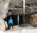
The Cabanons de Mane

If you like Bories, you'll see them in the distance at the start, then up close, and you can even go inside some of them. On your way back, before you get to the village, you'll walk up a superb calade (cobbled) street, and there's a little detour to see the Château de Mane.

Technical sheet

202055
Creation:
Last update:
Last review:
  • Walking
    Activity: Walking
  • ↔
    Distance: 7.03 km
  • ◔
    Average duration: 2h 30 
  • ▲
    Difficulty: Easy

  • ⚐
    Return to departure point: Yes
  • ↗
    Vertical gain: + 183 m
  • ↘
    Vertical drop: - 186 m

  • ▲
    Highest point: 618 m
  • ▼
    Lowest point: 440 m

Photos

Description of the walk

Park at the Prieuré de Salagon car park, well signposted in the village of Mane.

(S/E) Walk up the Chemin de Clavière, to the left. At the top, take the path straight ahead, then pass the first path on your left and take the next one, which is a little less well marked. Join another path above and continue straight on. On your left you'll see lots of hives so walk quietly so as not to disturb them, and continue to the end.

(1) To the left, be careful crossing the D950 and then take the path opposite.

(2) There's a little detour to see two bories next to each other. Continue straight on for 700m.

(3) Take the wide track to the right, and walk along the Ravin du Sauvage.

(4) Don't cross the ravine, but at the bottom turn right and then left after 80m. Go down until you reach the road, turn left, follow it along the left-hand side of the road because the pedestrian crossing is wider, and continue for about 300m.

(5) As soon as you have passed the protective barrier, follow the path to the right. Walk all the way down to the village, and follow the Chemin de Chamarge to get to the D4100 main road.

(6) Turn right along this road, then stay on the main road until you reach the maison de produits de pays (local produce store). Still on the right-hand side, a sign will direct you to the Prieuré de Salagon. You're now just 500m away from the original car park (S/E).

Waypoints

  1. S/E : km 0 - alt. 444 m - Prieuré de Salagon car park
  2. 1 : km 0.55 - alt. 475 m - Crossroads
  3. 2 : km 0.84 - alt. 466 m - Saint-Estève
  4. 3 : km 1.47 - alt. 524 m - Crossroads
  5. 4 : km 2.16 - alt. 530 m - Crossing the D950
  6. 5 : km 3.09 - alt. 615 m - Crossroads
  7. 6 : km 3.19 - alt. 618 m - Path forks
  8. 7 : km 3.66 - alt. 574 m - Intersection of roads
  9. 8 : km 4.2 - alt. 529 m - D950
  10. 9 : km 4.74 - alt. 528 m - To the right, after the protection along the road.
  11. 10 : km 5.88 - alt. 464 m - Left on the D4100
  12. 11 : km 6.35 - alt. 444 m - Straight ahead on the D4100
  13. S/E : km 7.03 - alt. 444 m - Prieuré de Salagon car park

Practical information

Wear walking shoes and take water.
Take band-aids
Be careful if you have children, you have to cross a road and walk 300m along the roadside.

In the nearby area

You must visit the Prieuré de Salagon
its museum and ethno-botanical gardens. You'll be parked in their car park.
The local produce store which you'll pass on the way back.
The Institut des huiles essentielles (Institute of essential oils) which you'll pass on the way back.
You can do a detour to see the Château de Mane from a distance - not open to the public.
And further away is the Château de Sauvan, signposted at the village exit.

Reviews and comments

4 / 5
Based on 41 reviews

Reliability of the description
3.7 / 5
Clarity of route map
4 / 5
Route interest
4.2 / 5
Titus04
Titus04

Overall rating : 3.3 / 5

Date of walk : Mar 30, 2025
Reliability of the description : ★★★☆☆ Average
Clarity of route map : ★★★☆☆ Average
Route interest : ★★★★☆ Good
Busy trail : No

Lacks a few markings on the trace.

Automatically translated

CRISTINA11
CRISTINA11

Overall rating : 4.3 / 5

Date of walk : Dec 29, 2024
Reliability of the description : ★★★★☆ Good
Clarity of route map : ★★★★★ Very good
Route interest : ★★★★☆ Good
Busy trail : No

Nice walk with no difficulty, the app is great, with the map in GPS mode plus the description, it's top notch!

Automatically translated

Christian13
Christian13

Overall rating : 4.7 / 5

Date of walk : Nov 24, 2024
Reliability of the description : ★★★★★ Very good
Clarity of route map : ★★★★★ Very good
Route interest : ★★★★☆ Good
Busy trail : No

Very nice little hike. The description is perfect. I recommend it 👍

Automatically translated

chris05
chris05
• Last modified:

Overall rating : 5 / 5

Date of walk : Nov 03, 2024
Reliability of the description : ★★★★★ Very good
Clarity of route map : ★★★★★ Very good
Route interest : ★★★★★ Very good
Busy trail : No

Hello
We did this route on Saturday.
The description is consistent with the terrain,
except at point 4 "cross the D950 road and continue along the path" which is a large track with a carriageway going uphill!
Interesting circuit at times, you have to look carefully to the left to see the drystone shelters in the vegetation!
We went to see a drystone shelter that can be seen at the bottom of the path before passing point 5 where you take the path to reach it.
Thanks for the topo
Christian

Automatically translated

Biquette13
Biquette13

Overall rating : 4 / 5

Date of walk : Oct 03, 2024
Reliability of the description : ★★★★☆ Good
Clarity of route map : ★★★★★ Very good
Route interest : ★★★☆☆ Average
Busy trail : No

The first drystone shelter towards the road was screened. After that, there was only one view of the two marked out.
The last one, in the ravine, meant we had to leave the route and plunge into the forest.
A pleasant hike, but mainly for the scenery.

Automatically translated

cathyferrer
cathyferrer

Overall rating : 4.7 / 5

Date of walk : May 27, 2024
Reliability of the description : ★★★★☆ Good
Clarity of route map : ★★★★★ Very good
Route interest : ★★★★★ Very good
Busy trail : No

A lovely walk in the sunshine and a great way to discover stone buildings.
Thanks to the author

Automatically translated

mo.renault
mo.renault
• Last modified:

Overall rating : 5 / 5

Date of walk : Apr 24, 2024
Reliability of the description : ★★★★★ Very good
Clarity of route map : ★★★★★ Very good
Route interest : ★★★★★ Very good
Busy trail : No

This is a nice, easy walk that can be enjoyed by children who are used to walking for several hours. Avoid hot weather. We met a local man who showed us around his rain water reservoir carved into rock.

Automatically translated

marieannick8
marieannick8

Overall rating : 3 / 5

Date of walk : Sep 23, 2023
Reliability of the description : ★★★☆☆ Average
Clarity of route map : ★★☆☆☆ Disappointing
Route interest : ★★★★☆ Good
Busy trail : No

hard-to-find or non-existent fittings

Automatically translated

Minoute186
Minoute186

Overall rating : 3 / 5

Date of walk : Sep 03, 2022
Reliability of the description : ★★★☆☆ Average
Clarity of route map : ★★★☆☆ Average
Route interest : ★★★☆☆ Average
Busy trail : No

There are a few drystone shelters along the way (some of them magnificently preserved). Otherwise, you'll need to be a fan of the Provençal environment (heath, holm oak woods, etc.).

Automatically translated

valcol9387
valcol9387

Overall rating : 4 / 5

Date of walk : Apr 15, 2022
Reliability of the description : ★★★★☆ Good
Clarity of route map : ★★★☆☆ Average
Route interest : ★★★★★ Very good
Busy trail : No

A very pleasant walk in Giono's Provence
Easy route, but you need the GPS from time to time.
I would recommend

Automatically translated

Charlotte.S
Charlotte.S

Overall rating : 4.7 / 5

Date of walk : Mar 18, 2022
Reliability of the description : ★★★★☆ Good
Clarity of route map : ★★★★★ Very good
Route interest : ★★★★★ Very good
Busy trail : No

A pleasant walk with no difficulties and the pleasure of "hunting" for drystone shelters.
- Just before point 2, when you reach the small road, don't hesitate to walk a few dozen metres along the track opposite to see a drystone shelter and a restored shelter.
- At point 3, you can extend the walk a little by making a loop to admire a magnificent drystone shelter, visible from the track you are on, at the bottom of the valley on the left. Simply take the path that descends to the left and immediately turn right (cairns) and make a round trip or go back up another path that takes you to the small pass at Magnaudis and back to point 3.

Automatically translated

LACeuro
LACeuro

Overall rating : 5 / 5

Date of walk : Feb 13, 2022
Reliability of the description : ★★★★★ Very good
Clarity of route map : ★★★★★ Very good
Route interest : ★★★★★ Very good
Busy trail : No

Nice little outing in the countryside, fairly short 2-hour circuit with no difficulties

Automatically translated

Annetton
Annetton

Overall rating : 5 / 5

Date of walk : Dec 05, 2021
Reliability of the description : ★★★★★ Very good
Clarity of route map : ★★★★★ Very good
Route interest : ★★★★★ Very good
Busy trail : No

Very quickly completed, but above all, magnificent restanques, cabanons and drystone shelters in the late autumn sunshine.
I didn't come across a single human

Automatically translated

bouchind.homme
bouchind.homme

Overall rating : 4.3 / 5

Date of walk : Oct 23, 2021
Reliability of the description : ★★★★★ Very good
Clarity of route map : ★★★☆☆ Average
Route interest : ★★★★★ Very good
Busy trail : No

A beautiful hike with a wide variety of viewpoints.
Prefer autumn because of the colours.
Return via Beaudine instead of following the D950.
Avoid the return via Mane by staying to the west of the D4100.

Automatically translated

dacloitre
dacloitre

Overall rating : 4.3 / 5

Date of walk : May 26, 2021
Reliability of the description : ★★★★★ Very good
Clarity of route map : ★★★★☆ Good
Route interest : ★★★★☆ Good
Busy trail : No

Very nice tour to do in any weather

Automatically translated

Other walks in the area

For more walks, use our search engine .

The GPS track and description are the property of the author. Do not copy them without permission.