In the footsteps of Vlaminck in Rueil-la-Gadelière

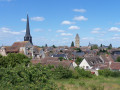
Vlaminck, the famous Fauvist painter, greets walkers as soon as they arrive, as his bust, sculpted by Paul Belmondo, stands in the Town Hall Square. He is then commemorated at La Tourillière, where he lived before being buried in the local cemetery.

Details

24811725
Creation:
Last update:
Last review:
  • Walking
    Activity: Walking
  • ↔
    Distance: 5.07 mi
  • ◔
    Average duration: 2h 25 
  • ▲
    Difficulty: Easy

  • ⚐
    Back to start: Yes
  • ↗
    Ascent: + 69 ft
  • ↘
    Descent: - 98 ft

  • ▲
    Highest point: 607 ft
  • ▼
    Lowest point: 502 ft

Description of the walk

Car park in front of the town hall (bust of Vlaminck on the square).

(S/E) With your back to the town hall, head left onto the D316.2 and, at the first junction, follow signs for Le Plessis.

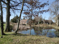
(1) Turn left at the pond and, at thefirst junction, turn left towards the Ruisseau de la Renauderie.

(2) Turn right along the stream to reach the hamlet of La Renauderie.

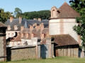
(3) In the hamlet, turn left onto the D102 for 500 m, then turn right twice onto a small road towards La Potinière, a fortified farm (view of the Gadelière site).

(4) At La Potinière, follow the tarmac road down alongside the wall, cross the D316.2 and continue straight on until you reach a side track.

(5) Turn left, walk along the edge of a wood and come out onto the D102. Turn right towards the D939 near La Friche des Bois.

(6) Cross the D939 with care (no pedestrian crossing) and continue along the Montigny-sur-Avre road (D102).

(7) Before the hamlet of Flouville, turn left along the grounds of the Château de Montuel, which is on your right. Continue to the white gate.

(8) At the barrier, take the path on the left, cross a bridge and keep to the right to reach the D939. Move over to the left towards the pedestrian crossing and head for the car park in front of the town hall (S/E).

Waypoints

  1. S/E : mi 0 - alt. 538 ft - Car park in front of the town hall
  2. 1 : mi 0.33 - alt. 554 ft - Le Plessis
  3. 2 : mi 0.94 - alt. 548 ft - Renauderie Stream
  4. 3 : mi 1.42 - alt. 574 ft - The hamlet of La Renauderie
  5. 4 : mi 2.27 - alt. 607 ft - La Potinière
  6. 5 : mi 2.75 - alt. 591 ft - Junction
  7. 6 : mi 3.39 - alt. 561 ft - D939
  8. 7 : mi 3.97 - alt. 558 ft - Junction before the hamlet of Flouville
  9. 8 : mi 4.42 - alt. 531 ft - White barrier
  10. S/E : mi 5.07 - alt. 535 ft - Car park in front of the town hall

Notes

PR® certified by FFRandonnée in collaboration with the Eure-et-Loir Departmental Hiking Committee. Follow the yellow markings.

Worth a visit

Always be cautious and plan ahead when you're outdoors. Visorando and the author of this route cannot be held responsible for any accidents occurring on this route.

The GR® and PR® markings are the intellectual property of the Fédération Française de Randonnée Pédestre.

Reviews and comments

4.2 / 5
Based on 3 reviews

Reliability of the description
4 / 5
Ease of following the route
4.7 / 5
Route interest
4 / 5
User 27213101

Overall rating : 3.7 / 5

Date of your route : Aug 18, 2025
Reliability of the description : ★★★★☆ Good
Ease of following the route : ★★★★☆ Good
Route interest : ★★★☆☆ Average
Very busy route : No

A consistent tour around Rueil, with many road sections without hard shoulders, however.

Machine-translated

FARGAS Jean-Claude
FARGAS Jean-Claude

Overall rating : 4.3 / 5

Date of your route : Jul 03, 2025
Reliability of the description : ★★★☆☆ Average
Ease of following the route : ★★★★★ Very good
Route interest : ★★★★★ Very good
Very busy route : No

This route has recently been revised to focus on the key sites associated with Vlaminck’s life in Rueil-la-Gadelière. The route still starts in front of the town hall, but you must first head towards the church, then walk past the cemetery where the painter’s grave is located. You’ll pass through part of the Paris water catchment area, before finally heading up towards Le Plessis.
The rest of the route remains unchanged. However, the signposting now leads to the entrance of Vlaminck’s house at La Tourillière, which can be visited on certain dates. You’ll need to retrace your steps to rejoin the route. It’s also worth noting that there is quick access to the Château de La Gadelière, which can also be visited during the season.
These changes have necessitated a revision of the route formerly known as ‘In the Footsteps of Vlaminck’. To avoid any confusion, it has reverted to its former name, ‘Fountain Trail’, as its theme now focuses more on the collection of spring water and its flow towards the River Avre.

Machine-translated

Tribodet
Tribodet

Overall rating : 4.7 / 5

Date of your route : Jul 16, 2023
Reliability of the description : ★★★★★ Very good
Ease of following the route : ★★★★★ Very good
Route interest : ★★★★☆ Good
Very busy route : No

A lovely walk in the sunshine, though it was very windy. We only came across one little rabbit...
A very easy walk that took us 1 hour 40 minutes...

Machine-translated

Other walks in the area

For more walks, use our search engine .

The GPS track and description are the property of this route's author. Please do not copy them without permission.