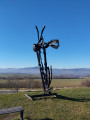
On the Puy d’Ecouyat

A short walk starting from Parent, in the Auvergne region, climbing to the summit of the Puy d’Ecouyat, which overlooks the Allier valley and offers views of the surrounding mountains. The walk can easily be shortened (see Practical Information).

Details

59203655
Creation:
Last update:
Last review:
  • Walking
    Activity: Walking
  • ↔
    Distance: 4.00 mi
  • ◔
    Average duration: 2h 35 
  • ▲
    Difficulty: Easy

  • ⚐
    Back to start: Yes
  • ↗
    Ascent: + 876 ft
  • ↘
    Descent: - 869 ft

  • ▲
    Highest point: 2,139 ft
  • ▼
    Lowest point: 1,470 ft

Description of the walk

In Parent, park in one of the car parks near the town hall.
Green markings andPR® signpost ‘Puy d’Ecouyat’

(S/E) Set off along Rue des Écoles towards the centre of the village, leaving the town hall behind you, and continue straight on along this street to reach Place du Quaire (fountain). Turn left onto Grand’Rue, then take the first street on the right, Rue des Lilas. Immediately afterwards, turn left under a portico to cross a square and join Rue de la Poste. Follow it to the right, ignoring the streets branching off to the right, until you reach the church; walk alongside it on your left until you come to the junction with Rue des Frères Mirallès.

(1) Follow this street, ignoring the side streets and cul-de-sacs, and at the Fork in the road, stay on this street as it curves to the left. Go to the end of the street, then continue in the same direction along the path that extends from it. You’ll come to a junction with a cross.

(2) Turn left, then at the next junction, turn left again, ignoring two paths on the right. Shortly after the second one, turn left onto a footpath. At the Fork in the road just after this, stay on the main path to the right. Further on, the path turns left and reaches the summit of the Puy d’Ecouyat.

(3) Panoramic view, orientation board. Head back down towards the south-west; the path is signposted. Continue in this direction to descend towards Parent, following cairns on sections where the path is barely visible. Caution: stony descent. Join a better-marked path further down, then come out onto a road.

(4) Follow it to the right, pass the cemetery and, at the Fork in the road, keep to the right on the track. Walk for about 150 m until you reach a junction with a cross.

(5) Turn right.

(6) Further on, the path bends to the left, then reaches a T-junction. Follow the path to the left.

(7) At the junction, turn onto the path on the right and follow it – ignoring a small track on the right – until you reach a street in Parent.

(8) Follow it straight on. Join a main road and follow it in the same direction. You’ll reach a crossroads at a square, Place du Courtiol. Follow the road to the right, then, at the Fork in the road, keep left onto Rue du Coin. Stay on this road at the next junction by turning right, then you’ll reach the car park near the town hall (S/E).

Waypoints

  1. S/E : mi 0 - alt. 1,509 ft - Town hall car park
  2. 1 : mi 0.26 - alt. 1,568 ft - Église Saint-Roch (Parent)
  3. 2 : mi 0.72 - alt. 1,834 ft - Crossroads
  4. 3 : mi 1.45 - alt. 2,139 ft - Summit of the - Puy d'Ecouyat
  5. 4 : mi 1.88 - alt. 1,588 ft - Junction of streets
  6. 5 : mi 2.12 - alt. 1,611 ft - Crossroads
  7. 6 : mi 2.61 - alt. 1,854 ft - Turn
  8. 7 : mi 3.22 - alt. 1,650 ft - Fork in the road
  9. 8 : mi 3.67 - alt. 1,512 ft - Path junction => road
  10. S/E : mi 4 - alt. 1,506 ft - Town hall car park

Notes

An easy hike with a fair bit of elevation gain. Standard hiking kit.

Please note: in wet weather, the descent from the summit, which is quite stony in places, can be slippery.

Short alternative route: At (4), turn left to quickly reach the church (1), then return to the car park (S/E) via the reverse route of the outward journey, or via other streets in the village.

Worth a visit

The Puy d’Ecouyat is the only ‘dyke’ in the Comté (canton of Vic-le-Comte). It is an imperfectly exposed lava wall, 200 m long, whose crest, 1 to 5 m wide, forms an irregular profile.

From the summit, and also along the route, there are views over the Allier valley, the Sancy massif and the Chaîne des Puys.

Always be cautious and plan ahead when you're outdoors. Visorando and the author of this route cannot be held responsible for any accidents occurring on this route.

The GR® and PR® markings are the intellectual property of the Fédération Française de Randonnée Pédestre.

Reviews and comments

4.8 / 5
Based on 2 reviews

Reliability of the description
4.5 / 5
Ease of following the route
5 / 5
Route interest
5 / 5
Pouilloux
Pouilloux

Overall rating : 5 / 5

Date of your route : May 18, 2026
Reliability of the description : ★★★★★ Very good
Ease of following the route : ★★★★★ Very good
Route interest : ★★★★★ Very good
Very busy route : No

A lovely walk. Easy, with a slight climb at the start. Very well signposted. Beautiful scenery.

Machine-translated

Noémie92
Noémie92
• Edited:

Overall rating : 4.7 / 5

Date of your route : Feb 24, 2025
Reliability of the description : ★★★★☆ Good
Ease of following the route : ★★★★★ Very good
Route interest : ★★★★★ Very good
Very busy route : No

Hello,
A short, easy walk with two pre-teens (aged almost 10 and 14)...
Lovely views of the Sancy range, Montpeyroux and the Allier valley.
Take care on the descent through the stony sections (markers 3 to 4): don’t hesitate to take a detour...
An interesting orientation map, though it appears to be slightly out of place...

Machine-translated

Other walks in the area

For more walks, use our search engine .

The GPS track and description are the property of this route's author. Please do not copy them without permission.