


!st Oak Park To 4th Brunswick
Details
Creation:
Last update:
–
–
-
 Activity: Walking
 -
 Distance: 7.03 mi
 -
 Average duration: 3h 15
 -
 Difficulty: Not specified
 -
-
 Back to start: No
 -
 Ascent: + 66 ft
 -
 Descent: - 194 ft
 -
-
 Highest point: 272 ft
 -
 Lowest point: 69 ft
-
 Country:
Australia
Country:
Australia
-
 Start: S 37.710486° / E 144.90215°
 -
 End: S 37.757159° / E 144.946413°
 -


 Hour-by-hour weather


Waypoints
- S : mi 0 - alt. 262 ft - Start on
- 1 : mi 0.01 - alt. 266 ft - Turn slight left
- 2 : mi 0.01 - alt. 269 ft - Turn left
- 3 : mi 0.54 - alt. 200 ft - Turn sharp left
- 4 : mi 0.89 - alt. 177 ft - Turn right
- 5 : mi 0.92 - alt. 171 ft - Turn left onto Moonee Ponds Creek Trail
- 6 : mi 1.75 - alt. 164 ft - Keep left onto Moonee Ponds Creek Trail
- 7 : mi 2.01 - alt. 154 ft - Keep right onto Moonee Ponds Creek Trail
- 8 : mi 2.79 - alt. 135 ft - Turn left
- 9 : mi 2.8 - alt. 135 ft - Turn right
- 10 : mi 2.83 - alt. 135 ft - Keep right
- 11 : mi 3.27 - alt. 131 ft - Turn right
- 12 : mi 3.29 - alt. 131 ft - Turn slight left
- 13 : mi 3.31 - alt. 135 ft - Turn right onto Park Street
- 14 : mi 3.32 - alt. 138 ft - Turn slight left onto Gaffney Street
- 15 : mi 3.37 - alt. 138 ft - Turn right onto Parker Street
- 16 : mi 3.46 - alt. 135 ft - At roundabout, take exit 1 onto Hayes Parade
- 17 : mi 3.62 - alt. 135 ft - Turn left onto Kernan Street
- 18 : mi 3.84 - alt. 128 ft - Turn right
- 19 : mi 3.86 - alt. 128 ft - Turn left onto Moonee Ponds Creek Trail
- 20 : mi 4.34 - alt. 115 ft - Turn slight left onto Moonee Ponds Creek Trail
- 21 : mi 5.56 - alt. 92 ft - Turn slight left onto Moonee Ponds Creek Trail
- 22 : mi 5.63 - alt. 89 ft - Turn left onto Eric Street
- 23 : mi 5.74 - alt. 105 ft - At roundabout, take exit 1 onto Vanberg Road
- 24 : mi 5.93 - alt. 92 ft - Turn right onto Lawson Street
- 25 : mi 5.99 - alt. 82 ft - Turn left onto Hilda Street
- 26 : mi 6.03 - alt. 79 ft - Turn right onto Moonee Ponds Creek Trail
- 27 : mi 6.19 - alt. 69 ft - Keep right
- 28 : mi 6.21 - alt. 72 ft - Turn sharp left onto Albion Street
- 29 : mi 6.49 - alt. 85 ft - Turn sharp left onto Kitchener Street
- 30 : mi 6.49 - alt. 85 ft - Turn left onto Albion Street
- 31 : mi 6.91 - alt. 151 ft - Turn left onto Jolley Street
- E : mi 7.03 - alt. 135 ft
Other walks in the area
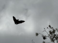
Along the Yarra River, Melbourne
 Association / Club / Walk leader
 1.64 mi
+72 ft
-69 ft
0h 50
1.64 mi
+72 ft
-69 ft
0h 50
 Easy
Departure from Australia
Easy
Departure from Australia
An easy walk along the Yarra River where you can meet Australia's largest colony of bats / flying foxes.
⚠️Please be quiet as you walk among our little furry friends and let the magic happen.
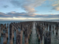
From Port Melbourne Beach to Princes Pier Gatehouse
 2.11 mi
+161 ft
-148 ft
1h 05
Easy
Departure from Australia
2.11 mi
+161 ft
-148 ft
1h 05
Easy
Departure from Australia
This walk is ideal for sunset lovers as it visits two piers including one with historical features. At Prince's Pier Gatehouse enjoy the view on ancient wooden posts located into the water and the nice houses and apartments around with a view of the Tasmanian Ferry.
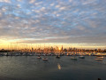
Saint Kilda beach - Stenhouse Reserve, Melbourne
 3.00 mi
+46 ft
-46 ft
1h 25
Easy
Departure from Australia
3.00 mi
+46 ft
-46 ft
1h 25
Easy
Departure from Australia
Start the walk in front of the famous Luna Park, and enjoy the beachside, the pier with views of the boats. If you go in the evening, you might be able to spot some penguins before enjoying Catani gardens and the Stenhouse Reserve to observe the colorful wind kite surfers at sunset.
From Luna Park to Saint Kilda Botanical Garden, Melbourne
1.50 mi
+20 ft
-20 ft
0h 40
Easy
Departure from Australia
This easy walk visits Saint Kilda's back streets and its peaceful Botanical garden past the community garden and back via the busy Ackland Street.
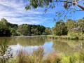
Ruffey Creek and lake
 1.13 mi
+46 ft
-98 ft
0h 35
Easy
Departure from Australia
1.13 mi
+46 ft
-98 ft
0h 35
Easy
Departure from Australia
This easy circular walk is quite and family-friendly. It is a nice spot to relax and birdwatching. Walk along Ruffey Creek before going round Ruffey Lake and its viewing platform.
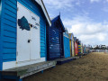
From Brighton Beach to the famous Middle Brighton Bathing Boxes
 2.37 mi
+23 ft
-23 ft
1h 05
Easy
Departure from Australia
2.37 mi
+23 ft
-23 ft
1h 05
Easy
Departure from Australia
This walk along the beach brings you to visit some great swimming, sunset viewpoints, and kite surfer spotting areas without missing the famous Middle Brighton Bathing Boxes.
Brighton Beach - Elsternwick Park Nature Reserve via Elster Canal
6.83 mi
+26 ft
-26 ft
3h 10
Easy
Departure from Australia
Walk along Brighton Beach waterside then go explore Elsternwick Park Nature Reserve before coming back via Elster Canal. Along the way, you will get to explore some hidden spots to catch the sunset or have a quiet break.
For more walks, use our search engine .
The GPS track and description are the property of this route's author. Please do not copy them without permission.

