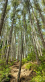
The Bastidon Trail from the Mayreste Viewpoint car park

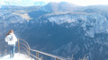
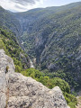
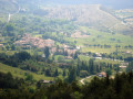
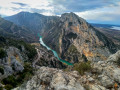
Although it does not offer direct views of the river, this path is very scenic and features a wide variety of landscapes.

Details

n°53270644
Creation:
Last update:
Last review:
  • Walking
    Activity: Walking
  • ↔
    Distance: 5.98 mi
  • ◔
    Average duration: 4h 25 
  • ▲
    Difficulty: Moderate

  • ⚐
    Back to start: Yes
  • ↗
    Ascent: + 1,873 ft
  • ↘
    Descent: - 1,864 ft

  • ▲
    Highest point: 2,690 ft
  • ▼
    Lowest point: 2,297 ft

Description of the walk

At the end or start of the walk, you can visit the Maireste Viewpoint (a round trip): it offers a beautiful view of the Gorges (+15 mins).

(S/E) Take the yellow-marked path towards La Maline / Sentier du Bastidon, which branches off to the left of the Mayreste Viewpoint (after the rubbish bins).

(1) Rouvière Ravine. Carry on; the tricky sections are secured. You’ll then enter the gorges via the path to cross the Ferné Ravine.

(2) Carry on along the hillside. Further on, you’ll reach a small pass just above the Ravin de Mainmorte.

(3) Head straight down to the ravine.

(4) Then climb up the opposite slope to the road.

(5) Turn round and head back to the car park (S/E) via the same route you took on the way out.

Waypoints

  1. S/E : mi 0 - alt. 2,648 ft - Mayreste car park. Near the - Verdon (rivière)
  2. 1 : mi 0.38 - alt. 2,579 ft - Rouvière Ravine
  3. 2 : mi 0.99 - alt. 2,372 ft - Ferné Ravine
  4. 3 : mi 2.43 - alt. 2,457 ft - Pass above Mainmorte
  5. 4 : mi 2.6 - alt. 2,310 ft - Mainmorte Ravine
  6. 5 : mi 2.99 - alt. 2,657 ft - Route de la Maline
  7. S/E : mi 5.98 - alt. 2,648 ft - Mayreste car park

Notes

Best avoided in very hot weather. Despite its proximity to the canyon, there are no particular views of the gorges.

Worth a visit

Mayreste Viewpoint

Reviews and comments

4.7 / 5
Based on 1 review

Reliability of the description
5 / 5
Ease of following the route
4 / 5
Route interest
5 / 5
puard daniel
puard daniel

Overall rating : 4.7 / 5

Date of your route : Jul 02, 2025
Reliability of the description : ★★★★★ Very good
Ease of following the route : ★★★★☆ Good
Route interest : ★★★★★ Very good
Very busy route : No

A superb route, somewhat physically demanding.

Machine-translated

Other walks in the area

For more walks, use our search engine .

The GPS track and description are the property of this route's author. Please do not copy them without permission.