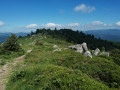
Castles Trail: from the Col du Boenlesgrab to the Petit Ballon

A walk exploring the castles around Guebwiller

Details

n°44629662
Creation:
Last update:
Last review:
  • Walking
    Activity: Walking
  • ↔
    Distance: 4.96 mi
  • ◔
    Average duration: 3h 40 
  • ▲
    Difficulty: Average

  • ⚐
    Back to start: Yes
  • ↗
    Ascent: + 1,545 ft
  • ↘
    Descent: - 1,522 ft

  • ▲
    Highest point: 4,173 ft
  • ▼
    Lowest point: 2,838 ft

Description of the walk

(S/E) From the Boenlesgrab car park, take the level forest track on the left (heading south-west) marked by the tower to reach the Ruhfelsen or Ruhenfels.

(1) Continue to the right along the forest track signposted ‘Château’ until you reach the junction with the path signposted ‘Red Triangle’. Ignore a path on the left and carry on straight ahead to the pass. You’ll come to a Fork in the road.

(2) Follow this path uphill to Kleinbelchen. Take the first path on the right, which turns into a track leading to the Mullermatt. Keep going in this direction until it is no longer possible. Turn right to rejoin the GR®.

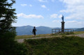
(3) Continue to the left (north) to reach the summit of the Petit Ballon. Keep to the right to reach it.

(4) Enjoy the view and return via the path to the left of the path you took on the way up. Carry on until the bend. Take the path starting on the left just after the bend. In the woods, turn right onto a track. First turn right then left. Carry on to the next track at Kahlenwasen.

(5) Turn right onto the track. At the bend, carry on straight ahead to reach the Strohberg farmhouse inn.

(6) Continue straight ahead downhill on the forest track marked with a Red Disc. Keep to the right at all times to return to Boenlesgrab. (S/E)

Waypoints

  1. S/E : mi 0 - alt. 2,838 ft - Start - Col de Boenlesgrab
  2. 1 : mi 0.8 - alt. 3,140 ft - Ruhfelsen
  3. 2 : mi 1.52 - alt. 3,094 ft - Fork
  4. 3 : mi 2.26 - alt. 3,720 ft - Mullermatt
  5. 4 : mi 2.98 - alt. 4,173 ft - Summit of the - Petit Ballon
  6. 5 : mi 3.49 - alt. 3,789 ft - Trail at Kahlenwasen
  7. 6 : mi 3.78 - alt. 3,560 ft - Strohberg Farm Inn
  8. S/E : mi 4.96 - alt. 2,838 ft - Boenlesgrab Pass (865m)

Worth a visit

- Strohberg farmhouse inn (6)
- Petit Ballon (4)

Always be cautious and plan ahead when you're outdoors. Visorando and the author of this route cannot be held responsible for any accidents occurring on this route.

The GR® and PR® markings are the intellectual property of the Fédération Française de Randonnée Pédestre.

Reviews and comments

4.3 / 5
Based on 2 reviews

Reliability of the description
4.5 / 5
Ease of following the route
4.5 / 5
Route interest
4 / 5
User 28233918

Overall rating : 4 / 5

Date of your route : Dec 28, 2025
Reliability of the description : ★★★★☆ Good
Ease of following the route : ★★★★☆ Good
Route interest : ★★★★☆ Good
Very busy route : No

Very beautiful hike. Not too crowded (given the season, I suppose). Beautiful views of the valley. Some parts were difficult, but only because of the melted and icy snow. Easy route to follow.

Machine-translated

Helmbacher Michel
Helmbacher Michel
• Edited:

Overall rating : 4.7 / 5

Date of your route : Mar 17, 2024
Reliability of the description : ★★★★★ Very good
Ease of following the route : ★★★★★ Very good
Route interest : ★★★★☆ Good
Very busy route : Yes

Hello, everyone!
Sought after since time immemorial by monks and hermits, the silence of the mountains is often synonymous with peace, tranquillity, serenity and calm. Even though they are not lacking in sounds (wind, storms, falling rocks, torrents, waterfalls, animals, birds...), there is often silence in the mountains, meaning no human speech or noise. This allows us to hear ourselves better, listen to each other and enjoy a break from our busy minds... provided, of course, that we go to the right place.
Last Sunday, quite by chance, we set our sights on the castle trail recommended by the Guebwiller tourist office, specifically the section that starts at the Col du Boenlesgrab and climbs to the summit of the Petit Ballon. It's a surprising route, and nothing like the Chemin des Châteaux-Forts d'Alsace marked out by the Club Vosgien! Except that on that day, 1,300 trail runners set off from Rouffach and criss-crossed the trails on this side of the Vosges mountains, with a mandatory passage through the Petit Ballon for those registered for the "53 km" trail! For your information, the first runner completed the 53 km with 2,200 m of elevation gain in 3 hours and 56 minutes, and the last, the1,125th, in 9 hours and 48 minutes. I'll let you imagine the effort required. Memories, memories... I took part in 2011 and 2014.
Go on, check it all out via the slideshow link below.
(My next walks will be on crutches, following a hip replacement on my right side; the left side was done four years ago!)
Michel Helmbacher

Machine-translated

Other walks in the area

For more walks, use our search engine .

The GPS track and description are the property of this route's author. Please do not copy them without permission.