


 Country:
 City:


Author: Röttingen Tourist InformationAuthor: Röttingen Tourist Information
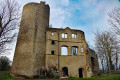
Schönstheimer Forest with the Schönstein castle ruins


On this circular walk, immerse yourself in the history of a ghost village. From Röttingen, the route first leads to Auber Berg and then across fields into the Schönstheimer Forest and on to Schönstein Castle. From there, the route takes you back through the forest to Röttingen.
Details
Creation:
Last update:
–
–
Last review:
–
–
-
 Activity: Walking
-
 Distance: 6.90 mi
-
 Average duration: 3h 45
-
 Difficulty: Moderate
-
-
 Back to start: Yes
-
 Ascent: + 659 ft
-
 Descent: - 653 ft
-
-
 Highest point: 1,220 ft
-
 Lowest point: 797 ft
Waypoints
- S/E : mi 0 - alt. 804 ft
- S/E : mi 6.9 - alt. 804 ft
Notes
Other walks in the area
Röttingen Forest Nature Trail
 Tourism professional3.76 mi
+295 ft
-282 ft
2h 00
 Easy
 Departure from Röttingen (Lower Franconia)
The Röttingen Forest Nature Trail invites you to enjoy a varied walk through the woods. Along the way, you’ll find interesting information about life in the forest and different types of trees. It’s ideal for anyone who wants to experience nature whilst discovering fascinating facts.
From Bad Mergentheim to Neuhaus Castle
 Visorando Member
 5.98 mi
+482 ft
-486 ft
3h 10
Moderate
Departure from Bad Mergentheim (Regierungsbezirk Stuttgart)
A real hidden gem for a tour through the lovely Tauber Valley is the town of Bad Mergentheim, with its beautiful old half-timbered houses and the historic Deutschherrenschloss (Castle of the Teutonic Knights) with its adjoining spa gardens. From here, we take a detour along the River Tauber to Igersheim, above whose rooftops, on a hilltop, stand the ruins of Neuhaus Castle. The circular route is very varied and offers an initial glimpse of the magnificent landscape and rich cultural heritage of the Tauber Valley.
For more walks, use our search engine .
The GPS track and description are the property of this route's author. Please do not copy them without permission.

