The start of the hike is about 4 km after Roche St Secret towards Dieulefit. Park in the picnic area at the car park, left just after the bridge, at the intersection of the small road named "Col de la Ruche".
(S) From the car park, you have to cross the D538 and the bridge to take the trail to the left, to the right of the Ravine de Maravant. Follow this until the crossroads located on the ridge (1).
Continue on the left to the Col de Bonnardel (2).
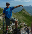
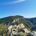
Those who wish to access the tip of the rock of Charousse, continue the track to the end and then take the trail that extends it. The markings are clear as far as the section in the rocks where the route veers to the right towards the south-east, then the markings become more sparse as it continues up the path through woods to reach the ridge and the summit of the rock (3).
To reach the Saracen Caves, return to Col de Bonnardel (2) by the same road, then head along it to the south and 20 or so metres on at a wire fence find a section that will allow you to cross it.
Then you have to go to the foot of the cliff, fifty metres to the right of the peak at the summit of La Charousse, through bushes and a grove of oaks heading north-east. Cross the fence at the foot of the rock (there is a section leads through it) and follow the path through the foot of the cliff until it turns left and climbs up an area above which are the caves. The largest opening (4) is located above the wire fence at the end of the bench. At the bottom of this there is a gallery that provides access to an ancient water reserve.
To reach the ruins of Béconne, return to the crossroads (1), By Col de Bonnardel (2), and take the left path. At the bottom of the descent go to the right, pass the "Tortel" house and after it turn left to head onto the GR9 (5).
Take it to right as it runs along the fields at the top and at the end heads right to reach the peak (6). Continue on the left path to the ruins of Béconne.
To reach the car park, head back to the fork (6) and continue on the path down the left side. After a right turn it continues to gently slope to the bridge of the Maravant ravine.
The Saracen Caves at the ruins of the old village of Béconne provide a short walk through the woods and fields of lavender and lead you on an enjoyable route among the vestiges of the past and let you indulge your imagination.
Technical sheet
-
 Activity: Walking
 -
Distance: 6.94 km
-
Average duration: 3h 05
-
Difficulty: Moderate
-
-
Return to departure point: Yes
-
Vertical gain: + 397 m
-
Vertical drop: - 397 m
-
-
Highest point: 723 m
-
Lowest point: 414 m
-
Country: France
-
-
District: Roche-Saint-Secret-Béconne (26770)
-
Start/End: N 44.497025° / E 5.060917°
-
IGN map(s): Ref. 3038SB, 3138OT
Photos
Description of the walk
Waypoints
- S/E : km 0 - alt. 415 m - Car park
- 1 : km 0.87 - alt. 561 m - Crossroads
- 2 : km 1.35 - alt. 611 m - Col de Bonnardel
- 3 : km 1.91 - alt. 691 m - Cime de Charousse
- 4 : km 2.89 - alt. 661 m - Saracen Caves
- 5 : km 4.58 - alt. 468 m - GR9
- 6 : km 5.08 - alt. 466 m - Crossroads to the Béconne ruins
- 7 : km 5.69 - alt. 473 m - Ruins of Béconne
- S/E : km 6.94 - alt. 414 m - Car park
Practical information
The hike is classified as average as the climb up Col Bonnardel to the peak of the rock of Charousse is pretty steep. Time there and back again - about an hour.
In the nearby area
Hikers take care!
The route uses private roads. Thank you in advance for respecting the area and its owners.
The caves are a fascinating site of the medieval era where people lived permanently.
A place to retreat and find some peace of mind, there are now only a few rooms that are large enough for some, a sloping gallery which leads onto a terrace and a masonry tank.
The ruins of the village of Béconne date back to the 13th century.
Reviews and comments
4.4 / 5
4.4 / 5
4.4 / 5

Overall rating : 5 / 5
Date of walk : May 23, 2025
Reliability of the description : N/A
Clarity of route map : ★★★★★ Very good
Route interest : ★★★★★ Very good
Busy trail : No
Very nice hike, easy but with a good climb from the start, just to warm up the legs... but at the top of the Charousse rock the view is really great!
There's no problem getting to the caves, as there is a small passageway over the barbed wire, and there too, superb views with flowers everywhere...
The only downside is that at the end of the hike you can't get to the ruins of the old village, there are signs forbidding access as there is a risk of them collapsing... shame.
Thank you very much for sharing your experience of the Dieulefit region, which is truly superb.
Automatically translated

Overall rating : 4.7 / 5
Date of walk : May 08, 2025
Reliability of the description : ★★★★★ Very good
Clarity of route map : ★★★★★ Very good
Route interest : ★★★★☆ Good
Busy trail : No
A short but varied and interesting route.
Note that at point 2 you really get the impression that everything has been done to prevent you from passing (barbed wire and high wire). In fact, you have to follow the description and go to the right where there is a passage. On the left, at the foot of the cliff, some people have cut the fence  even though it goes right through as indicated in the description!
Automatically translated

Overall rating : 3.7 / 5
Date of walk : Nov 03, 2024
Reliability of the description : ★★★☆☆ Average
Clarity of route map : ★★★★☆ Good
Route interest : ★★★★☆ Good
Busy trail : No
An unpretentious hike but worth the diversions a good time to discover beautiful landscapes very pleasant very easy and if opportunities to do during the period of lavender I think it must be even more beautiful because we cross some fields of lavender and frankly the landscapes are very beautiful I highly recommend this short hike not difficult at all
Automatically translated

Overall rating : 4.7 / 5
Date of walk : Sep 27, 2023
Reliability of the description : ★★★★★ Very good
Clarity of route map : ★★★★☆ Good
Route interest : ★★★★★ Very good
Busy trail : No
A very interesting hike. Care should be taken on the descent from the tip of the Charousse rock, as there is a few metres of rocky terrain. Not recommended for those afraid of heights.
Automatically translated

Overall rating : 4.3 / 5
Date of walk : Oct 29, 2022
Reliability of the description : ★★★★☆ Good
Clarity of route map : ★★★★☆ Good
Route interest : ★★★★★ Very good
Busy trail : Yes
Very good, it climbs a lot, almost all the time, but there's a great view of the Charousse rock and the Saracen caves are in good condition, so don't hesitate to climb up and have a look around, the largest is at the top with its underground passageway for even higher access and access to the cisterns.
It's true that the signs leave a little room for doubt, but we didn't have any problems.
A fairly busy walk.
Automatically translated

Overall rating : 5 / 5
Date of walk : Jun 18, 2022
Reliability of the description : ★★★★★ Very good
Clarity of route map : ★★★★★ Very good
Route interest : ★★★★★ Very good
Busy trail : No
Good evening, this is a lovely walk that takes in 3 points of interest:
- the top of the Charousse rock
- the Saracen caves (forbidden passage?)
- the ruins of Béconne
But there are a few things you should know:
At the start, a sign reads: "Private hunting. Hunting in progress from 15/08 to 28/02".
To go and see the caves, a sign hangs on the fence: it states that for our safety and the peace and quiet of the herd, you must not cross this fence.
I was able to cross it a little further towards the cliff (the barbed wire was slack). I didn't see any dogs or herds. So I continued along the fence, then skirted the foot of the cliff to finally emerge from this plot.
In the large cave, don't hesitate to climb up the dark passageway and come out to discover the old water tanks.
Automatically translated

Overall rating : 5 / 5
Date of walk : May 26, 2022
Reliability of the description : ★★★★★ Very good
Clarity of route map : ★★★★★ Very good
Route interest : ★★★★★ Very good
Busy trail : No
Thank you Denis26 for this hike.
The car park is very well signposted and practical. At the starting point, a barrier lowered in front of the signposted path and "Chasse gardée" signs made us hesitate. In the end, we took the path and enjoyed this beautiful and varied hike: undergrowth, rocks and fields, ending with the ruins in a very cool and relaxing area.
Automatically translated

Overall rating : 3.7 / 5
Date of walk : Apr 22, 2022
Reliability of the description : ★★★★☆ Good
Clarity of route map : ★★★☆☆ Average
Route interest : ★★★★☆ Good
Busy trail : Yes
In the end, it's better to do it the other way round, as the side at the start is too steep. And the water reserve is of very limited interest, although it does provide a pleasant backdrop.
Automatically translated

Overall rating : 4.7 / 5
Date of walk : Dec 29, 2021
Reliability of the description : ★★★★☆ Good
Clarity of route map : ★★★★★ Very good
Route interest : ★★★★★ Very good
Busy trail : Yes
A short, sporty hike with a good gradient right from the start. At the top of the first climb, you don't feel the cold! After that, we didn't see the caves but climbed to the top along the narrow path. The view was magical.
Once back down we visited the ruins without difficulty.
Automatically translated

I'm really sorry about this mishap. Normally there's a passage with bars that allow you to climb over the fence at the foot of the cliff.
As soon as I can, I'll go and have a look.
Automatically translated

Overall rating : 3.7 / 5
Date of walk : Oct 05, 2021
Reliability of the description : ★★★★☆ Good
Clarity of route map : ★★★★☆ Good
Route interest : ★★★☆☆ Average
Busy trail : No
Impossible to access the caves as there is a heavy fence all the way to the foot of the cliff and no way through.
Automatically translated

Overall rating : 4 / 5
Date of walk : Feb 20, 2021
Reliability of the description : ★★★★☆ Good
Clarity of route map : ★★★★☆ Good
Route interest : ★★★★☆ Good
Busy trail : No
Family outings. Reliable description. We were disappointed not to see the caves, as we would have had to go over a barbed wire fence at the risk of coming across dogs guarding the herds. We decided against this part of the route. On the other hand, it was a pleasant walk to the ruins of Béconne. The old stones are there for all to see. 
Automatically translated

Overall rating : 5 / 5
Date of walk : Mar 06, 2020
Reliability of the description : ★★★★★ Very good
Clarity of route map : ★★★★★ Very good
Route interest : ★★★★★ Very good
A very beautiful hike. The climb to the top of Charousse requires poles if it has rained, as it is slippery. The summit, caves and ruins of Béconne make this a particularly interesting hike. Thank you for this beautiful route
Automatically translated

Overall rating : 4.7 / 5
Date of walk : Feb 23, 2020
Reliability of the description : ★★★★★ Very good
Clarity of route map : ★★★★★ Very good
Route interest : ★★★★☆ Good
The weather was ideal for this first day back on the trail. The explanations and map enabled us to follow the route without any problems. We took our time and enjoyed the caves and ruins of the village of Béconne. It's true that with the lavender fields in flower, it must be sumptuous. Be careful, though, if it's raining, you'll need sticks for safety, as well as good shoes, especially for the climb up to the Charousse rock.
Thank you for introducing us to this route.
Automatically translated

nimb,
I'm really sorry for the inconvenience.
I try to be as precise as possible in my descriptions, but I deliberately don't use the concepts of time and distance very much, as they are very differently assessed by the different people who hike.
Distances are nevertheless indicated in the waypoints on the right of the description.
When I did this walk, the GR markings were clearly visible and therefore easy to follow at the top of the lavender fields, but perhaps this is no longer the case. The IGN map (or the one supplied with the description) comes in very useful as a complement to the description, and the compass with it, and that's just great!
Yours faithfully
Automatically translated
Other walks in the area
 The peak of Chenavari
For more walks, use our search engine .
The GPS track and description are the property of the author. Do not copy them without permission.


