


Refine your search for walks in Sapoie (cours d'eau) - Sans affluent (perte)
Sapoie (cours d'eau) - Sans affluent (perte) walks


 Circular field in the woods between Montenois and Lougres
 Visorando Member
 9.29 mi
 +712 ft
 -699 ft
 4h 55
4h 55
 Easy
Easy
 Departure from Montenois (Doubs)
This is a good family walk to do outside of flood season, as the area along the Doubs river would not be passable. Apart from one or two poorly marked spots, the route is easy to follow, winding through fields and undergrowth. Most of the time, the paths are well marked (used by tractors) and widely accessible by mountain bike.
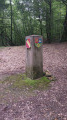
The Four Boundaries Marker
 4.05 mi
+456 ft
-436 ft
2h 15
Easy
Departure from Lougres (Doubs)
4.05 mi
+456 ft
-436 ft
2h 15
Easy
Departure from Lougres (Doubs)
Enjoy a pleasant stroll through the Lougres Forest to discover the inter-municipal boundary marker.
Arcey circular route via Gonvillars and Villers-sur-Saulnot
 5.60 mi
+538 ft
-515 ft
3h 05
Easy
Departure from Arcey (Doubs) (Doubs)
5.60 mi
+538 ft
-515 ft
3h 05
Easy
Departure from Arcey (Doubs) (Doubs)
An easy walk through the woods and along small village roads, passing through Gonvillars and Villers-sur-Saulnot, and returning via the ‘Bois des Jonquilles’ in spring, between Villers and Arcey.
Walks near Sapoie (cours d'eau) - Sans affluent (perte)
From Malsaucy near Évette-Salbert to Bavilliers via the forts
 8.71 mi
+1,371 ft
-1,509 ft
5h 10
8.71 mi
+1,371 ft
-1,509 ft
5h 10
 Moderate
Departure from Évette-Salbert (Territoire-de-Belfort)
Moderate
Departure from Évette-Salbert (Territoire-de-Belfort)
This walk follows the fortified belt around Belfort. You’ll discover lovely countryside and woodland scenery, the village of Evette Salbert and the towns near Belfort: Essert and Bavilliers. You’ll pass by Fort du Salbert and the Ouvrage de la Côte, which formed part of Belfort’s line of defence. The start and finish points are accessible by bus or train.
Forests and canal in Danjoutin
 5.88 mi
+213 ft
-203 ft
2h 55
Moderate
Departure from Danjoutin (Territoire-de-Belfort)
5.88 mi
+213 ft
-203 ft
2h 55
Moderate
Departure from Danjoutin (Territoire-de-Belfort)
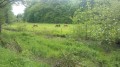
The aim of this walk is to explore part of the communal forests, the Grand Bois and the Bosmont, the Montbéliard Canal in Haute-Saône, as well as the landscapes near the village of Danjoutin.
An easy walk suitable for everyone.
The walk is signposted.
From Sévenans to Bessoncourt via the forts
 10.58 mi
+285 ft
-197 ft
5h 05
Moderate
Departure from Botans (Territoire-de-Belfort)
10.58 mi
+285 ft
-197 ft
5h 05
Moderate
Departure from Botans (Territoire-de-Belfort)
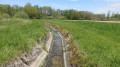
This walk follows the fortified belt around Belfort.You’ll discover lovely countryside and woodland scenery, as well as several charming villages: Sévenans, Leupe, Meroux, Vézelois, Chèvremont and Bessoncourt. You’ll pass several structures of the Belfort fortified belt: the forts.
Belfort - Fesches-le-Châtel
 13.19 mi
+712 ft
-804 ft
6h 40
13.19 mi
+712 ft
-804 ft
6h 40
 Difficult
Departure from Belfort (Territoire-de-Belfort)
Difficult
Departure from Belfort (Territoire-de-Belfort)
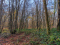
This hike is the first of two stages linking the end of the Vosges crossing in Belfort to the start of the Grande Traversée du Jura (or GTJ on maps), located at the start of Mandeure. This hike is very cultural, starting in the historic town of Belfort. The first part takes you past three forts: Belfort, Basses Perches and Bosmont. The hike is never very far from urban areas and it is even possible to get there by TGV as the high-speed train passes through. It is a hike that alternates between woods, agricultural plains and villages of varying sizes, including Bourogne and its charming wash houses. The end of the hike is the most pleasant part of the route, crossing the dry grasslands of Bourogne and walking along the Rhône-Rhine Canal.
The thousand ponds starting from Mélisey
 3.81 mi
+279 ft
-272 ft
2h 00
Easy
Departure from Mélisey (Haute-Saône)
3.81 mi
+279 ft
-272 ft
2h 00
Easy
Departure from Mélisey (Haute-Saône)
A very beautiful hike to do with the family to discover or rediscover foxgloves, which are the local flower in June, and stroll around the ponds. Leave a car at the Parc de la Praille car park at the end of the circular hike to avoid finishing the circular with 1.5 km of uninteresting and disappointing road compared to the rest.
Feedback from several hikers reports poorly marked paths that are difficult to find or completely abandoned.
From Chaux to Malsaucy via Fort de Giromagny
 7.69 mi
+453 ft
-584 ft
3h 55
Moderate
Departure from Chaux (Territoire de Belfort) (Territoire-de-Belfort)
7.69 mi
+453 ft
-584 ft
3h 55
Moderate
Departure from Chaux (Territoire de Belfort) (Territoire-de-Belfort)
This walk follows the fortified belt around Belfort. You’ll discover lovely countryside and woodland scenery, as well as several charming villages: Chaux, La Chapelle-sous-Chaux and Évette-Salbert.You’ll pass by Giromagny Fort. The walk ends with a landscape featuring numerous ponds and the Malsaucy nature reserve. As well as a beautiful view of the Vosges, you’ll be able to spot a variety of birds.
The start and finish points are accessible by bus or train.
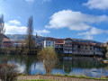
Mandeure - Pont-de-Roide
 8.30 mi
+876 ft
-814 ft
4h 35
Moderate
Departure from Mandeure (Doubs)
8.30 mi
+876 ft
-814 ft
4h 35
Moderate
Departure from Mandeure (Doubs)
This stage is the first stage of the Grande Traversée du Jura (or GTJ). It is the easiest. It can be done in a morning and can be combined with the next stage, which goes to Saint-Hippolyte. Most of the route is through forest. The starting point is in Mandeure. A detour to the Gallo-Roman theatre allows you to start with a touch of history. After an hour's walk, the stage passes near the Mandeure viewpoint before continuing through the forest. There are a few open spaces, but they are rare. The descent to Pont-de-Roide is then short and quick.
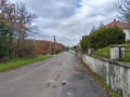
Fesches-le-Châtel - Mandeure
 15.73 mi
+1,201 ft
-1,191 ft
8h 15
Difficult
Departure from Fesches-le-Châtel (Doubs)
15.73 mi
+1,201 ft
-1,191 ft
8h 15
Difficult
Departure from Fesches-le-Châtel (Doubs)
This is the last stage before the start of the Grande Traversée du Jura. The hike is mainly through forest, crossing the woods of Sochaux, Fays and Goutils. At the end of the stage, you can explore the village of Thulay. Halfway along the route, there are shops where you can buy supplies in Seloncourt. There are also some interesting viewpoints along the way.