Refine your search for walks in Ruisseau de Lavaure (cours d'eau) - Affluent du Manaurie
Ruisseau de Lavaure (cours d'eau) - Affluent du Manaurie walks


 Circular via Rouffignac and Mauzens-et-Miremont
 Tourist office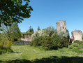
 17.55 mi
 +1,266 ft
 -1,263 ft
 Duration unknown
 Difficult
 Departure from Rouffignac-Saint-Cernin-de-Reilhac (Dordogne)
This challenging circular mainly takes you through Rouffignac-Saint-Cernin, a village in the Vézère valley in the heart of the Périgord Noir region of Dordogne, a pretty woodland trail, then the village of Mauzens-et-Miremont with its12th-century fortress offering panoramic views.
 Limeuil – Les Eyzies-de-Tayac-Sireuil
  Visorando Member