The Rossignol Mill in Armissan and the Marmorières dovecote

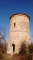
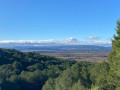
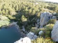
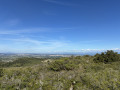
A walk in the La Clape mountains with views of the Pyrenees, the Montagne Noire and the Mediterranean. Discover the ‘Rossignol’ mill in Armissan, then admire the view from the Vinassan information sign, and finally the dovecote at the chapel on the Domaine de Marmorières estate.

⚠️ 25/06/2026: Route modified and shortened to avoid a private area.

Details

206306
Creation:
Last update:
Last review:
  • Walking
    Activity: Walking
  • ↔
    Distance: 3.26 mi
  • ◔
    Average duration: 1h 50 
  • ▲
    Difficulty: Moderate

  • ⚐
    Back to start: Yes
  • ↗
    Ascent: + 374 ft
  • ↘
    Descent: - 377 ft

  • ▲
    Highest point: 413 ft
  • ▼
    Lowest point: 138 ft
  • ⚐ Country: France
  • ⚐ City: Vinassan (11110)
  • ⚑
    Start/End: N 43.204506° / E 3.08371°
  • ❏
    IGN map(s): Ref. 2545ET, 2546OT
  • Hour-by-hour weather

Photos

Description of the walk

Park at the fork in the road just after passing under the A9 motorway (there is space for up to two vehicles).

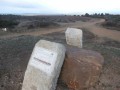
(S/E) At the start, turn right onto the small, stony dirt track next to the memorial stone. Walk past the first path on the right.

(1) When you reach Chemin Catou, turn right and continue for 100 m, then turn left twice in succession to reach a crossroads.

(2) Follow the small path ahead of you and walk for about 200 m through the woods to reach the Rossignol mill.

(3) Retrace your steps back to the path (2). Walk back about twenty metres, then turn right heading north-east onto the dirt track leading to the viewpoint.

(4) Turn right onto the path leading down towards the vineyards.

(5) Before reaching the tarmac road further on, turn left to follow the signposted path. Keep straight ahead at the next junction.

(6) At the fork, turn left twice in succession to enter the woods. Pass the first bend to the right, then another to the left, and continue to the plateau. At the fork, turn left to reach another crossroads not far from the viewpoint you visited on the way there.

(7) Turn right and head downhill to the starting point (S/E).

Waypoints

  1. S/E : mi 0 - alt. 141 ft - Parking space at the fork in the road
  2. 1 : mi 0.58 - alt. 387 ft - Chemin Catou, turn right
  3. 2 : mi 0.9 - alt. 371 ft - Go straight on at the junction
  4. 3 : mi 1.01 - alt. 381 ft - Rossignol Mill
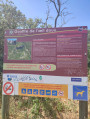
  5. 4 : mi 1.47 - alt. 410 ft - Orientation map
  6. 5 : mi 1.75 - alt. 328 ft - Turn left onto the path
  7. 6 : mi 2.14 - alt. 276 ft - Turn left to enter the woods
  8. 7 : mi 2.55 - alt. 407 ft - Turn right to return to the starting point
  9. S/E : mi 3.26 - alt. 138 ft - Parking space at the fork in the road

Notes

This walk can be done in running shoes. Binoculars are recommended on clear days.

Worth a visit

Views of the Montagne Noire, the Narbonne plain, the Mediterranean, the Pyrenees and the air base.
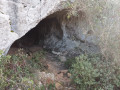
Pass by the mill. Chapel and dovecote at Marmorières.
Whilst you’re there, make the most of it and visit the Vinassan ice house, which is a 350-metre walk from the start of the walk. Go under the motorway tunnel; take the first dirt track on the left opposite the large wooden gate. Walk alongside the motorway and, following the path, you’ll reach the ice house.

Reviews and comments

4.7 / 5
Based on 2 reviews

Reliability of the description
4.5 / 5
Ease of following the route
5 / 5
Route interest
4.5 / 5
User 8645761

Overall rating : 4.3 / 5

Date of your route : Apr 06, 2026
Reliability of the description : ★★★★☆ Good
Ease of following the route : ★★★★★ Very good
Route interest : ★★★★☆ Good
Very busy route : No

A pleasant route with a slight incline and stony paths. We do cross a private road, but we weren’t bothered; we kept a fair distance from the estate.

Machine-translated

catchine
catchine

Hello, chapel and dovecote on the Marmotières estate. NO ENTRY, we'll get thrown out.

Machine-translated

Rutgermudde
Rutgermudde

Overall rating : 5 / 5

Date of your route : Aug 20, 2018
Reliability of the description : ★★★★★ Very good
Ease of following the route : ★★★★★ Very good
Route interest : ★★★★★ Very good

Is was a nice and interresting walk. Tip start early beceause of the heat.

Other walks in the area

For more walks, use our search engine .

The GPS track and description are the property of this route's author. Please do not copy them without permission.