La Clape off the beaten track

Circular route on the Montagne de la Clape passing close to the Chapel of Notre-Dame des Auzills.

Details

70924670
Creation:
Last update:
Last review:
  • Walking
    Activity: Walking
  • ↔
    Distance: 7.41 mi
  • ◔
    Average duration: 4h 20 
  • ▲
    Difficulty: Easy

  • ⚐
    Back to start: Yes
  • ↗
    Ascent: + 1,017 ft
  • ↘
    Descent: - 988 ft

  • ▲
    Highest point: 669 ft
  • ▼
    Lowest point: 174 ft
  • ⚐ Country: France
  • ⚐ City: Narbonne (11100)
  • ⚑
    Start/End: N 43.150334° / E 3.076854°
  • ❏
    IGN map(s): Ref. 2546OT
  • Hour-by-hour weather

Photos

Description of the walk

From Narbonne, take the D168 dual carriageway towards Narbonne-Plage. At the roundabout, turn right onto the D31 towards Gruissan. At the next roundabout at Ricardelle, turn left onto the Route de la Couleuvre to climb up onto the plateau. Further on, take the tarmac road at a 90° right turn towards the Bergerie de Figuières. Park next to the gate to the property.

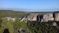
(S/E) Leave the car park near the Source de Saint-Louis and quickly take the path that heads off to the left. Then take the climb up through a scree slope leading onto the plateau. Follow a faintly marked path through the heath. For the most part, the route runs along the edge of the cliff without posing any danger.

(1) When you reach a stony track, turn left. At the next hairpin bend, a path climbs up to the left. This allows you to cut across the next two hairpin bends on the track. Return to the track and cut across another hairpin bend. The track continues north-east.

(2) At the next right-hand bend, leave the track. The path climbs through the heath, turns 90° to the right and continues north-east until it joins another track. Head left for about 60 metres.

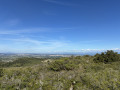
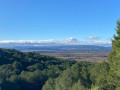
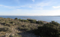
(3) Turn right onto a wide path. The path heads south. It offers lovely views of the coast and the sea.

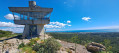
(4) Turn left onto the wide stony track leading to the lookout post.This service building is used during the summer to monitor the entire mountain range and alert the fire services in the event of a fire breaking out. The view from here is magnificent.

(5) Head back the way you came and look for the start of a path on the left, about 100 m away. Follow this path, which descends gently at first, becoming steeper after you’ve walked alongside the cliffs. You’ll come to a wide stony track.

(6) Turn right at the bend and take the small track that branches off to the right for a few metres, then follow the path as it turns 90° to the right. Follow the (almost always dry) stream of La Combe de Tintaine to reach a crossroads of paths. Turn onto the path on the right, make a wide bend to reach another crossroads of paths. Carry on straight ahead; the path veers to the right, then to the left, followed by a hairpin bend to the right, then to the left onto a new track. You’ll reach a junction of tracks near the Saint-Obre estate.

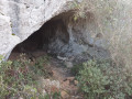
(7) Turn right to go round the estate and, once you reach the rear of the buildings, take the track that branches off to the right at a right angle. This track leads to one of the few springs to be found in this mountain range.Notable for its stone tunnel structure, this attraction is well worth a visit.

(8) Retrace your steps for about 250 m. Head up to the right into a field, following the edge of the woodland. Enter the woodland via a path that becomes increasingly faint, which will lead onto a track further up after crossing a fairly steep, stony slope. Follow the track to the left, which leads to the Chapelle des Auzils.

(9) When you reach the hairpin bend, turn right at a right angle and follow the yellow-marked path. At the next bend, ignore the path that heads straight on. At the next junction, ignore the path on the left leading to the Rec d’Argent (another spring). Further on, you’ll reach a junction of paths (elevation 158).

(10) Turn right and continue along the path which takes you to the top of the cliffs of the Plateau de Figuières. The path runs along the cliffs before descending towards the Source de Saint-Louis and the Figuières estate (S/E).

Waypoints

  1. S/E : mi 0 - alt. 469 ft - Car park in front of the estate gate
  2. 1 : mi 1.28 - alt. 505 ft - Gravel track
  3. 2 : mi 1.62 - alt. 561 ft - Path: leave the track
  4. 3 : mi 1.97 - alt. 663 ft - At the junction, turn south
  5. 4 : mi 2.41 - alt. 623 ft - A/R junction at the watchtower
  6. 5 : mi 2.5 - alt. 607 ft - Watchtower
  7. 6 : mi 2.86 - alt. 282 ft - Track for a few metres
  8. 7 : mi 3.72 - alt. 177 ft - Go round the estate
  9. 8 : mi 4.4 - alt. 299 ft - Source
  10. 9 : mi 4.97 - alt. 476 ft - Leave the track and take the path on the right - Chapelle Notre-Dame-des-Auzils (Gruissan)
  11. 10 : mi 5.97 - alt. 518 ft - Trail junction: head towards the cliff
  12. S/E : mi 7.41 - alt. 472 ft - Car park in front of the estate gate - Source de Saint-Louis (Gruissan)

Notes

There are no drinking water points along the route. It is not recommended to drink water from any of the springs you come across.

Worth a visit

Reviews and comments

3.3 / 5
Based on 5 reviews

Reliability of the description
3.2 / 5
Ease of following the route
2.4 / 5
Route interest
4.4 / 5
User 28617303

Overall rating : 2.7 / 5

Date of your route : May 12, 2026
Reliability of the description : ★★★☆☆ Average
Ease of following the route : ★☆☆☆☆ Very disappointing
Route interest : ★★★★☆ Good
Very busy route : No

A magnificent route with splendid views. Please note: there are absolutely no signposts. Some paths are very difficult to access. Make sure you wear hiking boots (suitable for mountain terrain). There are many sections over scree or even rocky ground.
A must-do

Machine-translated

JP DULO
JP DULO

Overall rating : 3.7 / 5

Date of your route : May 11, 2026
Reliability of the description : ★★★☆☆ Average
Ease of following the route : ★★★☆☆ Average
Route interest : ★★★★★ Very good
Very busy route : No

It’s not an easy route, as mentioned in the text

Machine-translated

fredmontredon
fredmontredon

Overall rating : 3.7 / 5

Date of your route : Nov 02, 2025
Reliability of the description : ★★★☆☆ Average
Ease of following the route : ★★★★☆ Good
Route interest : ★★★★☆ Good
Very busy route : No

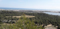
Beautiful panoramic views of Narbonne, the Gruissan lagoon and the sea as far as Sète. You can imagine La Clape as an island (which it used to be).
Point (5) is a bit tricky. At (8), the stony path is almost a scree slope...
In any case, allow around 5 hours for the walk.

Machine-translated

Kate31130
Kate31130

Overall rating : 3.3 / 5

Date of your route : Oct 20, 2025
Reliability of the description : ★★★★☆ Good
Ease of following the route : ★★☆☆☆ Disappointing
Route interest : ★★★★☆ Good
Very busy route : No

I agree with the previous review. The hiker's advice is sound. You need trousers and to be able to follow the trail with your GPS, otherwise it's impossible. That said, the walk is very pleasant and the views are magnificent.

Machine-translated

Christian Billiard
Christian Billiard
• Edited:

My intention was to warn other potential hikers and was not meant to be derogatory in any way. I apologise if you took it that way. I am 74 years old and I have probably not yet entered "seniorhood" (I may have the answer to that question). On the other hand, I walk in shorts from March to November inclusive...!

Machine-translated

La Gerve
La Gerve

Your response is rather disparaging, to say the least.
We are not used to walking in flip-flops. I am giving my opinion based on what we have seen. Recommending trousers is normal because those who are unfamiliar with these passages should be warned so that they can equip themselves accordingly. I maintain that some passages are difficult for seniors and it is normal to offer an alternative.

Machine-translated

Christian Billiard
Christian Billiard

The name of the route is: "La Clape off the beaten track". So, it's a change from the paths commonly used by "walkers" and is aimed more at hikers, as its name suggests. What's more, there are no dangerous sections if you're wearing something other than flip-flops, which are often seen here (because we're by the sea). La Clape remains an easy mountain range to walk in when you stick to the marked trails, but not when you venture "off the beaten track".

Machine-translated

La Gerve
La Gerve
• Edited:

Overall rating : 3.3 / 5

Date of your route : Oct 13, 2025
Reliability of the description : ★★★☆☆ Average
Ease of following the route : ★★☆☆☆ Disappointing
Route interest : ★★★★★ Very good
Very busy route : No

The first part is through a low, thorny heath, so trousers are essential. The descent after point 5 includes two very difficult and even dangerous sections. It is better to continue straight on at point 3, rejoin the path and turn right until point 6, a detour of about 2 km. Follow your GPS as some sections have been erased. Bring enough water in hot weather.

Machine-translated

Other walks in the area

For more walks, use our search engine .

The GPS track and description are the property of this route's author. Please do not copy them without permission.