


🚌Public Transportation
- Bus 1253: Sintra➡️Cabo da Roca €1,55
- Bus 1254: Azenhas do Mar➡️Sintra €1,55
- Using the zapping method on the Navegante card is possible to pay for transport.
(2) Next to the restaurant is a public bathroom


This cliff route along the coastline of Portugal offers beautiful ocean views on a sunny day. It took me around 4 hours to finish, because I took a lot of time taking pictures.
Note: Do not climb down if you see a beach! You can always detour by following the dotted lines on the basemap. Climbing down is a bit dangerous and time-consuming.


🚌Public Transportation
(2) Next to the restaurant is a public bathroom
From Carcavelos station to Santo Amaro station along the beaches 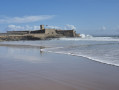 2.78 mi
+105 ft
-102 ft
1h 20
2.78 mi
+105 ft
-102 ft
1h 20
 Easy
Lisbon and the Belém neighbourhood 5.30 mi
+112 ft
-112 ft
2h 30
Easy
Departure from Lisboa (Lisbon District)
Lisbon and the Alcantara neighbourhood 5.28 mi
+597 ft
-328 ft
2h 55
Moderate
Departure from Lisboa (Lisbon District)
Parque Eduardo VII circular, Lisboa
Easy
Lisbon and the Belém neighbourhood 5.30 mi
+112 ft
-112 ft
2h 30
Easy
Departure from Lisboa (Lisbon District)
Lisbon and the Alcantara neighbourhood 5.28 mi
+597 ft
-328 ft
2h 55
Moderate
Departure from Lisboa (Lisbon District)
Parque Eduardo VII circular, Lisboa 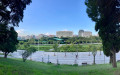 0.91 mi
+167 ft
-167 ft
0h 35
Easy
Departure from Lisboa (Lisbon District)
The Principe Real, Chiado and Bairro Alto neighbourhoods of Lisbon 5.28 mi
+433 ft
-423 ft
2h 50
Easy
Departure from Lisboa (Lisbon District)
Baixa district of Lisbon (city centre) 3.60 mi
+387 ft
-371 ft
2h 00
Easy
Departure from Lisboa (Lisbon District)
Cacilhas district of Lisbon 4.58 mi
+518 ft
-522 ft
2h 35
Easy
Departure from Almada (Setúbal District)
0.91 mi
+167 ft
-167 ft
0h 35
Easy
Departure from Lisboa (Lisbon District)
The Principe Real, Chiado and Bairro Alto neighbourhoods of Lisbon 5.28 mi
+433 ft
-423 ft
2h 50
Easy
Departure from Lisboa (Lisbon District)
Baixa district of Lisbon (city centre) 3.60 mi
+387 ft
-371 ft
2h 00
Easy
Departure from Lisboa (Lisbon District)
Cacilhas district of Lisbon 4.58 mi
+518 ft
-522 ft
2h 35
Easy
Departure from Almada (Setúbal District)
For more walks, use our search engine .
The GPS track and description are the property of this route's author. Please do not copy them without permission.
Scan this QR code with your smartphone's camera.
To open this route on your smartphone, you must have the Visorando app installed. If not, got to the Apple Store (iPhone) or Google Play Store (Android) to download the app.
 Visorando Member
 Association / Club / Walk leader
