Country:

 City:
City:


To reach the hamlet of Saint-Véran, take the very narrow road that branches off to the left or right of the D991, depending on which direction you’re coming from. It is impossible for vehicles to pass each other on this road: passing places have been provided, but you’ll need to be very vigilant and confident in reversing if necessary. Once in the hamlet, park in the small car park at the entrance.
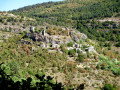
(S/E) Head towards the hamlet and then turn left up a paved slanting street offering views over the Dourbie valley and the magnificent slate-roofed houses that have been restored. At an old letterbox set into the wall, turn right, climb a few steps and then turn left again to walk alongside some beautiful Caussenard-style houses. Leave the hamlet by passing through the old gate in the medieval wall and you’ll immediately reach a crossroads by a beautiful stone cross.
GR®62 white and red markings
Head straight ahead, walk past the last few houses and follow the stony path which quickly leads to a fork in the track.
Signposting: GR®62 (white and red) + PR® (yellow)
Leave the return path on your left and continue to the right. The path gives way to a wide track winding through dry meadows, offering splendid views over the Dourbie valley and the Church of Notre-Dame des Treilles.
(2) Walk past the beautiful Causse-style farmhouse at Costeplane and continue slightly downhill until you reach the D41.
(3) Cross this road carefully – it’s quite busy during the summer months – and head up to the right for about a hundred metres before turning left onto a narrower tarmac track: follow the signs for Montméjean and the Botanical Trail. This track leads gently to the hamlet, set in beautiful natural surroundings and dominated by the ruins of its feudal castle. Walk through the hamlet and, as you leave, you’ll come to a junction with a signpost.
Yellow PR® markings for the botanical trail
(4) Turn right, following the sign for “Roques Altès direct”. Pass a few hairpin bends and head north-west, quickly leaving a path on your right that leads back uphill: an old wooden sign for “Font Doulse”. Continue along the contour line, ignoring another path branching off to the right (markings are poor at this point), and reach the fountain in question, whose muddy basin makes the water hardly fit for drinking. Carry on to quickly emerge onto a cross-country path after climbing a few stone steps.
(5) Turn right: the left-hand branch of the path, which can be misleading, does not appear on the base maps but is clearly present on the ground. The path winds through a beautiful pine wood and reaches a fork.
No signposting
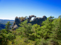
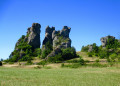
(6) Look out for a signpost on the right, about fifty metres away; head towards it and carry on straight ahead. Then follow the wide path which slopes to the left, running alongside an electric fence. The steady climb leads to a high point from where you can begin to enjoy views of the curious dolomite formation of Roques Altès, dominating the landscape to the left. Begin the descent, then cut left across a dry meadow to reach the magnificent farm of the same name, where two picnic tables await beneath a majestic chestnut tree.
(7) After a short break, if you wish, head towards the clearly visible signpost next to another post indicating that you are in a Sensitive Natural Area. Turn left towards Montméjean, signposted as 2.3 km away.
Signposting: GR®62 (white and red) + PR® (yellow).
Walk alongside the rocks on your right-hand side until you reach a junction, then turn left to arrive immediately at a signpost. Turn right here, following the sign for “Corniche du Rajol”, and continue to the next signpost.
Yellow PR® markings
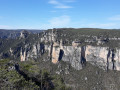
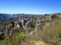
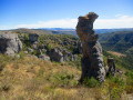
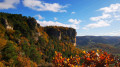
(8) Head to the right, leaving the GR® behind, which continues straight on. When you reach a rather imposing cairn, turn right to get as close as possible to the cliffs. Walk along the cliffs, taking in the rugged dolomite landscapewith its manystrangely shaped rocks, against the backdrop of the Dourbie valley and, in the distance, the ever-present Millau Viaduct.
(9) At this junction, turn left: look out for the yellow markings on the ground – you can’t miss them. Follow the path until you rejoin the GR®62.
GR®62 markings: white and red + PR®: yellow
(10) Turn right to follow the GR®62.
(11) Leave the path on your left that leads to the Rajol mast and turn right, following the sign for “Montméjean”. Return to the entrance to the hamlet.
(4) Cross back through the hamlet and rejoin the D41. Descend carefully to the right.
No signposting
(3) Ignore the double signposting leading off to the left along the path taken on the way there; stay on the road and continue downhill on the right-hand side, which has several sections on the verge. Carry on to the hairpin bend to the right.
Yellow PR® signposting
(12) Look out for the small, very inconspicuous sign on the left indicating the path back to Saint-Véran. This path follows the contour lines, offering beautiful views of the Dourbie valley and Saint-Véran itself , and eventually joins the route you started on.
GR®62 + Yellow PR® signposting
(1) Continue straight on to return to the hamlet and the car park at the exit (S/E).
 Visorando Member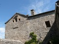

 Association / Club / Walk leader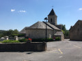

 Easy
Easy 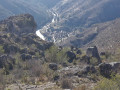
 Difficult