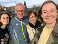
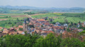
Ringeldorf and its woodland as seen from Morschwiller

A walk starting from Morschwiller, passing through Grassendorf, Ringeldorf and its woodland, and the Chapel of Saint Anthony in Dauendorf. Return via the panoramic path.

Details

n°31194074
Creation:
Last update:
Last review:
  • Walking
    Activity: Walking
  • ↔
    Distance: 7.17 mi
  • ◔
    Average duration: 3h 45 
  • ▲
    Difficulty: Moderate

  • ⚐
    Back to start: Yes
  • ↗
    Ascent: + 548 ft
  • ↘
    Descent: - 525 ft

  • ▲
    Highest point: 978 ft
  • ▼
    Lowest point: 676 ft

Photos

Description of the walk

Start at the junction of Rue de l’Argile and Rue des Abeilles in Morschwiller.

(S/E) Follow Rue de l’Argile southwards.

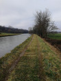
(1) After 220 m, turn right and walk alongside the Landgraben (river). Continue along this path until you reach the junction with a tarmac track. Carry on along the path opposite until you come to a path running at right angles.

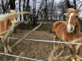
(2) If you’d like to say hello to some horses, turn left and head towards the small copse.

(3) The horses will be delighted to eat the fresh grass you’ve plucked for them – as we all know, the neighbour’s grass is always greener! But don’t give them anything else to eat! This round trip is 400 m. Return to the junction of the paths.

(2) Carry straight on along the path until you reach the D25.

(4) Turn right towards the village of Ringeldorf. When you reach the traffic lights, cross the junction and, from there, follow the Club Vosgien’s ‘Red Ring’ markings.

(5) At the three-way junction, keep left and carry on straight ahead until you reach the edge of the forest.

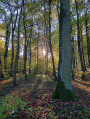
(6) About a hundred metres past a large viewing tower, at the edge of the forest, head down to the left and enter the forest. Stay on the ‘Red Ring’ markings until you leave the forest.

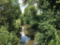
(7) Cross only the first small bridge and follow the stream along the right bank, ignoring the signposting which heads off to the left. Continue along the grassy path beside the stream until you reach a pond.

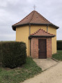
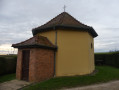
(8) At the junction, turn left towards Dauendorf. At the end of this path, just past a farm shed, turn right for about a hundred metres, then right again towards Saint-Antoine Chapel.

(9) Next to the chapel, you’ll find a table and chairs for a picnic sheltered from the wind. Carry on towards the telecoms mast visible on Morschwiller Hill (south-west).

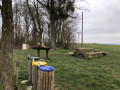
(10) At the relay station, you can rest in the shade of the chestnut tree and the wayside cross. Take the opportunity to admire Strasbourg Cathedral, which is visible due south on a clear day. Continue along the scenic path towards the water tower and, about 200 metres past it, you’ll find a picnic area set up by the municipality of Morschwiller. A barbecue is available. Carry on along the path until you come to a path on the left.

(11) Follow this path down towards the village of Grassendorf.

(12) Cross the D419 and immediately turn left onto Impasse des Prés (rather than walking along the side of the road) towards Morschwiller.

(13) Just after entering Morschwiller, turn right onto Rue des Abeilles. Follow this street for a few hundred metres until you reach the junction with Rue de l’Argile (S/E).


Waypoints

  1. S/E : mi 0 - alt. 709 ft - Junction of Rue de l’Argile and Rue des Abeilles
  2. 1 : mi 0.17 - alt. 689 ft - On the right
  3. 2 : mi 1.08 - alt. 850 ft - Return journey
  4. 3 : mi 1.2 - alt. 883 ft - Horses
  5. 4 : mi 2.12 - alt. 833 ft - Junction with the D25
  6. 5 : mi 2.47 - alt. 873 ft - Three-way junction
  7. 6 : mi 2.84 - alt. 912 ft - Entrance to the forest
  8. 7 : mi 3.65 - alt. 676 ft - Footbridge
  9. 8 : mi 4.21 - alt. 774 ft - After the pond
  10. 9 : mi 5.06 - alt. 768 ft - Saint-Antoine Chapel
  11. 10 : mi 5.78 - alt. 945 ft - Mobile phone mast/calvary
  12. 11 : mi 6.38 - alt. 951 ft - Descent towards Grassendorf
  13. 12 : mi 6.64 - alt. 830 ft - Junction with the D419
  14. 13 : mi 6.86 - alt. 794 ft - Rue des Abeilles
  15. S/E : mi 7.17 - alt. 709 ft - Junction of Rue de l’Argile and Rue des Abeilles

Notes

There are three picnic spots along the route, in the final third: at La Chapelle, at the mobile phone mast, and after the Morschwiller water tower, where a barbecue is available.

Possible in the height of summer, but best done early in the morning or late in the afternoon as you’ll be exposed to the sun for much of the route.

Worth a visit

Plenty of roe deer can be spotted along the route, except in summer when they hide in the maize, wheat and meadows.

Reviews and comments

3.6 / 5
Based on 3 reviews

Reliability of the description
3.3 / 5
Ease of following the route
3.3 / 5
Route interest
4 / 5
DELABAROTTE
DELABAROTTE
• Edited:

Overall rating : 3.3 / 5

Date of your route : May 05, 2025
Reliability of the description : ★★★☆☆ Average
Ease of following the route : ★★★☆☆ Average
Route interest : ★★★★☆ Good
Very busy route : No

Hike followed the route description.
The first part was fine as far as Ringeldorf… a bit boring.
To get to the large viewing platform, go straight on (not signposted) as you leave the village
Large metal viewing platform, then 50 metres further on (not 200) enter the forest.
At the edge of the forest, first bridge = OK, but no further path to follow the stream.
We followed the red circle, which involved a long detour, to rejoin the route after Dauendorf...
But it was still nice!

Machine-translated

Phelim
Phelim

Overall rating : 4 / 5

Date of your route : Jan 16, 2024
Reliability of the description : ★★★★☆ Good
Ease of following the route : ★★★★☆ Good
Route interest : ★★★★☆ Good
Very busy route : No

I only completed part of this walk

Based on the suggested route, I decided to skip the section around Grassendorf and through Ringeldorf.
We started the walk in Morschwiller. We parked in the car park opposite the church.
We then walked up through the village towards Ringeldorf, passing point 12, then 11 and 10, before cutting across to point 5 at the entrance to the Ringeldorf woods.
We then continued via points 6, 7 and 8 to the mobile phone mast at point 9. From there, we walked back down to Morschwiller to return to the car park opposite the church. End of the walk.
Just so you know, this makes for a walk of about 2 hours 15 minutes, covering 7 km with an elevation gain of 130 m.

As for my thoughts on this route, it’s a countryside walk, mainly across open fields, so obviously you shouldn’t expect any spectacular views.

- Nice view at point 10.
- The section through the woods is a pleasant change of scenery.
- As you come out of the woods, you’ll follow a stream; make sure you keep to the right bank after the footbridge as you leave the woods.
- We saw lots of roe deer, some of which emerged right in front of us from the undergrowth alongside the stream.
- After the stream, I found this to be the weakest part of the route, right up to Saint-Antoine Chapel.
- If you enjoy unobstructed views over kilometres of fields, this is perfect.

Thanks to the person who created the route!

Machine-translated

Chenluque
Chenluque

Thank you, Goettle, for your comments. Edits/corrections added

Machine-translated

goettle
goettle
• Edited:

Overall rating : 3.3 / 5

Date of your route : Mar 03, 2023
Reliability of the description : ★★★☆☆ Average
Ease of following the route : ★★★☆☆ Average
Route interest : ★★★★☆ Good
Very busy route : No

(6) Before reaching the pond, you need to follow the small stream along its right bank. In fact, just cross the first small bridge and take the grassy path on the right bank of the small stream.

(11) It is not ‘Impasse des Champs’ but ‘Impasse des Prés’
Apart from that, it’s a lovely walk – best avoided after rain or in the blazing sun in summer

Machine-translated

Other walks in the area

For more walks, use our search engine .

The GPS track and description are the property of this route's author. Please do not copy them without permission.