


 Country:
 City:
City:


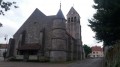
Parking is available at Place Christian de Bartillat, near the church.
(S/E) With your back to the town hall, turn right. Walk a few dozen metres, then turn right again onto Rue du Pont des Planches and continue to the fork in the road after crossing the Thérouanne.
(1) Turn left onto Route du Gué à Tresmes and continue to the junction with Rue de Breuil, at the end of the Paul Ponchard stadium.
(2) Turn left and carry on along the road, which is closed to traffic.
(3) Pass under the TGV line and carry on straight ahead until you reach the junction with the D405, at Le Gué à Tresmes.
(4) Cross carefully and head straight on along Rue du Gué, running alongside the Lycée des Métiers. You’ll reach a junction
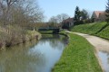
(5) Leave the road by turning left towards Le Moulinet. Then follow the path that branches off to the right, running alongside the Canal de la Thérouanne: be careful at the narrow section where you’ll be riding – it’s best to dismount. Then follow the canal , keeping an eye out for wild boar. You’ll reach the Pont de la Fesse.
(6) Turn right towards the Congis-sur-Thérouanne cemetery: the gravel path ahead is very rough.
(7) At the cemetery, turn left onto the road which crosses the bascule bridge and descends towards the centre. Continue straight on, passing the town hall and then Saint-Rémi Church.
(8) Turn right onto Rue des Grands Prés to head out of the village and reach the nature reserve.
(9) Carry on straight ahead, skirting the reserve, and ignore the dead-end path on your right. Follow the path which turns sharply left towards the stadium.
(10) Turn right just before the stadium, walk past the Maison de la Réserve du Grand Voyeux and turn left onto Chemin de l’Épine Blanche.
(11) Turn right into the woodland to follow the Bougrandeuse along a winding path.
(12) At the end of the path, at Poirier Paulet, follow the path opposite, slightly to your right. Turn right onto this path to arrive opposite the nature reserve.
(13) Turn left onto the Chemin du Grand Voyeux, cross the D121E with care, and ignore the first small road on your left, known as the Grande Ruelle.
(14) Turn left onto the path, cut across Grande Ruelle and then Rue des Buttes, and carry on straight ahead until you reach the Canal de l’Ourq.
(15) Head left and follow the canal to the Congis bascule bridge. Turn right to cross it again and you’ll arrive at the corner by the cemetery.
(7) Walk along the left-hand side of the cemetery, continuing straight on along the road, until you reach a junction you passed on the way out.
(5) Keep to the road on the left, heading in the opposite direction to the outward journey, to rejoin the D405 at Gué à Termes.
(4) Cross with the same caution as on the outward journey and carry straight on, in the opposite direction to the outward journey, along the road closed to traffic.
(3) Pass under the TGV line again and follow the outward route in the opposite direction to return to Place Christian de Bartillat (S/E).
 Visorando Member

 Difficult
 Very difficult
