


 Country:
 City:
City:


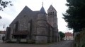
Park on Place Christian de Bartillat in Étrépilly
(S/E) Head towards Val de l’Église; turn right onto Rue du Maréchal; stay on this road at the Y-junction by keeping to the right; following the yellow signposts, you’ll soon reach a multi-way junction marked by a cross.
(1) Leave the signposted route and take the grassy path leading uphill opposite. Stay on this path, ignoring the offshoots to the left and right. After a final straight stretch, you’ll reach the high-speed rail line (LGV) at a place called Coupe Gorge.
(2) Walk alongside it on the left for a few metres, then go through the tunnel, turn left and join the GR®1B.
(3) Turn right onto it and follow the red and white markings to reach Varredes and the bridge on Rue Victor Claret.
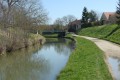
(4) Turn right to cross the Canal de l’Ourcq; keep to the left on the GR® to follow the canal bank. Follow a long path along the bend in the canal to reach the Congis-sur-Thérouanne bascule bridge.
(5) Cross the Canal de l’Ourcq to the left, then continue straight on to the cemetery. Carry on to the right, still on the GR®, until you reach the Pont de la Fesse.
(6) Turn right onto it to cross the Canal de la Thérouanne, then turn left to follow it along the canal – watch out for overhanging foliage and banks that are difficult to see in places – until you reach the Moulinet barrier.
(7) Leave the GR® here and follow the yellow PR® markings to the left; this is the path that goes up Rue du Gué, then at the next junction take the road on the right to reach the D405.
(8) Cross the road with great care, continue towards the Ferme du Gué, and carry on until you reach the LGV again.
(9) Go through the tunnel under the railway line and continue towards the Stade Paul Ponchard in Étrépilly. Turn right onto the Route du Gué à Tresmes, continuing alongside the stadium, then turn right onto Rue du Pont des Planches to cross over the Thérouanne towards Étrépilly town centre. Turn left onto Rue du Maréchal, then right to return to Place Christian de Bartillat (S/E).
 Visorando Member
 Difficult
 Very difficult
