Bergues Ramparts, Fort Vallières and Bois des Forts

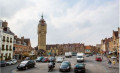
As part of the 2023 Parcours du Cœur, the CCAS France Services in Bergues is organising a 10 km walking route. You will walk along part of the ramparts of the town of Bergues, then follow the Bergues Canal; after crossing the Bois des Forts, you will return to your starting point at the Foyer socio-éducatif.

Details

n°30325229
Creation:
Last update:
–
Last review:
  • Walking
    Activity: Walking
  • ↔
    Distance: 6.27 mi
  • ◔
    Average duration: 2h 55 
  • ▲
    Difficulty: Moderate

  • ⚐
    Back to start: Yes
  • ↗
    Ascent: + 26 ft
  • ↘
    Descent: - 26 ft

  • ▲
    Highest point: 49 ft
  • ▼
    Lowest point: 0 ft
  • ⚐ Country: France
  • ⚐ City: Bergues (59380)
  • ⚑
    Start/End: N 50.970715° / E 2.43894°
  • ❏
    IGN map(s): Ref. 2302O
  • Hour-by-hour weather

Photos

Description of the walk

Park near the Foyer socio-éducatif, Avenue de la Liberté in Bergues.

(S/E) Head towards Bergues town centre along Avenue de la Liberté and pass the ramparts.

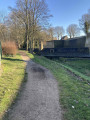
(1) Take the alleyway on the right and climb the stairs to reach the ramparts. Turn left and follow the path along the ramparts. Descend from the ramparts at the Porte d’Hondschoote.

(2) At Rue du Marché aux Poissons, turn right and then immediately left onto Avenue de Vauban (a dead end).

(3) Cross the Canal de la Basse Colme. Then turn left straight away onto Promenade Charles Quint and walk along the canal. Pass the Bergues tennis club, then turn right onto the path.

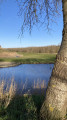
(4) Continue along the Canal de Bergues, keeping the return route on your right. Pass the Dunkirk golf course on your right and head towards Fort Vallières.

(5) Turn right towards the fort and immediately turn left to walk round it. You’ll arrive at the rear of the fort.

(6) Head slightly to the left and follow the path that runs alongside the sports grounds. At the corner of the last one, carry straight on to enter the Bois des Forts. You’ll reach the Allée des Mésanges, which cuts across.

(7) Turn right onto this path, keep to the right at the next junction, then continue left along the Allée des Éperviers until you reach a junction with the Allée du Relais des Forts.

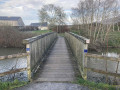
(8) Cross it (toilets nearby) and carry on straight ahead along the Allée des Pinsons, following the Canal de Coudekerque until you reach a bridge at a junction.

(9) Turn left to cross the bridge and carry on straight ahead to reach Allée des Ramiers.

(10) Turn left onto it, walk round the island and then, at the end of the path, turn left to cross the Canal de Coudekerque again (toilets nearby).

(11) Cross the car park and re-enter the Bois des Forts by following the Allée de Bergues. Once at the end, turn right to head back up to the Canal de Bergues at the junction you passed on the way out.

(4) Turn left and walk alongside the canal again, taking the Promenade Charles Quint. Pass the Bergues tennis club once more, then, at the end of the promenade, turn right onto Avenue Vauban and cross the Canal de la Basse Colme.

(3) You’ll come out onto Route d’Hondschoote; turn left to reach the pedestrian crossing. Cross the road and take the path opposite, with a fully restored section of the ramparts on your right. Follow the path straight ahead until you reach Avenue de la Liberté. Turn left to reach the social and educational centre and the car park (S/E).

Waypoints

  1. S/E : mi 0 - alt. 26 ft - Social and Educational Centre
  2. 1 : mi 0.13 - alt. 36 ft - Stairs leading up to the ramparts
  3. 2 : mi 0.36 - alt. 13 ft - Hondschoote Gate
  4. 3 : mi 0.39 - alt. 13 ft - Bridge. Common junction for out-and-back route - Canal de la Basse Colme
  5. 4 : mi 0.97 - alt. 10 ft - Junction of the main circular loop - Canal de Bergues
  6. 5 : mi 2.48 - alt. 7 ft - Fort Vallières
  7. 6 : mi 2.84 - alt. 7 ft - Behind Fort Vallières, turn left
  8. 7 : mi 3.14 - alt. 3 ft - Allée des Mésanges
  9. 8 : mi 3.56 - alt. 3 ft - Relais des Forts car park
  10. 9 : mi 3.9 - alt. 0 ft - Crossing the Coudekerque Canal
  11. 10 : mi 4.05 - alt. 7 ft - Allée des Ramiers
  12. 11 : mi 4.62 - alt. 0 ft - Car park / toilets
  13. S/E : mi 6.27 - alt. 26 ft - Social and Educational Centre

Notes

It is easy to park around the Foyer socio-éducatif (start and finish point).
We recommend wearing suitable footwear, particularly for walking along the ramparts.
Public toilets are available at points (8) and (11) along the route and at (S/E).

Worth a visit

You’ll discover several entrances to the town of Bergues: notably the Porte d’Hondschoote, which is a listed historic monument.
You’ll walk alongside the Bergues Canal for 3 km to reach the Dunkirk Golf Course.
You’ll walk around Fort Vallières.
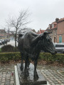
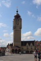
You can round off this route with a visit to the historic town centre: the other city gates, the belfry, the town hall, the bastions, the museum, etc.

Reviews and comments

3.7 / 5
Based on 3 reviews

Reliability of the description
3.7 / 5
Ease of following the route
4 / 5
Route interest
3.3 / 5
Luc Bouchard
Luc Bouchard

Overall rating : 4.7 / 5

Date of your route : Jul 25, 2023
Reliability of the description : ★★★★★ Very good
Ease of following the route : ★★★★★ Very good
Route interest : ★★★★☆ Good
Very busy route : Yes

A pleasant route, especially on the return leg; the outward leg, which runs alongside the canal as far as point 5, is a bit long and rather monotonous, with the noise of traffic from the main road on the other side of the canal.
But you’ll soon forget all that on the return leg, as you walk through the peaceful and pleasant Bois des Forts.

Machine-translated

Luc Rammant
Luc Rammant

Overall rating : 3.7 / 5

Date of your route : May 29, 2023
Reliability of the description : ★★★★☆ Good
Ease of following the route : ★★★★☆ Good
Route interest : ★★★☆☆ Average
Very busy route : Yes

I did part of the route

Machine-translated

Gégé128
Gégé128

Overall rating : 2.7 / 5

Date of your route : Apr 17, 2023
Reliability of the description : ★★☆☆☆ Disappointing
Ease of following the route : ★★★☆☆ Average
Route interest : ★★★☆☆ Average
Very busy route : No

This route suggested by Visorando is no longer reliable as it has been completely redesigned. It would be a good idea to offer a shorter alternative so that a visit to Bergues can be included, as 15 km for the route alone is a bit long.

Machine-translated

Other walks in the area

For more walks, use our search engine .

The GPS track and description are the property of this route's author. Please do not copy them without permission.