Country:

 City:
City:


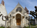
Start from the car park, Allée René Florentin.
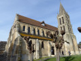
(S/E) From the car park, return to the entrance to Allée René Florentin and turn left onto Rue de la Falaise, cross the bridge over the Sausseron and continue along the main road, the D64. Just past the church, turn left onto Rue Saint-Jean, then, at the end of this street, continue along Chemin de la Garenne (also known as Chemin de Rochefort) towards the campsite. This road climbs and crosses the fields, passes under high-voltage power lines and arrives at the campsite entrance.
(1) Carry on along the path opposite, which enters the Forêt de la Tour du Lay, and follow the signs for the Polissoir. Atthe first junction, turn left and, at the next one, turn right at the gate. 500 metres further on, after ignoring aPR® sign on the left, turn left at the second junction and arrive at the Polissoir on your left.
(2) Continue along the path and, at the next junction, turn right (PR®) to join a cross-country track. Follow it to the left (PR®) for about 500 m until you reach thefourth turning on the right.
(3) Turn right and, at the next fork, leave thePR® behind and continue straight on until you reach a small forest track.
(4) Turn left and, at the three-way junction after a horse pasture, turn left again to join the Hédouville road, opposite a car park.
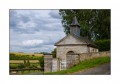
(5) Follow this small road to the left, which runs alongside the forest for 1 km. At the three-way junction with a central traffic island and a wayside cross, continue to the left. Note, in the bend to the right, at the foot of a large tree, the Chapel of Saint-Robert. Do not hesitate to take a detour along the path. Continue to Hédouville.
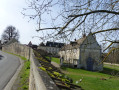
(6) At the bottom of the descent, take the hairpin bend to the right onto Grande Rue, pass the wash house and turn left at the next junction. At the fork in the road a few metres further on, take the middle branch, Rue de Grainval, then turn left onto Rue du Château Mol. Enjoy the lovely view and rejoin the main road through the village.
(7) At the Stop sign, carry on straight ahead towards Frouville until you reach the junction with the D151.
(8) Turn right and head for Frouville Town Hall.
(9) Stay on the main road, pass the church and reach a three-way junction at no. 57.
(10) Ignore Rue du Margat on the left (return route) and carry on to the next fork in the road with a wayside cross at no. 71.
(11) Turn left downhill and do stop for a break opposite the castle.
At the 90° right-hand bend, turn left, cross the Grand Bois and join a small road. Follow it downhill to the left and, after crossing a small bridge (another spot to stop), head back up Rue du Margat to rejoin the Grande Rue.
(10) Turn right and head towards the town hall.
(9) Head downhill to the right along Rue de Labeville towards the hamlet of Biard.
(12) At the junction by No. 6, at the top of the hill, take the sharp right-hand bend onto a path leading to the Croix de la Beauve.
(13) At this cross, head down to the left and then continue along Rue de la Beauve. At the four-way junction, turn right towards Vallangoujard along Rue de l’Ancienne Gare, and you’ll reach a fork in the road opposite No. 5.
(14) Turn left, walk past the church and then the town hall, and turn right onto Rue du Château, the D64 towards Nesles-la-Vallée; you’ll reach Rue du Petit Biard on the left at the corner of a wall with a porch.
(15) Walk past the washhouse and, at the end of the street, turn right onto Rue du Grand Biard, continue straight on and reach No. 24.
(16) Turn right onto the Sente “Gauchois” or “du Vieux Lavoir”. This path (recently opened and not shown on maps) crosses the marsh and leads to a road.
(17) First turn right then left and take Allée Saint-Denis. Carry on straight ahead until you reach the car park on Allée René Florentin (S/E).


 Visorando Member
 Moderate
 AONB
AONB