


QEP HALF V2
Details
Creation:
Last update:
–
–
-
 Activity: Walking
 -
 Distance: 13.68 mi
 -
 Average duration: 6h 20
 -
 Difficulty: Not specified
 -
-
 Back to start: Yes
 -
 Ascent: + 66 ft
 -
 Descent: - 66 ft
 -
-
 Highest point: 49 ft
 -
 Lowest point: 10 ft
-
 Country:
United Kingdom
Country:
United Kingdom
-
 City:
London Borough of Newham
City:
London Borough of Newham -
 Start/End: N 51.537804° / W 0.014043°
 -


 Hour-by-hour weather


Waypoints
- S/E : mi 0 - alt. 16 ft
- 1 : mi 0.85 - alt. 30 ft - Turn left onto Marshgate Terrace
- 2 : mi 2.39 - alt. 26 ft - Turn right onto White Post Lane
- 3 : mi 2.43 - alt. 23 ft - Turn left onto Clarnico Lane
- 4 : mi 2.58 - alt. 43 ft - Turn left onto Waterden Road
- 5 : mi 2.77 - alt. 30 ft - Turn left
- 6 : mi 2.87 - alt. 30 ft - Turn right onto East Bay Lane
- 7 : mi 2.93 - alt. 30 ft - Turn left onto East Bay Lane
- 8 : mi 2.99 - alt. 20 ft - Turn slight right onto East Bay Lane
- 9 : mi 3.09 - alt. 23 ft - Turn right
- 10 : mi 3.1 - alt. 23 ft - Turn sharp right onto North West Road
- 11 : mi 3.25 - alt. 30 ft - Turn sharp right onto North West Road
- 12 : mi 6 - alt. 39 ft - Turn left
- 13 : mi 11.79 - alt. 26 ft - Turn left onto Marshgate Terrace
- S/E : mi 13.68 - alt. 13 ft
Other walks in the area
Stratford to Canary Wharf via Limehouse Cut
 Visorando Member5.65 mi
+112 ft
-115 ft
2h 40
Visorando Member5.65 mi
+112 ft
-115 ft
2h 40
 Easy
Easy
 Departure from London Borough of Newham (Greater London)
An interesting, but industrial, walk from the Olympic Park to the skyscrapers in Docklands.
Limehouse to Little Venice by the Regents Canal
8.93 mi
+167 ft
-115 ft
4h 15
 Moderate
Departure from London Borough of Tower Hamlets (Greater London)
Moderate
Departure from London Borough of Tower Hamlets (Greater London)
The Regent's Canal provides a watery escape from the bustle of the streets of London. Starting at Limehouse this walk takes you across London finishing at Little Venice. In general the route is easy to follow and any lileky problems are dealt with in the walk decsription.
Around ponds in Wanstead Park
 3.48 mi
+52 ft
-52 ft
1h 40
Easy
Departure from London Borough of Redbridge (Greater London)
3.48 mi
+52 ft
-52 ft
1h 40
Easy
Departure from London Borough of Redbridge (Greater London)
This beautiful circular walk which mainly uses Chestnut Trail is a good way to discover Wanstead Park walking along several lovely ponds and River Roding.
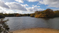
Hollow and Bullrush Ponds from Snaresbrook Road
 2.97 mi
+56 ft
-56 ft
1h 25
Easy
Departure from London Borough of Waltham Forest (Greater London)
2.97 mi
+56 ft
-56 ft
1h 25
Easy
Departure from London Borough of Waltham Forest (Greater London)
This easy circular walk mainly uses sections of Epping Forest Centenary Walk and Greenwich Meridian Trail enjoying paths in woods and wildlife along Hollow Pound.
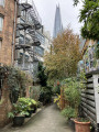
London Bridge to Canary Wharf
 4.42 mi
+128 ft
-89 ft
2h 10
Moderate
Departure from London Borough of Southwark (Greater London)
4.42 mi
+128 ft
-89 ft
2h 10
Moderate
Departure from London Borough of Southwark (Greater London)
A walk off the beaten path from central London to Canary Wharf.
Thames Path From Waterloo To Greenwich
 8.18 mi
+197 ft
-210 ft
3h 55
Easy
Departure from London Borough of Lambeth (Greater London)
8.18 mi
+197 ft
-210 ft
3h 55
Easy
Departure from London Borough of Lambeth (Greater London)
There is so much to discover when you walk along the Thames in London. From Waterloo to Greenwich, encounter London’s most famous landmarks and hidden gems, from ancient sites to modern developments. Take a walk down the history lane along the iconic River Thames to see London from a different perspective.
Strawberry Hill Ponds, Mount Pleasant and Connaught Water from Barn Hoppitt
 7.00 mi
+387 ft
-410 ft
3h 35
Moderate
Departure from London Borough of Waltham Forest (Greater London)
7.00 mi
+387 ft
-410 ft
3h 35
Moderate
Departure from London Borough of Waltham Forest (Greater London)
This circular walk with ascents and decents in Epping Forest explores paths in Warren and Strawberry Hills before you go back across Hill Woods. You finally walk along Connaught Water and go back to Barn Hoppitt.
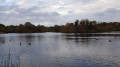
Bury Wood and Connaught Water from Chingford Plain
 3.45 mi
+115 ft
-115 ft
1h 40
Easy
Departure from London Borough of Waltham Forest (Greater London)
3.45 mi
+115 ft
-115 ft
1h 40
Easy
Departure from London Borough of Waltham Forest (Greater London)
This pleasant circular walk combines several paths in Bury Woods including Holly and Willow Trails. Then, you will walk around Connaught Water enjoying its wildlife!
For more walks, use our search engine .
The GPS track and description are the property of this route's author. Please do not copy them without permission.

