Port de Campbieil

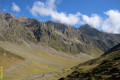
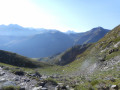
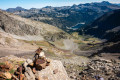
A hike starting from the Piau Engaly resort. There is a steep section from (3) to (4) leading up to the Port de Campbieil. A stunning view awaits you at the top. Take a good look around you during this hike; you’re sure to come across marmots basking in the sun and, with a bit of luck, chamois or vultures.

Details

737503
Creation:
Last update:
Last review:
  • Walking
    Activity: Walking
  • ↔
    Distance: 7.95 mi
  • ◔
    Average duration: 6h 00 
  • ▲
    Difficulty: Difficult

  • ⚐
    Back to start: Yes
  • ↗
    Ascent: + 2,684 ft
  • ↘
    Descent: - 2,703 ft

  • ▲
    Highest point: 8,517 ft
  • ▼
    Lowest point: 5,971 ft

Photos

Description of the walk

Park in the upper car park at Piau Engaly.

(S/E) Take the tarmac road leading towards the Mouscadès chairlift. You’ll need to pass through an electric fence, which you must close behind you.

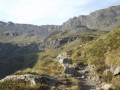
(1) After the chairlift, leave the ski run and take the path on the right which crosses the stream. The path climbs gradually until the next fork.

(2) After crossing the small bridge, turn right onto the Port de Campbieil path (the one on the left leads to Lac de Badet). Continue to the next junction, which is marked by a signpost.

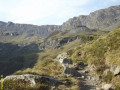
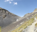
(3) Take the path on the right towards Port de Campbieil; the other path leads to the Hourquette de Héas. From here, you can clearly see the very steep path climbing up to Port de Campbieil. Begin the ascent and, via numerous hairpin bends, reach Port de Campbieil. Enjoy the magnificent view.

(4) Follow the same path back to the junction by the small bridge.

(2) Take the path on the right, head downhill and reach the Lac de Badet junction at the bridge over the Neste de Badet.

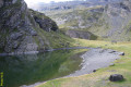
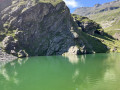
(5) Cross the small bridge, then continue to the right to reach Lac de Badet.

(6) To return to the resort, retrace your steps to the hut near the bridge.

(5) Leave it on your left and carry on straight ahead along the well-trodden, clearly signposted path leading to the Piau Engaly resort.

(1) Carry on straight ahead, pass the chairlift and follow the route you took on the way out to reach the Piau Engaly car park (S/E).

Waypoints

  1. S/E : mi 0 - alt. 6,142 ft - Piau Engaly car park
  2. 1 : mi 0.36 - alt. 5,974 ft - Path on the right
  3. 2 : mi 2.17 - alt. 7,034 ft - Junction after the bridge
  4. 3 : mi 2.47 - alt. 7,306 ft - Junction
  5. 4 : mi 3.59 - alt. 8,504 ft - Port de Campbieil (2596m)
  6. 5 : mi 5.55 - alt. 6,791 ft - Bridge over the Neste de Badet - Neste (rivière)
  7. 6 : mi 5.78 - alt. 6,834 ft - Lac de Badet
  8. S/E : mi 7.95 - alt. 6,142 ft - Piau Engaly car park

Notes

Make sure you wear good hiking boots and remember to take several litres of water per person.

This route passes through a protected area, which may be subject to special regulations:

Worth a visit

Marmots are very common throughout this hike. With a bit of luck, you may spot vultures, chamois or even Egyptian vultures.

Reviews and comments

4.6 / 5
Based on 3 reviews

Reliability of the description
4.7 / 5
Ease of following the route
4.7 / 5
Route interest
4.3 / 5
Alexhat
Alexhat

Overall rating : 4.7 / 5

Date of your route : Aug 08, 2023
Reliability of the description : ★★★★★ Very good
Ease of following the route : ★★★★★ Very good
Route interest : ★★★★☆ Good
Very busy route : No

A walk that takes you up to the Soum des Salettes from the Port de Campbieil.

Machine-translated

missina
missina

Overall rating : 4 / 5

Date of your route : Jul 07, 2023
Reliability of the description : ★★★★☆ Good
Ease of following the route : ★★★★☆ Good
Route interest : ★★★★☆ Good
Very busy route : No

We combined this hike with the one to the Hourquette de Héas. Alas, we never managed to find the path leading to the Port de Campbieil. We realised this too late to turn back, but on reflection it seems the signposts in the area must have led us astray. At the start, we saw the signposts so we thought, “Right, no need to have our noses buried in the guidebook”… Well, we certainly should have!
It’s also worth noting that, at the start of the walk, I don’t think there’s any point in crossing the bridge straight away after the chairlift to climb gradually up through the scree. I think it’s better to carry on for a few hectometres along the path and then join the well-marked trail on the right. It’s certainly a bit steeper, but it’ll be easier on your ankles.
We eventually carried on to the foot of the Hourquette de Héas and then descended via Lake Badet.
We came across very few people; it was a good warm-up for our weekend.

Machine-translated

gadan
gadan

Overall rating : 5 / 5

Date of your route : Sep 03, 2019
Reliability of the description : ★★★★★ Very good
Ease of following the route : ★★★★★ Very good
Route interest : ★★★★★ Very good
Very busy route : No

A lovely, very accessible walk for experienced walkers
Tip: challenging for occasional walkers
Tricky sections during the final hour of the ascent
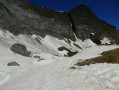
Snow on the ascent and at the pass
Marmots, chamois and other wildlife if you set off very early
Avoid the intense afternoon heat in summer

Machine-translated

Other walks in the area

For more walks, use our search engine .

The GPS track and description are the property of this route's author. Please do not copy them without permission.