


 Country:

 City:
City:


Car park at the waste collection point on Chemin de la Pontière in Les Salelles, on the GR®4.
(S/E) Continue for about fifty metres along the Chemin de la Pontière, then turn right onto the concrete GR®4. Turn left at the end of the long wall made of concrete blocks. Walk down this paved slanting street to the old canal.
(1) Head towards the piers of the old stone bridge and cross the river via the two small bridges. Head left and take the local footpath (yellow markings) towards the Camping de la Vermède.
(2) Walk alongside the campsite, past its entrance, and continue along the path. Cross two stream beds (often dry). Walk past the foot of the fortified town by the river and turn left, following the field paths until you reach the tarmac road.
(3) Cross a road and continue to follow the yellow markings as they climb up the old paved slanting street, which is in rather poor condition, to the crossroads in the hamlet of Les Armas.
(4) Take the road on the right, cross the D901 carefully and head towards the hamlet of Pradal opposite.
(5) Continue up the Pradal hill, turning right onto the Chemin des Claparèdes du Barret. This tarmac road continues as a track to the hamlet of Paihlères.
(6) Carry on along the road until you reach the D901. Turn right down the hill, follow this departmental road for about a hundred metres, then turn left onto the Route de Paihlères. Continue down this road until you reach the hamlet of Chazalette.
(7) Turn left towards L’Argilier (GRP® red and yellow markings). Pass beneath a large house, then turn left again at the end of the path. Cross the Ruisseau du Coudoular and continue to follow the yellow markings. Turn right at the crossroads towards the D113.
(8) Cross the main road with care. You may wish to visit Notre-Dame de Lourdes at this junction. Take the Chemin du Coudoulas and continue along this path until you reach the junction with the Camping du Rocheyrol.
(9) Turn left, then take Impasse de la Baumette on the right. At the end of the cul-de-sac, take the path on the right which leads back to La Pontière.
(1) Head towards the Pontière bridge and walk back up to the car park (S/E).
 Visorando Member
 Easy
Easy 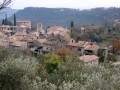
 Difficult
