Country:

 City:
City:


To reach the starting point, leave the Val d’Aran road and head towards Es Bordes, then follow the small tarmac road all the way to its end, which climbs up to the Artiga de Lin refuge (1,465 m).
(S/E) With your back to the refuge, head right and cross the Plan dera Artiga.
(1) After about 1,500 m of gentle climbing to warm up gradually, the route includes a challenging initial section up to an altitude of around 2,050 m. The path is always well marked but involves three sections in succession with handrails to provide safety in case of wet rock or if you feel uneasy about the slope. Reach the first high point at Ibón de Coll de Toro.
(2) Descend into the Val de l’Escaleta towards Plan d’Aigualluts, near the Trou Del Toro.
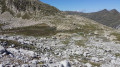
(3) This is the entry point to the Val de Barrancs, the route leading to Aneto. The well-marked path features red and white markings along its route beside the River Esera, which you follow up the right bank.
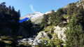
(4) Ignore the path on the right – which you’ll take on the return journey – and follow the River Esera upstream to around 2,230 m before crossing it. The markings then disappear and the route heads south-west towards the foot of a stony ridge (shown by the blue arrow in the attached photo), which you must follow up to around 2,800 m. Then, after a less steep climb through the granite maze.
(5) You’ll approach the first snowfields if the ascent takes place between mid-August and mid-September.
You can then see, to the west and higher up, the standard route coming from the Portillon Supérieur and the Refuge de la Rencluse. This is the time to put on your crampons and then climb between the rocky outcrops to join the very/too busy snow track, which you will need to follow for about 800 m.
(6) Look out for the track on the right, which you will follow on the descent, and continue climbing to the rocky base of Aneto.
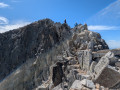
(7) Then stow your crampons on your rucksack and climb up to the secondary summit, where you’ll often have to wait a while before you can set off up the famous Pas de Mahomet.
(8) Cross this exposed section with the usual precautions and continue to the summit.
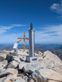
(9) Aneto: take in the 360° panorama. Descend to the rocky base of the peak, put on your crampons and walk about a hundred metres to reach the original fork in the path.
(6) Head diagonally to the left to cross the glacier and continue to the small Lac de la Basa des Salterillo, a fairly well-trodden bivouac area for early-morning ascents of Aneto
(10) From there, follow the stream flowing out of the lake along its right bank until you rejoin the ascent route at the bottom of the Val de Barrancs.
(4) The return journey then follows exactly the same route as the outward journey back to the car park (S/E).


 Visorando Member
 Moderate
 Association / Club / Walk leader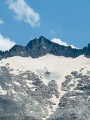
 Difficult
 Very difficult